
I offer you a selection of free resources and projects with satellite data, programs for processing this data, and useful articles.

As an analyst, the use of reference points in a photographic environment is not a new concept. Checking a photo or video often boils down to tracking city skylines, mountain/land horizons, and street names. However, I began to wonder how important it would be to use natural cues to narrow down the scale of a place both nationally and globally. After all, the flora and fauna have their own uniqueness, and with the use of certain tools, it is possible to obtain fairly accurate geodata. For example, tree identification can be done using aerial photographs or satellite photographs. Or use the world animal location map to determine the location. All weather phenomena can also provide not only hints, but also fairly accurate information or geolocation.
I’ve seen people on TV surviving by navigating deep forests using only their knowledge of plants and maps of the sun. If they can do that, I thought maybe similar skills could be used for image verification. After doing some research, I realized that there are several techniques that can be used to get clues from images that can point us to specific locations based on plants and animals. Therefore, if you wish, you can solve puzzles with the search for geodata using my methods, or develop something of your own. Note: I am not a survivalist, nor am I the least bit of an expert in the outdoors. I have been camping maybe 3 times in my life and would probably die after one day in the outdoors so please make sure you check any conclusions based on these methods.
Let’s imagine that we received for analysis a photo of a wooded area where a crime took place. We have nothing concrete in the photo, except for the surrounding nature. Where should we start? Identifying plants in your photo that may be native is a great starting point. Native plants, if specific enough, can allow us to identify the state or country where the photo was taken.
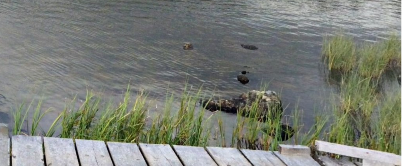
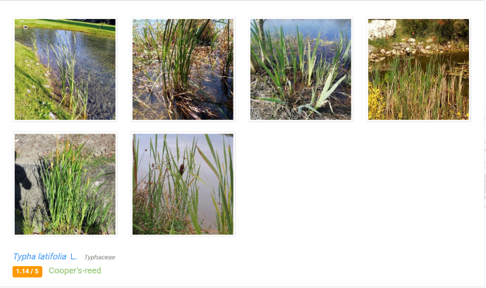
As an example, I took a picture from Sector035 Quiztime in March, cropping only the plants in the water. Then I went to identify.plantnet.org to try to identify the grass. The site offers many potential suggestions for what this herb could be.
Identify.plantnet.org provides several photos of each so we can compare them to our original. At first glance, I think it looks pretty close to the first version of Cooper’s Reed. But this similarity still needs to be checked if it is really the grass from our image.
Being able to identify a native plant is only the first step. Many native plants exist elsewhere outside of their native habitat, so while this may help narrow the field, I wouldn’t consider it definitive. If the photo in question looks like a man-made landscape (ie gardeners have planted plants), this trick won’t be very useful.
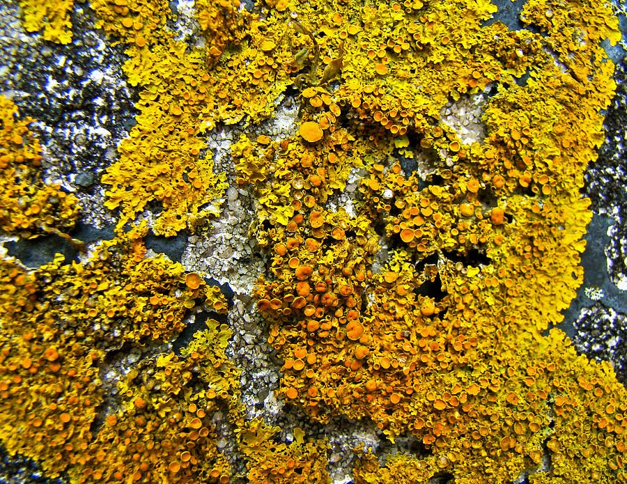
It is also worth considering the growth habits of plants. For example, most types of lichen are gray or green and known to grow in shady areas, but the rust-colored type (Xanthoria Perientina) only grows on south-facing surfaces. It can indicate a physical direction.
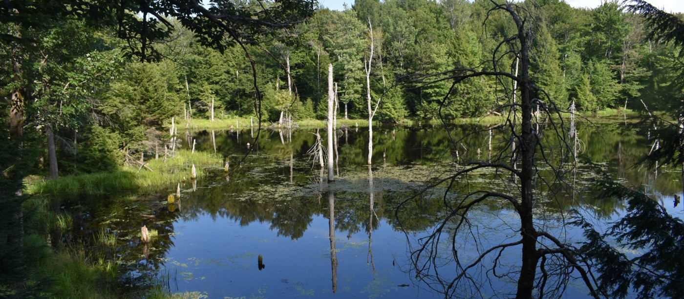
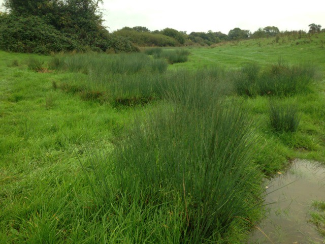
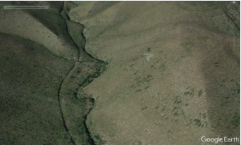
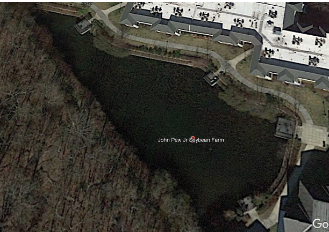
Also, grasses like Soft Rush tend to indicate wet areas of land and a potential swamp nearby. In the photo below, we see patches of grass where the ground is wetter than the surrounding area. These types of patterns are also found in tree growth, as we will explore in the next section.
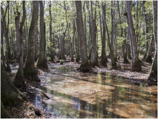
Naturalists learn to notice how the sun affects plant growth and how wind direction can shape a tree line. We can also try to identify the surrounding area in our photo by looking at the types of trees. Certain types of trees can also be seen in certain geographic areas of the United States. For example, the trees (Tupelo) below are most often seen in the southern region and on the east coast, where they thrive in marshy standing water. Whereas giant redwoods can be found on the west coast of California. In addition, we can detect changes in the environment by observing trees. Willow and alder lines like to grow near rivers and are often a sign of a nearby water source.

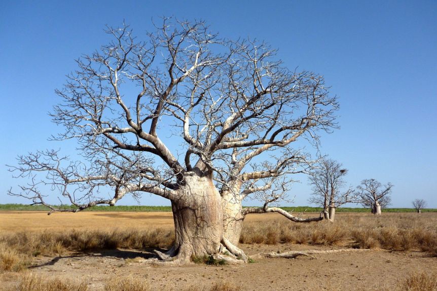
Determining the country of origin is also possible when researching tree species. Something like a Boab tree can narrow our search to specific areas in Australia, Madagascar, and Africa. In North America we can use the What Tree is That? to help identify different types of trees.
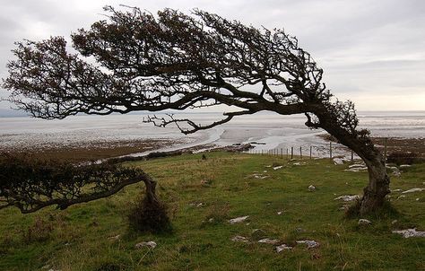
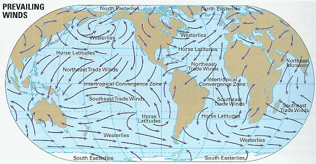
One interesting thing I came across in my research was the use of wind damage to trees as an indicator of direction of travel. Single deciduous trees, as shown below, are the best source for this type of analysis. Because the wind blows constantly in certain directions depending on the prevailing winds and can eventually push the branches of the tree to grow in the same way. If we know the general region where our photo was taken, we can compare it to wind maps to help pinpoint potential locations.
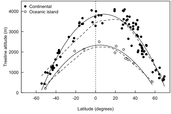
Finally, the placement of trees along the landscape can demonstrate the height of our photograph. Looking at this photo below, we can clearly see a strange tree phenomenon that no one can fully explain, called the “global tree line”. The global treeline is a rough line of trees showing the area of elevation where they can no longer thrive due to soil problems or lack of air. A global treeline can be used as a check to approximate the height in a photograph.
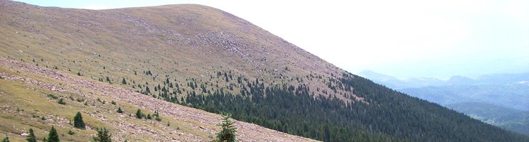

The tricky part about using forest lines for geolocation is that, although it’s a global phenomenon, the elevation varies by area, as shown in this chart. I think to be useful for verification we need to have a general idea of the starting place.
There has also been some interesting research on large-scale tree identification from aerial photographs, which seems to be done mostly by algorithms. There are a few tricks I picked up from deer hunting sites that we may be able to use here with Google Earth. Hunters seem to use Google Earth to scout their hunting grounds ahead of time and use trees to find potential deer trails. Hunters can determine if a set of trees is a species by using Google Earth’s history option and looking at the area in fall or winter. Oak trees keep their leaves longer in the fall and winter season, so that they are visible in the photo. In autumn we can also use color to identify the type of tree.

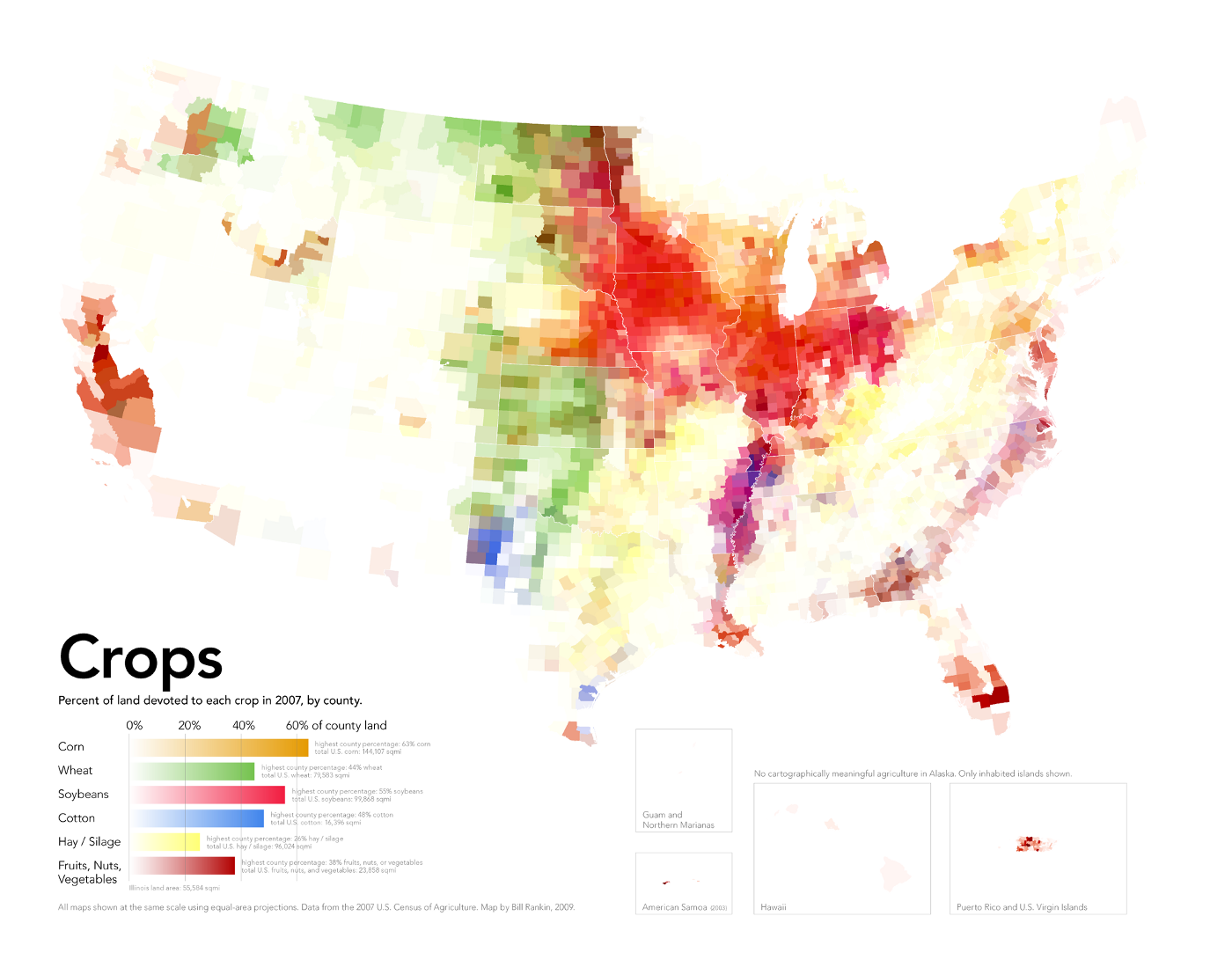
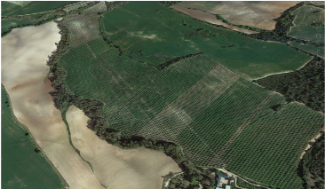
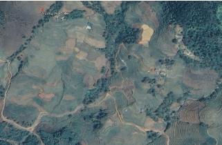
It may be possible to narrow down the location from aerial photography or satellite photography by identifying crops in the area. Often certain crops are only grown in certain regions and can be identified using the location of fields, plants and animals. Below we can see, if placed side by side, that corn, soybeans, rice and olives are grown in a special way that often stands out in the images. Using different farming patterns combined with equipment and buildings found on the ground, we can estimate a location based on region-specific crops.
 |
 |
 |
 |
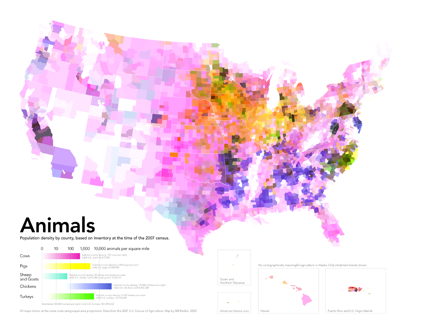
If our photo has a farm animal in the background, the location of the photo can be determined based on the agricultural industry. If we look at the map of the United States below, we can see that cattle are raised in different regions. For example, based on this map, if our photo shows a pig farm, we know to focus our search around the Iowa/Illinois area.
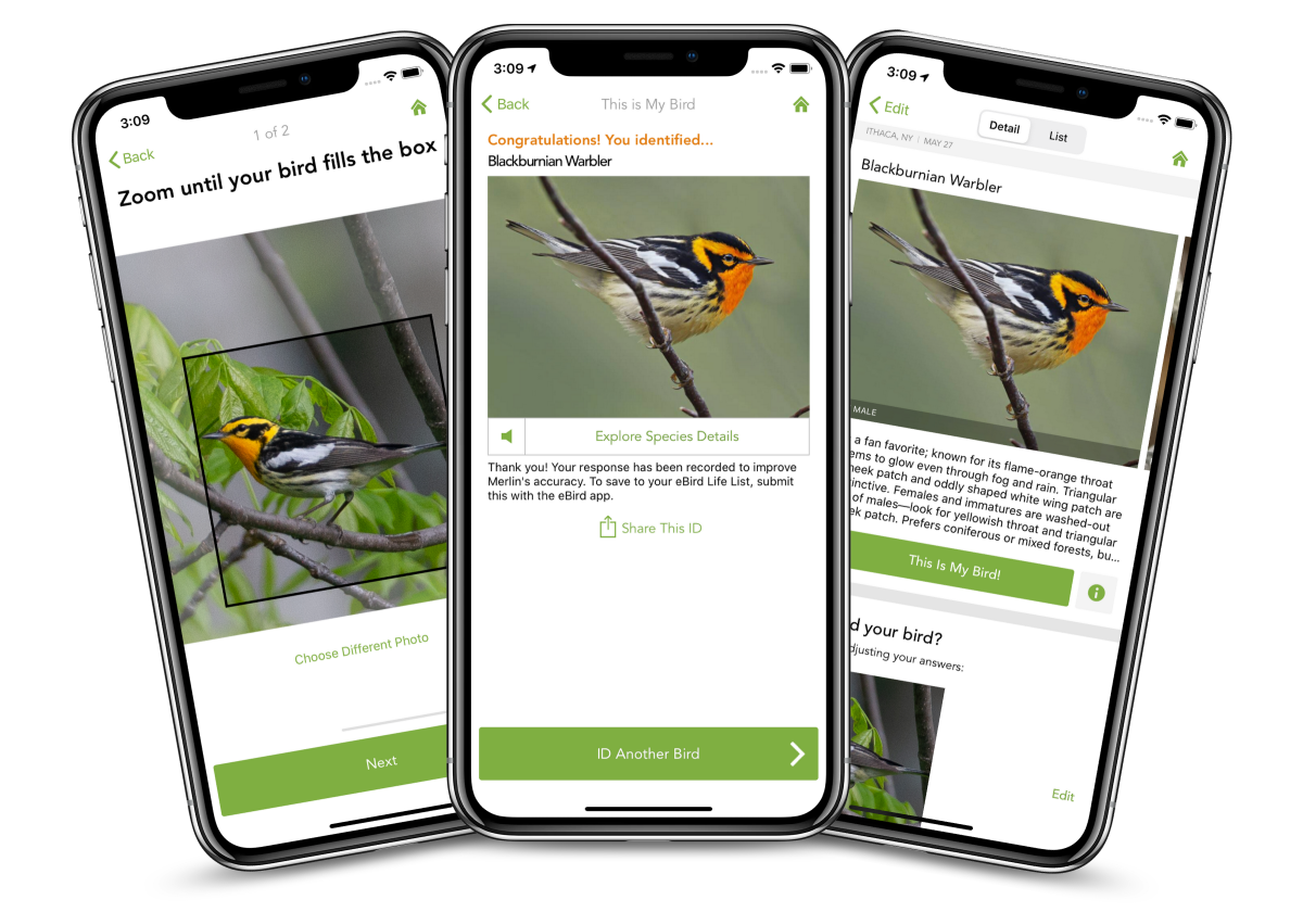
Birds are another great resource for nature geolocation, as they often appear in all outdoor photography. Using Cornell’s free Merlin Bird ID app allows us to identify a bird from an uploaded photo.
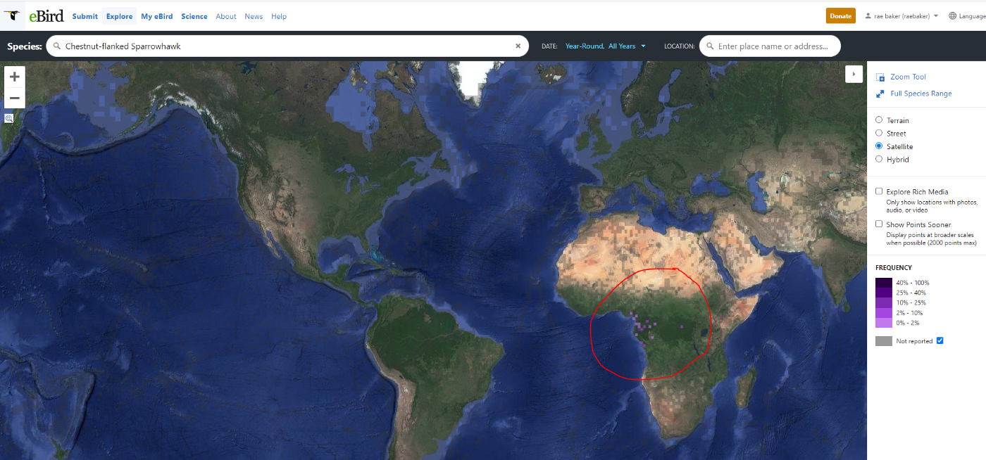
Once we’ve identified a bird species like this goshawk below, we can go to a site like Ebird.org and look up a map of the species’ habitat.

It quickly becomes apparent that this particular bird species is only found in West Central Africa, which greatly narrows the scope of our research. From here we can match this with native plants or trees in the photo and try to find an area that matches the image.
This all sounds pretty strange, but when would we need to use such techniques? Well, if you want to practice, I definitely recommend Quiz Time. Daily review puzzles often include landscapes with plant life to explore. A more noble cause would be Europol’s Trace an Object program. Europol publishes photographs of child exploitation cases (minus the child) and asks for help identifying where the photo was taken/what is in the photo. These photos often show wooded areas where nature tracking can potentially be used. If any of these methods help you in your investigation, I’d love to know! Please let me know if you have any additional methods to add.

