Discover the Universe of OSINT: Investigation Tools and Resource Collections.

A detailed investigation is underway, using open sources of information to determine the exact location of the image posted on Twitter. Using OSINT techniques such as reverse image retrieval and satellite imagery analysis, it shows how important information can be extracted from limited data.

Determine the coordinates of the place where the photo was taken.
Let’s start with the text. We know the original tweet was in Arabic and the English part we see is just a translation. This gives us some information about the publisher.
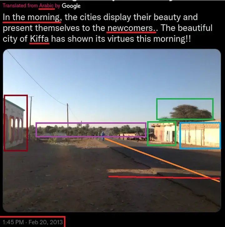
In the text, our mysterious man says “in the morning” and “newly settled.” They are important and we can use them to determine the location and time when the image may have been taken. However, the poetic language and the possibility of a broken translation leave question marks in my mind. And of course he mentions “Kiffa,” which is a city in Mauritania.
According to the Twitter timestamp, it was *posted* at 1:45 PM on February 20, 2013. I emphasize the word “published” because we need to be careful about the delay between when the image is captured and when it is published.
Let’s analyze the image:
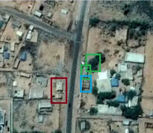
On the left we see the corner of the building. Marked in burgundy.
The two shadows with straight lines indicate that there are two buildings on the left, one of which is outside the image. Marked in red.
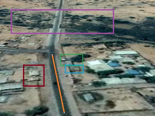
We can see the horizon, an asphalt road stretching far away, and many trees. The horizon is marked in purple, and the asphalt road is marked in orange.
We have two buildings on the right. Same height and similar material. Marked in green and blue.
On the top of these buildings on the right we see a tree. Relatively larger than other trees we see. Marked in green.
First, I wanted to see if there was any information on the internet about this image. Sometimes the information provided may be incorrect and a reverse image search may reveal more accurate information about the general location of the image.
With a Chrome extension called “Fake news debunker by InVID & WeVerify”, you can perform a reverse image search on multiple search engines at the same time.
No, nothing happened. Except for a ton of posts about the same task.
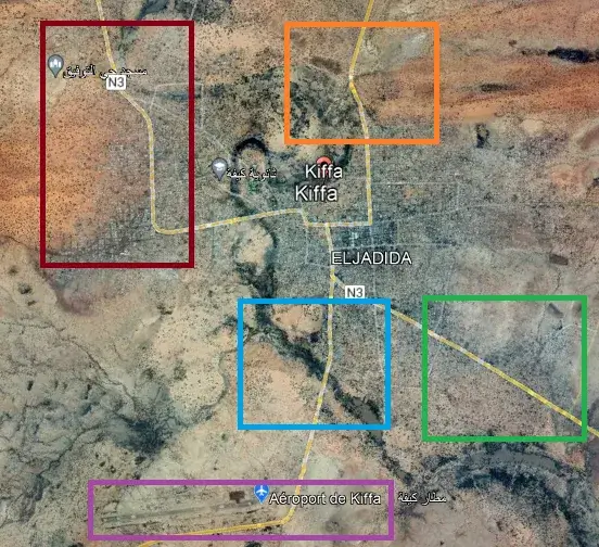
This is Kiffa, Mauritania. With Google Earth Pro, you can go back to satellite images from 2013 (for more accuracy) and check those images. The town has 4 main (and paved) entry points, but only two of them seem a bit green (marked in blue and orange).
Also, because of the word “newbies” in the tweet, I wanted to check out the airport as well. Unfortunately, this part of the city is quite deserted. However, because of this word, I checked the blue marked road first.
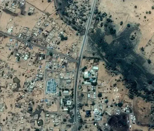
We were able to see the horizon in our original image and no city was visible in the distance. Therefore, I turned the map upside down and put the city “behind my back”. Also, we were a bit far from the trees. With these two points in mind, I narrowed down my search.
After that I just tried to find “two buildings on the left with a small gap between them” and “two buildings on the right connected to each other by a large tree next to them”. There are no cool tools for this except your eyes. You only need to scan the roadside.
The best part is that this photo was taken on the outskirts of the city, so you don’t have to go deep into the city.
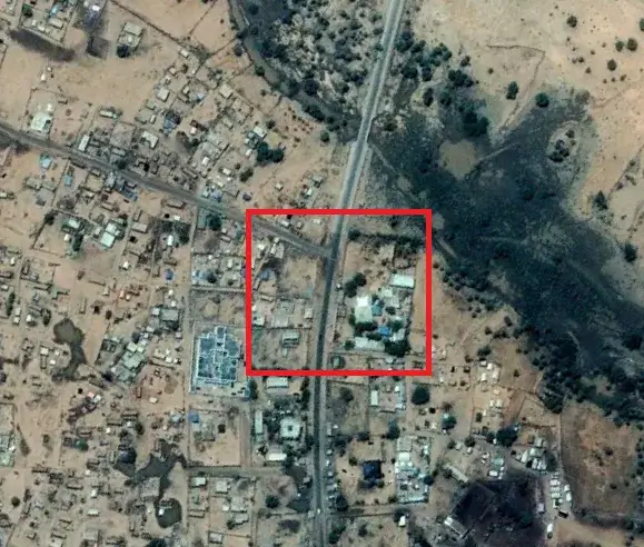
The area marked in red is the outskirts of the city. These are the first buildings. I started from there and saw a large tree on the right side, similar to our original image.
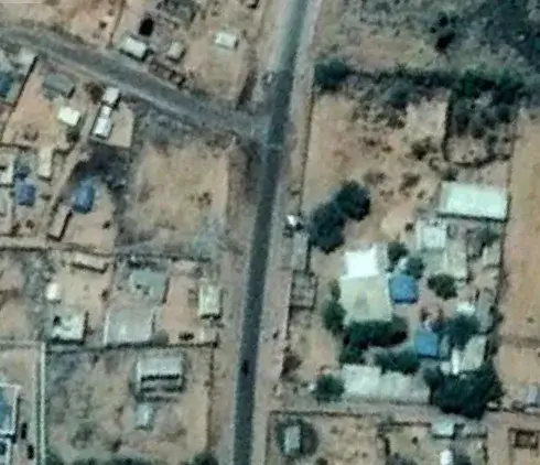
Let’s look at it with a slight slant and compare it to the source:

Task: Determine the coordinates of the place where the photo was taken.
Coordinates: 16°36’34.3″N, 11°23’52.1″W