12.01.2024
13 min
829

Ukraine is facing an unprecedented threat today — millions of hectares of agricultural land are mined. This article tells how local farmers are clearing fields by hand, with rakes and tractors, and how the latest technologies — drones, satellites and AI — are helping to speed up humanitarian demining. Find out which regions are most affected, how international organizations are working, and how long it will take to completely clear the territories.
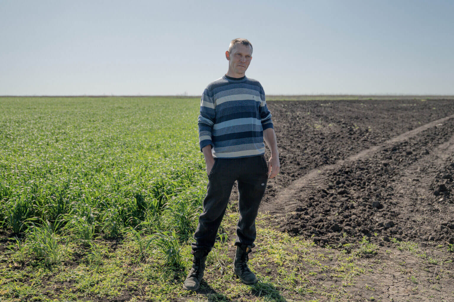
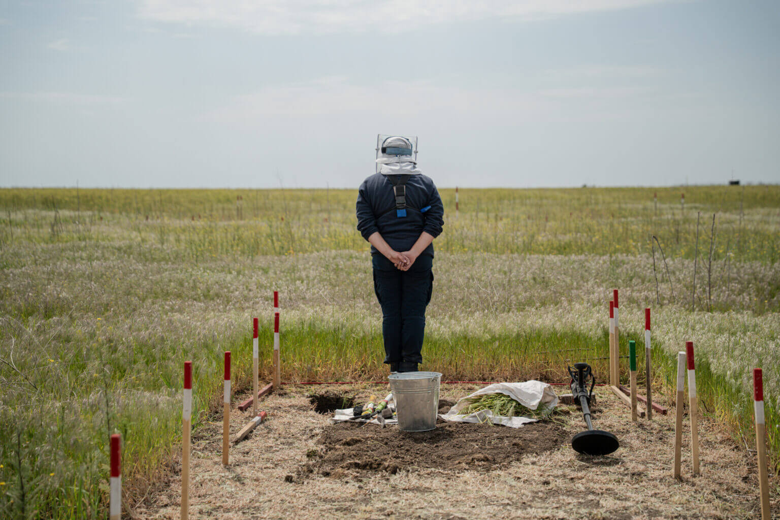
In a field near the small town of Bezymenne in southern Ukraine, Viktoriya Shynkar carefully picks a narrow path through the overgrown grass ahead of her. This small corridor of farmland in the Mykolaiv region will be checked for mines and explosives.
If all goes well, Shynkar – a 36-year-old who worked as a hairdresser until Russia’s full-scale invasion in February 2022 – will continue his work and create another space of the same size. While she enjoys spending her days outdoors, it remains a laborious and dangerous job.
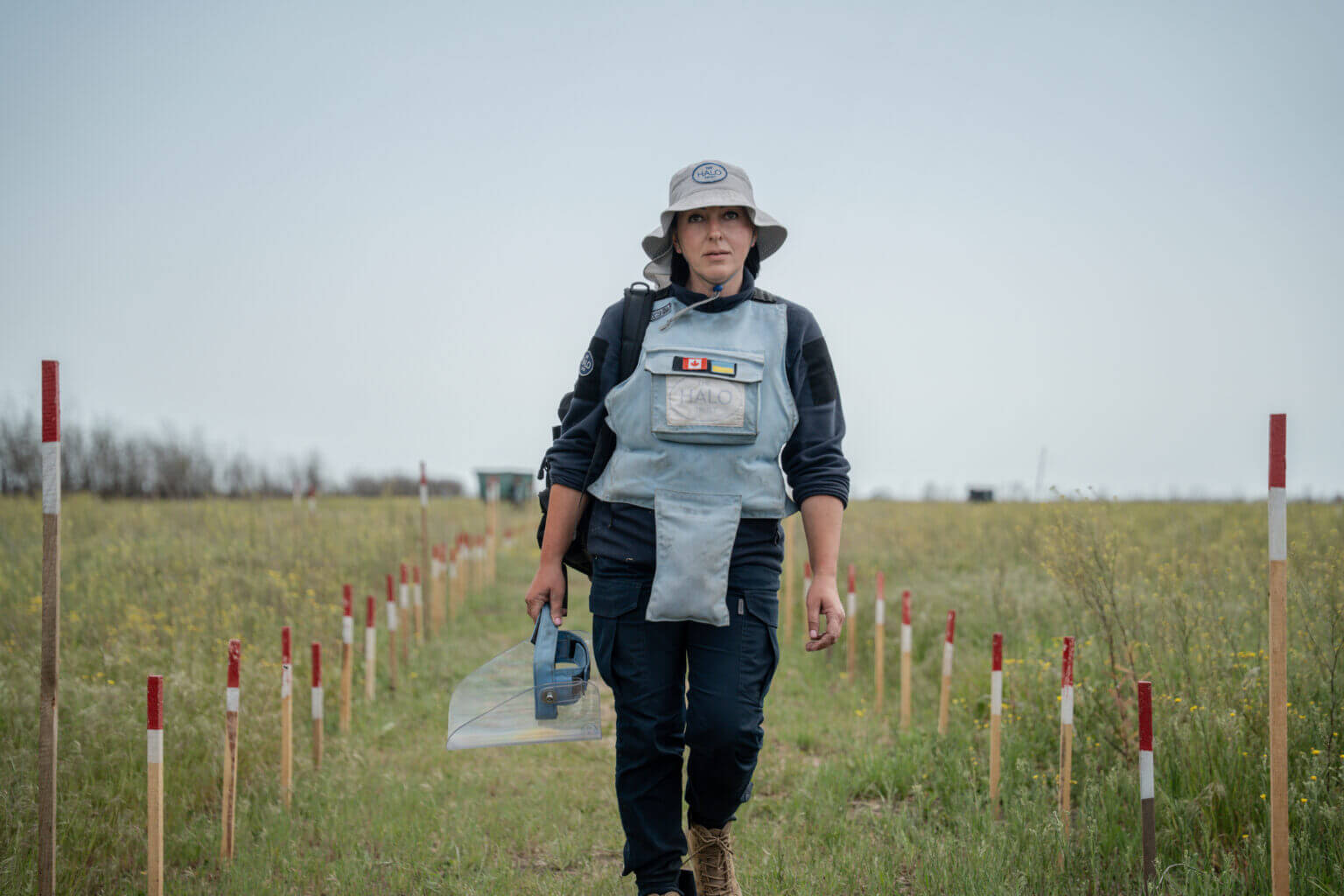
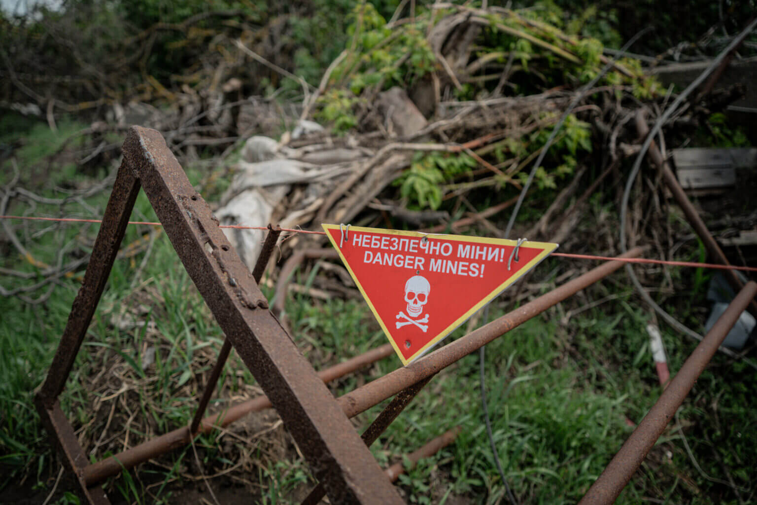
Shynkar and her colleagues, who work for the demining charity Halo Trust, discovered 243 Soviet-made TM-62 anti-tank mines left by the Russian army in a nearby field. The crude and fearsome TM-62 grenade, measuring 32 centimeters in diameter and 13 centimeters wide, contains 7.5 kilograms of TNT and can penetrate a tank if triggered.
The presence of landmines and other unexploded ordnance is a significant problem in Ukraine, affecting the civilian population and Ukraine’s agricultural sector, the country’s main employer and source of income.
Since the start of Russia’s full-scale invasion, numerous organizations have attempted to quantify the impact of landmines on Ukraine.
Created by the Ministry of Defense, the country’s National Mine Action Center (NMAC) has created a map showing confirmed hazardous areas, suspected hazardous areas, and areas that have been cleared or tested for hazards. It can be seen here and in the image below.
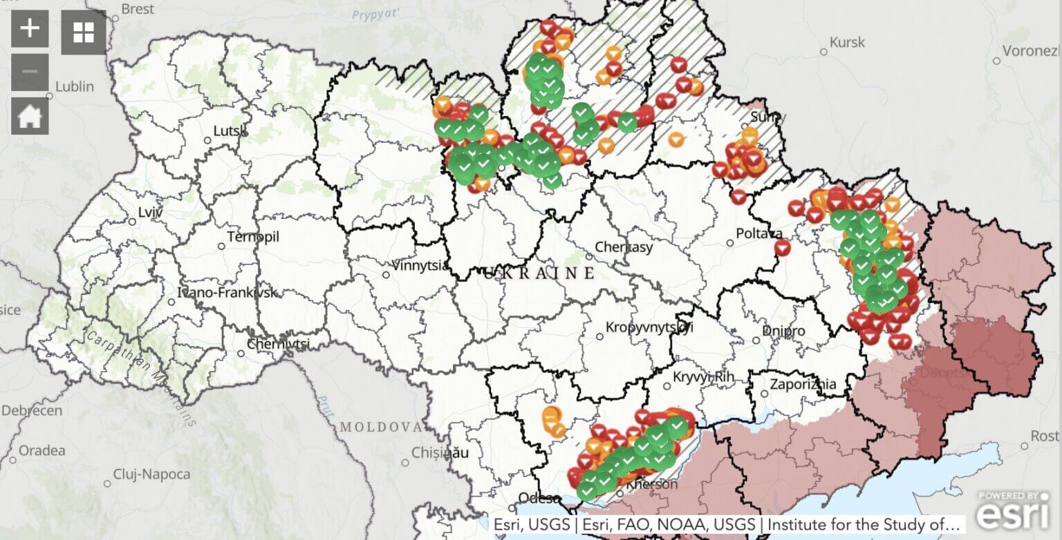
The information is gathered from more than 80 demining teams operating in the country, where people like Shynkar work. They collect data from the scene and share it with NMAC, which uploads it to this map, created using the IMSMA platform developed by the Geneva International Centre for Humanitarian Demining.
However, the data contained in the NMAC map, while significant, is only partial.
For example, it only shows the Ukrainian side of the front line, and only a part of it, with a section 20 kilometers from the front line inaccessible to demining teams. The same demining teams also do not work in Russian-controlled areas, which makes the overall picture even less clear.
Furthermore, just because a certain area may be marked as mine-free does not mean that it is not at risk from mines or other explosive devices that may not have detonated on impact. Some of them may simply not have been found yet.
This worries Igor Knyazev, a farmer from the town of Dovgenyke in the Kharkiv region. He tells AFP that he has been waiting for a demining team to visit for a long time. “Every year they promise: ‘Tomorrow, tomorrow we will clear all the fields,’” he says.
Knyazev says he has taken on the dangerous task of clearing his own fields with a metal detector. “Everyone clears mines themselves, absolutely everyone,” he insists. He even says he ran over a mine with his tractor and was lucky not to get hurt.
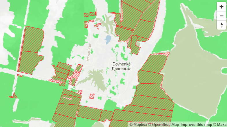
Although Knyazev discovered that his land was indeed contaminated, his predicament highlights the important issue of demining in Ukraine and for farmers returning to areas previously occupied or near the contact lines.
While some areas have been clearly identified as mined, uncertainty remains about those where mining is only suspected.
Experts have warned of the economic damage that can result from suspicions that turn out to be false. As the 2024 United Nations Development Programme report notes, areas suspected of contamination but not actually contaminated are either left untouched or subjected to the same lengthy clean-up process, which can be costly.
Such land could be used to grow crops and help farmers return to work. Despite the war, Ukraine remains a huge food exporter, making the problem significant beyond its borders.
Some farmers spoken to by AFP highlighted the difficulty of trying to determine which areas are contaminated and which are not.
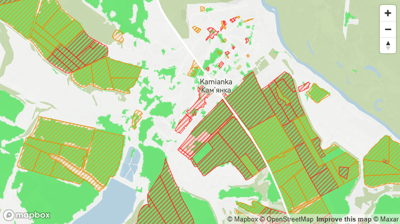
In the town of Kamianka in Kharkiv Oblast, Viktor and Larisa Sysenko express their gratitude to a team from the Swiss Demining Foundation (FSD) who helped clear their land with a specialized demining machine. “There were many explosions under this machine,” Larisa recalls.
Many of the mines were PFM-1 anti-personnel mines, which are more sensitive than anti-tank mines and can be deadly if stepped on by a person. The Sysenkos also had to deal with the danger of unexploded ordnance – remnants of a Ukrainian attack on retreating Russian troops in 2022 that remained buried in the soft soil without exploding.
However, in several other fields nearby, the situation was different, with FSD sappers finding only three explosive remnants after a long and laborious search.
One FSD team member told AFP that the metal contamination in these fields was “so immense that our detectors became useless, beeping constantly.” Of the thousands of metal fragments found, the vast majority turned out to be non-explosive.
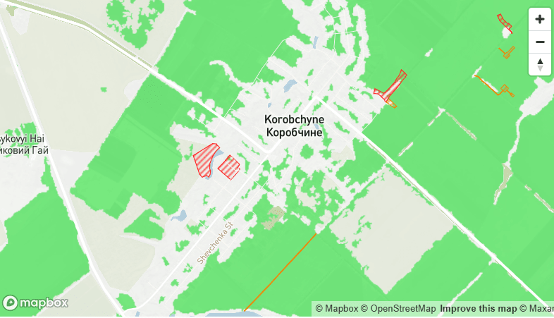
A few hundred miles to the west, in the town of Korobchyne, Mykola Pereverzev describes building a remote-controlled tractor to try to activate all the mines planted in about 200 hectares of fields there.
Pereverzev, who works for an agricultural company, describes blowing up a tractor and building another because the first one was beyond repair. The land is eventually reused, and Pereverzev mixes herbicides into the soil to plant sunflowers. But doubts remain about what might be underneath.
“The socialists say you can go through a place five times and blow it up the sixth time. Even the professionals blow it up, so what about us? We’re just an agricultural company,” he says.
Not surprisingly, Ukraine’s agricultural exports have suffered severely since the start of Russia’s full-scale invasion. The country’s agriculture minister, Vitaly Koval, told AFP that “grain production has fallen from 84 million tonnes in 2021 to 56 million tonnes.”
He continued: “Ukraine has 42 million hectares of agricultural land, including arable land. On paper, we can cultivate 32 million hectares. But what is available, uncontaminated, unoccupied land? 24 million hectares.”
“When we come to Brussels (to prepare for Ukraine’s future EU membership), we are shown infographics that say we have 42 million hectares. But the reality, unfortunately, is 24 million,” Koval said.
Of course, not all of this is due to the presence of landmines or explosive devices. Other factors also affect agricultural production. These include land being located in areas of ongoing fighting, destruction of agricultural equipment or farmers joining the armed forces, fleeing to safety or not returning. However, landmines remain a significant part of the mix.
Koval’s office said that just over 123,000 km² of land still needs to be assessed for mines or explosives. That’s a vast area, almost the size of Greece, much of which remains inaccessible along a 1,500-km front line.
Of the agricultural land that is accessible and assessed today, the Ministry of Agriculture has identified 14,200 hectares as contaminated. As of May 2025, the ministry said 11,800 hectares of this area had been cleared.
However, to be clear, these figures do not take into account areas still suspected of contamination or the large area of the front that is currently inaccessible to demining teams, all of which will need to be assessed in the future. If Ukraine withdraws from the Ottawa Convention on Anti-Personnel Mines, as it announced last week, it will likely add another layer of complexity to future demining efforts. Russia has never signed the 1997 convention, and several of Ukraine’s neighbors have recently signaled that they may also withdraw from the treaty.
Paul Heslop is the head of the United Nations Development Programme’s mine action programme in Ukraine. Like all the experts interviewed for this article, he is cautious about making precise estimates of the scale of the mine problem, given the length of the front line and the many unknowns that remain in a country at war.
However, he admits to AFP that it is a significant phenomenon, given that Ukraine is likely to contain millions of mines or unexploded ordnance.
But he adds that by organising and taking a strategic approach to priority areas for assessment, the land that is most important can potentially be returned to productive use first.
The most contaminated land will be located closest to the front line, he told AFP. He adds that a little further away there is another area that has been significantly affected, although less intensively. In this area “there is critical infrastructure, bridges, power lines, power plants… transformers, schools, hospitals. They need to be cleared first,” he says.
As an example, Heslop points to the farmland north of Kyiv or between the Ukrainian capital and Kharkiv that was occupied at the beginning of the war. “A significant portion of this land is now assessed as uncontaminated… or the contaminated areas have already been cleared.” However, he acknowledges that some areas, especially along the current front line, will take a long time to assess.
Pete Smith is another well-known demining expert. He oversees the work of the Halo Trust and its 1,500 staff in Ukraine. Like Heslop, he acknowledges the scale of the problem, suggesting that Ukraine may be the most heavily mined country in the world. But he also sees hope in new technological solutions that could speed up the pace of demining.
In an interview with AFP, he said: “We can innovate and use technologies like satellite imagery, drone imagery, which helps us pinpoint in great detail where the concentrations of landmines and explosive ordnance are.”
He describes analysts who analyze drone and satellite imagery “pixel by pixel” to find mines, and use artificial intelligence algorithms to aid the search. However, while Smith is enthusiastic about such developments, he adds: “It’s not yet an industrial process.” “We are getting small benefits,” he adds. “But I think this is where we will continue to grow.” For now, those working in the field, like Viktoriya Shynkar, will continue their work to clear mines in Ukraine.
As of May 31, 2025, she has worked at Halo Trust for a year. It is a position she feels comfortable in, despite the dangers associated with the work.
“I have never regretted [taking this job], not at all,” she says. “I really like this job. Because there are a lot of good people here, and I feel like I am relaxing at work.”
She also finds satisfaction in the results of her work.
“There is a lot of pollution here… and farmers can’t work, they can’t grow crops,” she says.
“We really need it, so I want to help in any way I can to make our country prosper.”