
11.10.2023
6 min
1846

We will talk about the steps necessary to effectively determine the location using road signs indicating the distance to the nearest cities. Especially in the field of OSINT, they allow analysts to more quickly collect and analyze geographic data, which is essential for real-time incident investigations and location-specific intelligence gathering.

Today we will talk about road signs that show the distance to the nearest cities. Let’s try to find out where this road sign is located.
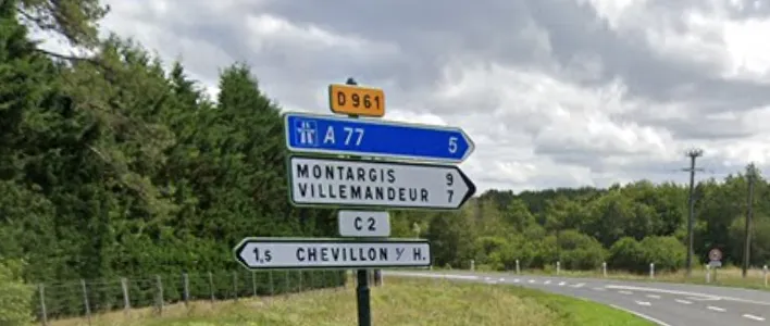
The first thing to do is to look up the names of the cities in the search engine and find out where they are located. You can use Google Lens to recognize and translate text.
Then open FreeMapTools ( https://www.freemaptools.com/radius-around-point.htm ):
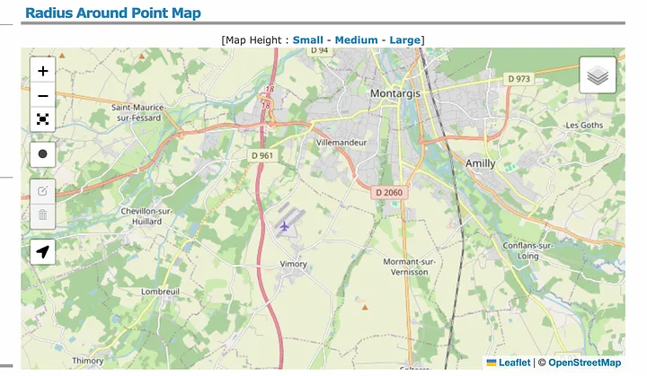
And draw circles around each city (the radius should be one kilometer more than indicated on the sign). Be careful! In some countries, miles are used instead of kilometers. You can convert miles to kilometers directly in the Google search form.
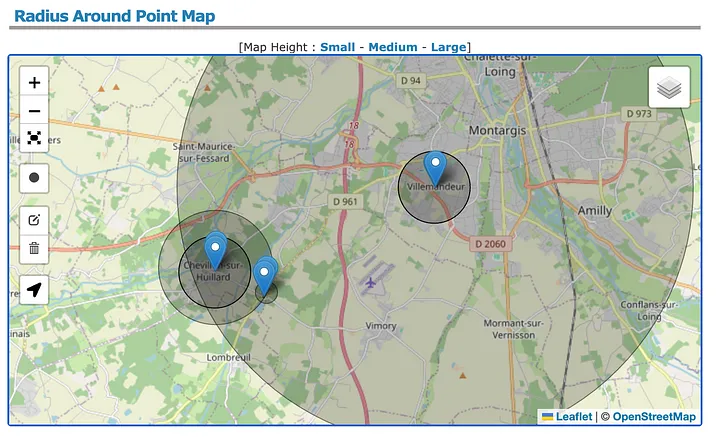
After that, find the intersection where the circles intersect and draw another small circle there (THIS IS IMPORTANT).
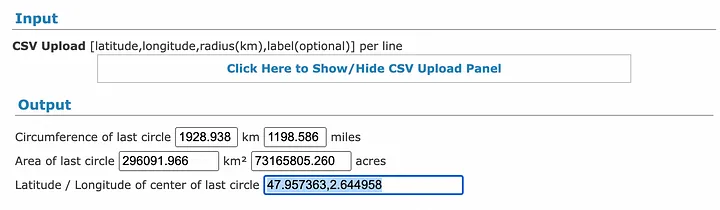
Then scroll down the page a bit and copy the coordinates from the “Lat/Long of the center of the last circle” field.
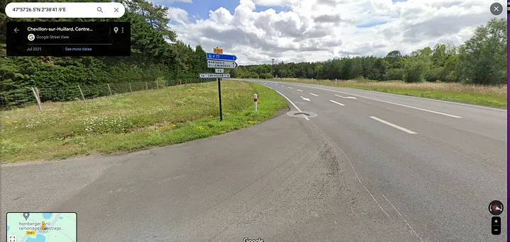
Then just paste these coordinates into the Google Maps search box and use Google Street View.
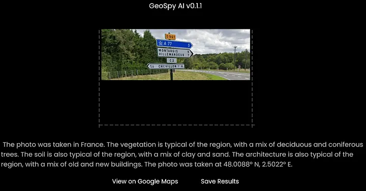
Sometimes it happens that the names of settlements on signposts are found in dozens of different parts of the world. In this case, you can use AI tools to determine the approximate location of the image:
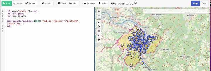
If the distance is short and there is a visible object near the sign (such as a bus stop or a tree), you can use OverPass Turbo: overpass-turbo.eu
rel[name=”Koblenz”]->.rel;
.rel out geom;
.rel map_to_area;

node(area)(around.rel:10000)[“public_transport”=”platform”][“bus”=”yes”];
out;
Upon request above, you will find bus stops within 10 km of Koblenz.
You can also search for various objects related to roads, such as traffic lights and intersections. If the distance exceeds a couple of tens of kilometers, in this case, try to find an image of the sign in Google Lens or use the ruler tool to find the necessary points on the roads on Google Maps.