
03.07.2025
4 min
1367

Deadly floods in Beijing have become one of the largest natural disasters of 2025. Open source intelligence (OSINT) has helped to establish the true scale of the tragedy: more than 40 people died, tens of thousands were evacuated, and hundreds of hectares of farmland were destroyed in Hebei province. Analysis of satellite images, eyewitness photos and videos, as well as official statements from local authorities, has revealed serious gaps in China’s preparedness for extreme weather conditions.
Beijing authorities have put all 16 districts of the city on high alert due to torrential rains. Since then, more than 40 people have been confirmed dead and 80,000 have been evacuated across the city due to flooding.
But what can open-source data tell us about the damage?
Satellite imagery has allowed us to track the impact on both urban and rural areas. But on social media, a flood of fake AI-generated videos continues to garner far more views than many real eyewitness videos.
In the northeast of Beijing, near the largest reservoir in northern China, the city of Taishitun has seen the highest number of deaths. Thirty-one of the confirmed fatalities occurred at a nursing home near the banks of the Qingshui River, which runs through the city.
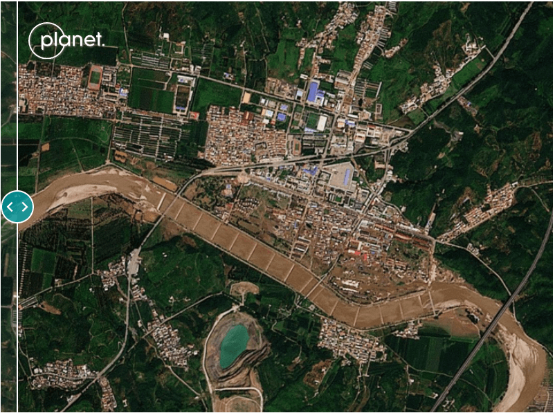
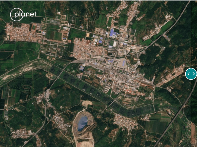
Taishitun Village, Miyun District, Beijing. Comparison 07/18/2025 with 07/30/2025. Photo: Planet.
Yu Weigo, Communist Party secretary of Miyun District, which includes Taixitun, told a news conference that there were “gaps” in the city’s preparedness.
“We lacked knowledge about extreme weather. This tragic lesson has warned us that putting people first, putting human life first is more than just a slogan,” Yu said.
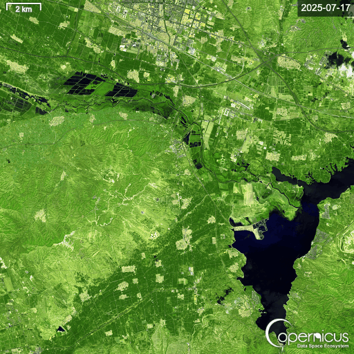
Across Hebei province, which borders Beijing, farmland has also been badly affected. In the village of Juying, more than 1,300 hectares of farmland, much of it low-lying cornfields, were flooded, Reuters reported. Satellite data from the area north and east of Juying showed the extent of the flash floods.
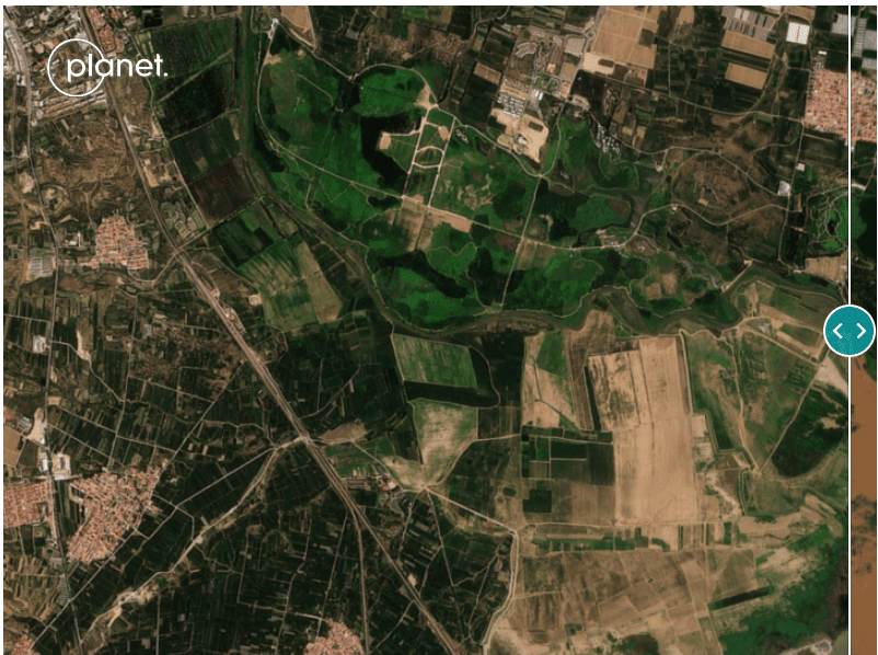
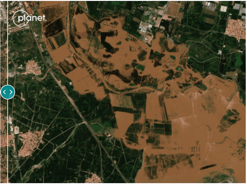
Juying Village, Hebei Province. Comparison 07/17/2025 with 07/30/2025. Photo: Planet.
Zooming in even further, you can see how the Copernicus False Color (Urban) strip shows flooded areas in dark blue, highlighting the impact on Hebei Province.
However, on other open platforms, such as social media and video-sharing sites, the picture has been complicated by accounts posting false and disinformation.
An English search for #beijingflood on YouTube Shorts revealed several AI-generated thumbnails, one of which has surpassed 18 million views. Meanwhile, shorts featuring real footage have barely surpassed 1,000 views.
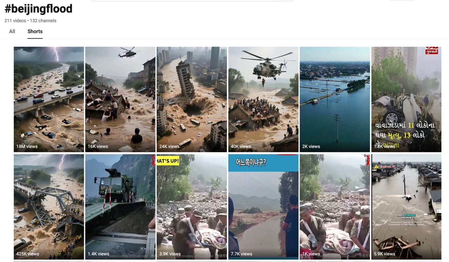
All five top results had the hallmarks of AI-generated content: cars randomly appearing and disappearing, disproportionately large objects, and overly dramatic scenes lasting only a few seconds.
On Facebook, a search for “Beijing floods” yielded several fake AI-generated posts claiming that actor Jackie Chan had died in the floods. Using AI-generated photos of Chan lying in a hospital bed or in a coffin, the posts collectively garnered over 150,000 likes.

In comparison, Chinese social media platforms, including Baidu’s Haokan Video, Weibo, and Douyin, featured very few AI-generated videos. Instead, the vast majority appeared to be genuine posts documenting the real-world impact of the floods.
A montage of videos found on Haokan in several areas of Beijing.
In an attempt to verify a sampling of what we saw, Bellingcat geotagged several videos. Note that Google and Baidu use different coordinate systems. We identified all landmarks on Baidu maps before completing the geotagging in Google Earth Pro.
One video showed a series of clips, including a bulldozer driving down a flooded road with two lifeboats in tow. This shot was geotagged at the People’s Government Building in Taishitun Township.
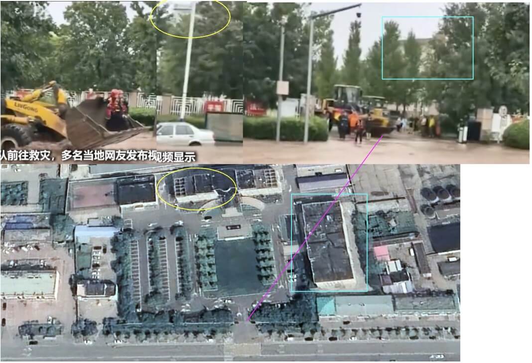
Later, in another clip from the same video, a bulldozer can be seen, again not far from a government building in Taishitun.
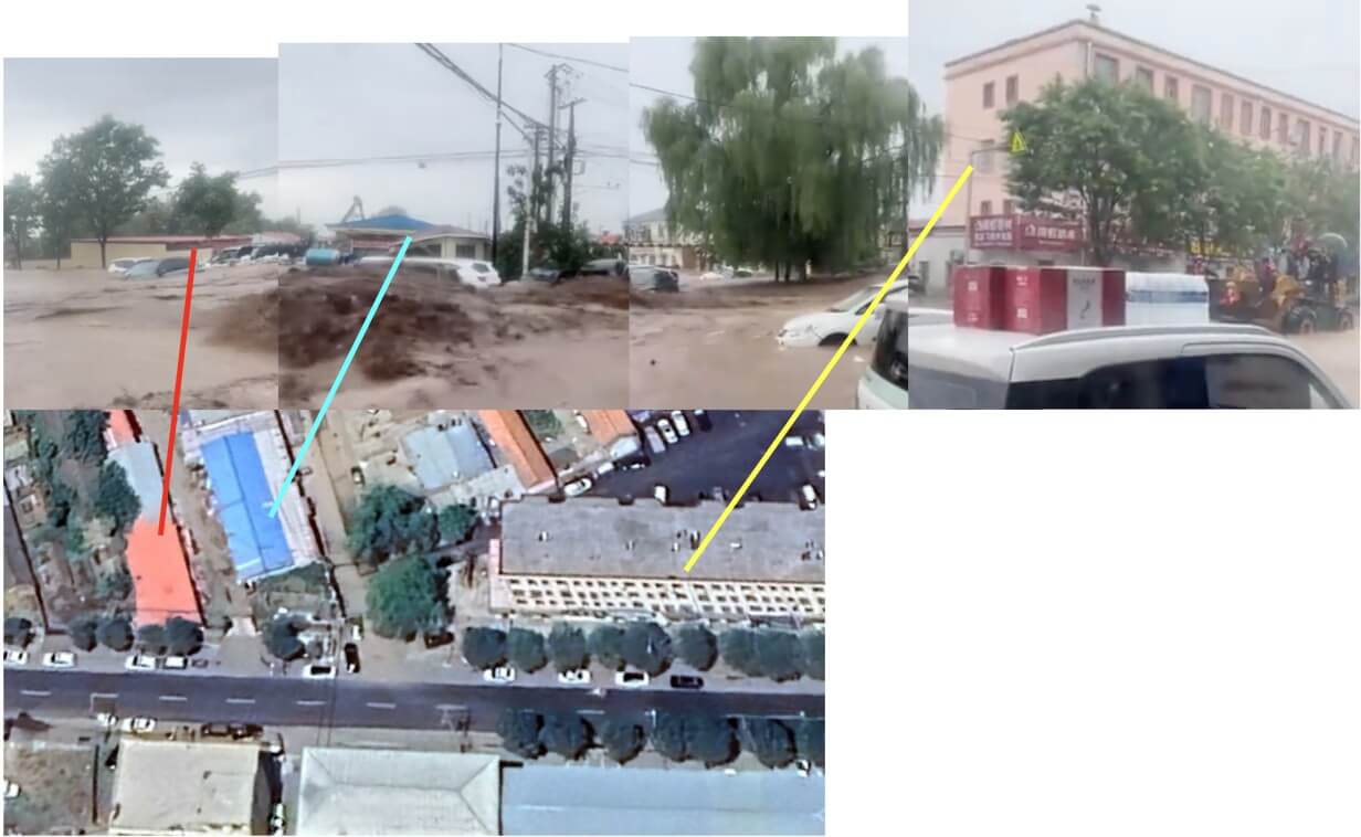
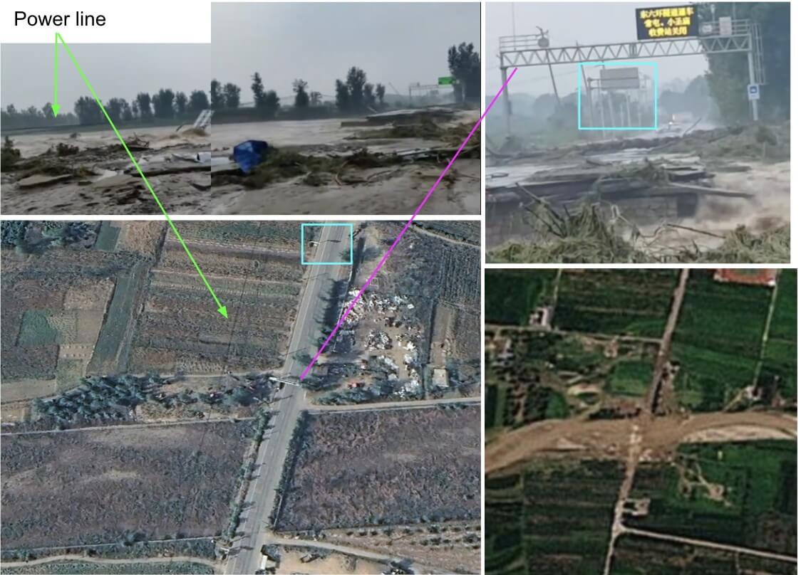
Another video posted on Haokan showing the collapsed bridge was geolocated east of Bulaotun village. The collapsed bridge can also be seen in Planet footage from July 30.
A search on Chinese social media has revealed some rehashed footage of past floods. For example, on Douyin, China’s version of TikTok, one of the top results for the search term “Beijing flood” was a 2021 video showing a landslide in Japan engulfing buildings and trees.