In the article, you will learn about the key conclusions of the analysis of fires in Russia for the third quarter of 2023

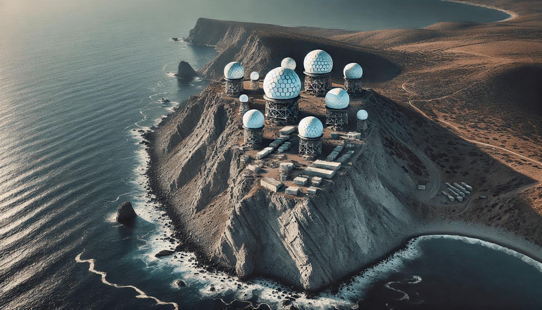
Having occupied Crimea, Russia turned it into a military base, installing modern radars there to control the airspace. These domes protect the radar from weather conditions and possible attacks. The article also explains how analysts discovered the locations of these complexes using tourist photos and social media.
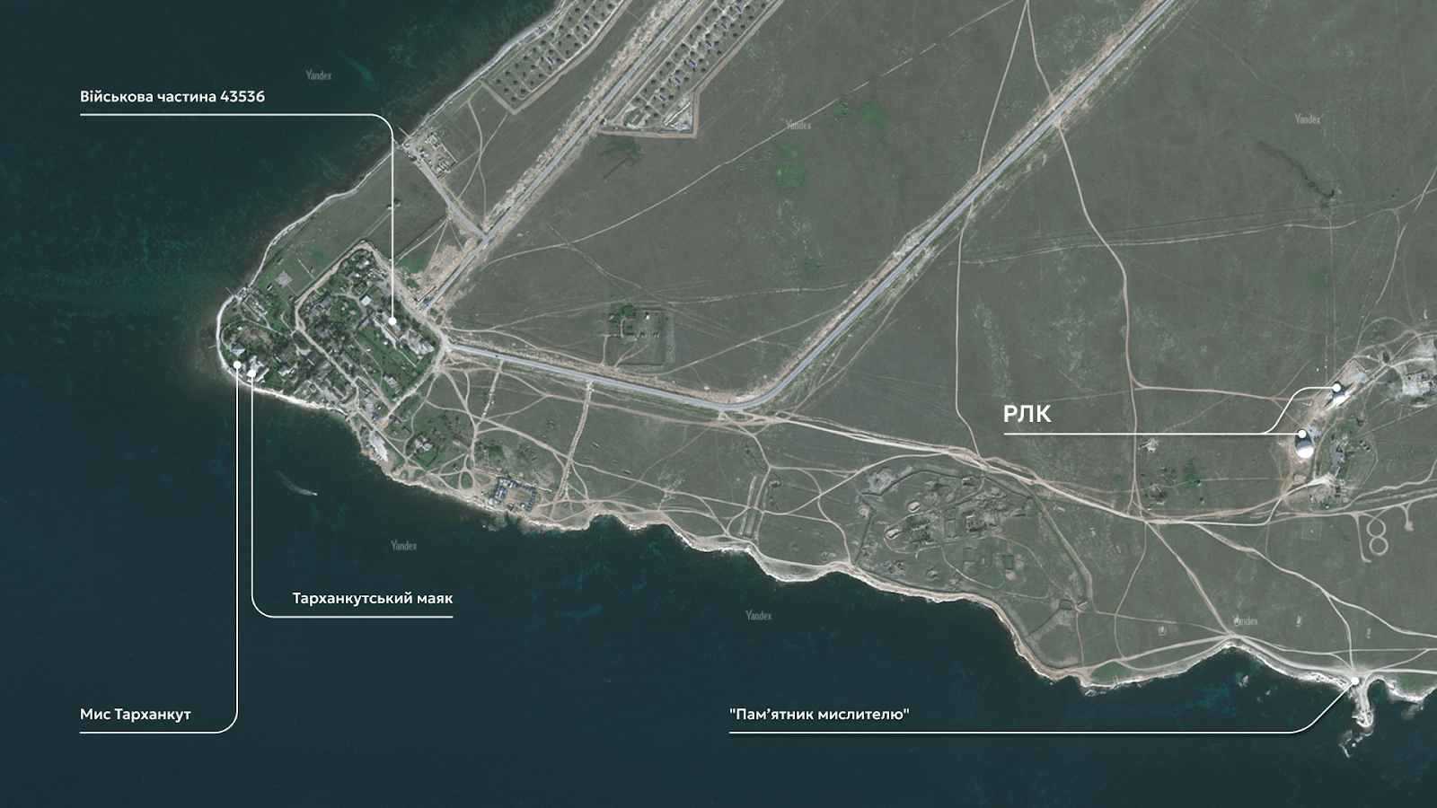
Cape Tarkhankut is an important military facility of the Russian Federation that performs strategic tasks and controls the airspace in the region.
Before the occupation of Crimea by Russia, Cape Tarkhankut was the base of the 40th separate radio engineering brigade of the Ukrainian Air Force. In 2016, the Russian Federation deployed the Nebo-U, Nebo-SVU and Kasta-2E2 low-altitude all-round radar systems here. We will tell you more about these Russian radars later.
About two kilometers from this place is military unit 43536, the base of the 3rd radio engineering regiment of the radio engineering troops of the Russian Aerospace Forces.
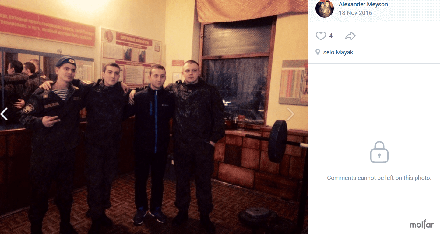
Between 2016 and 2019, an asphalt road was laid to the military town located a few kilometers away, which indicates the regular use of the facilities by the Russian military. At the beginning of July 2023, in the “Excursions to Crimea from Sevastopol” group in VKontakte, photos were published in which vacationers were photographed against the background of a military town.
Russian radar systems are used to detect, track, and identify objects in the air, on land, and in water. They ensure airspace security and threat detection.
At Cape Tarkhankut, there are modern radars “Nebo-U”, “Nebo-SVU” and low-altitude radar “Kasta-2E2”. These systems are capable of detecting targets at great distances and heights.
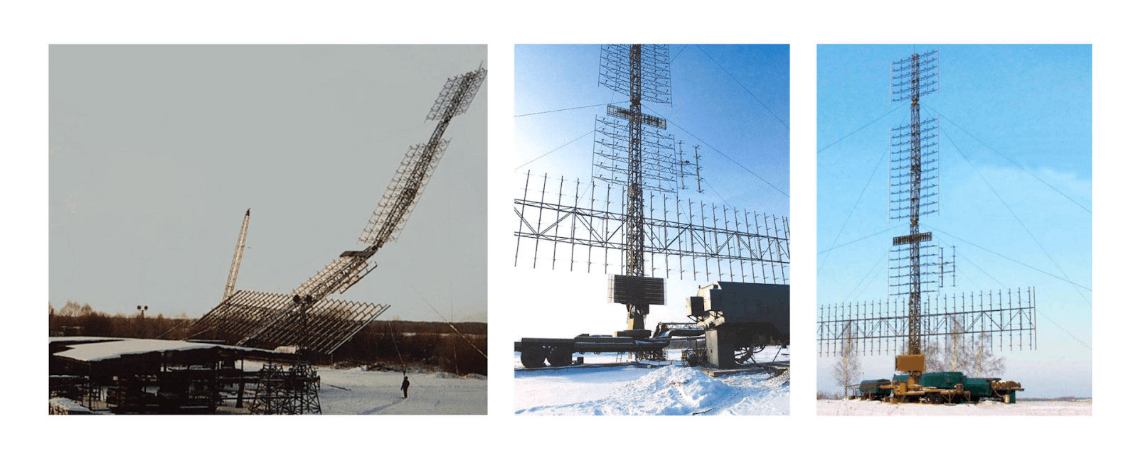
“Nebo-M” (also known as “Nebo-UE”) is a mobile multi-band radar complex that can detect and track air objects of various types, including ballistic missiles and drones developed using stealth technology.
The complex consists of a meter-range radar module RLM-D (“Protyvnyk-G”), a centimeter-range radar module (not detected at the site as of 2016) and a control cabin.
RLK is able to detect fighters at an altitude of 20 km at a distance of up to 380 km, and at an altitude of 500 m – up to 65 km. Deployment/collapse time is about 30 minutes.
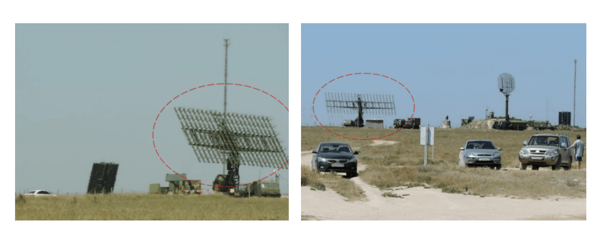
“Каста-2Е2” — it is a Russian three-coordinate radar system (Radar) of low-altitude duty mode circular survey, which is designed for airspace control. It is capable of determining the range, azimuth, altitude and track characteristics of aerial objects such as airplanes, helicopters, unmanned aerial vehicles (UAVs) and cruise missiles. According to Russian data, this system can detect up to 50 air targets with a circular survey of up to 150 km.
The 14-meter antenna is capable of detecting targets at an altitude of 60 meters and at a distance of up to 30 km. Another version of the antenna, 52 meters long, detects targets at a distance of up to 95 km. It is also stated that the “Kasta-2E2” can detect fifth-generation F-35 fighters.
A radio-transparent dome, or radome, is a structure that covers the antenna of a radar station or other transmitting devices. The main function of this dome is to protect the antenna from external influences, such as weather conditions or drone attacks, while ensuring minimal absorption and reflection of radio waves.
It is likely that the radar stations were covered with domes in 2019-2020 in preparation for a full-scale Russian invasion of Ukraine. Also, this decision could be made due to the large number of tourists in the area. For example, less than a kilometer from the largest dome is the popular tourist attraction “Monument to the Thinker”. Radars located nearby often appear in photographs.
A 55Zh6U “Nebo-U” radar was installed near Feodosia under such a dome. In 2016, user starcom68 identified and photographed the antenna.
Practice since the times of the USSR: During the times of the USSR, radar antennas were placed under radio-transparent domes. It is known about such a radar under a dome near Feodosia, which is also known as a “space tracking station”.
The dome appeared in 2019-2020: The Russians probably created the domes in preparation for a full-scale invasion of Ukraine to protect important equipment from possible attacks by the Armed Forces in occupied Crimea.
Cape Tarkhankut is a tourist location: the Cape is often photographed with the “Monument to the Thinker”. Usually the photo is taken with a view of the sea, leaving the domes out of the frame, but sometimes military objects also get into the pictures. This helped Molfar analysts in verifying the impact on this object.
“Nebo-U”, “Nebo-SVU”, “Kasta-2E2” are modern anti-aircraft missiles: These are the latest developments of the Russian military-industrial complex, deployed on the territory of occupied Crimea as early as 2016, which makes them priority objects for protection.
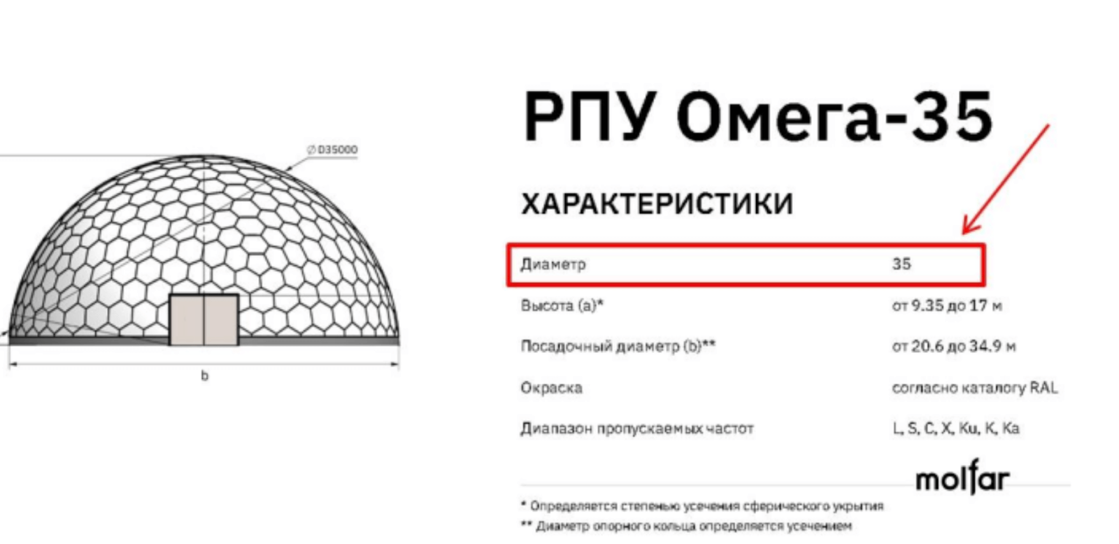
The radio-transparent shelters on Cape Tarkhankut were probably created by the Russian scientific and industrial association “Radiovolna” (NPO “Radiovolna”). According to information from their official website, the company has a patented technology for the production of RPU with a diameter of 1 to 35 meters.
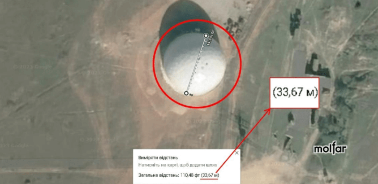
It seems to be RPU Omega-35.
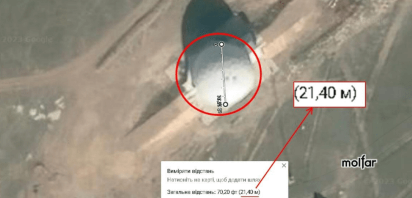
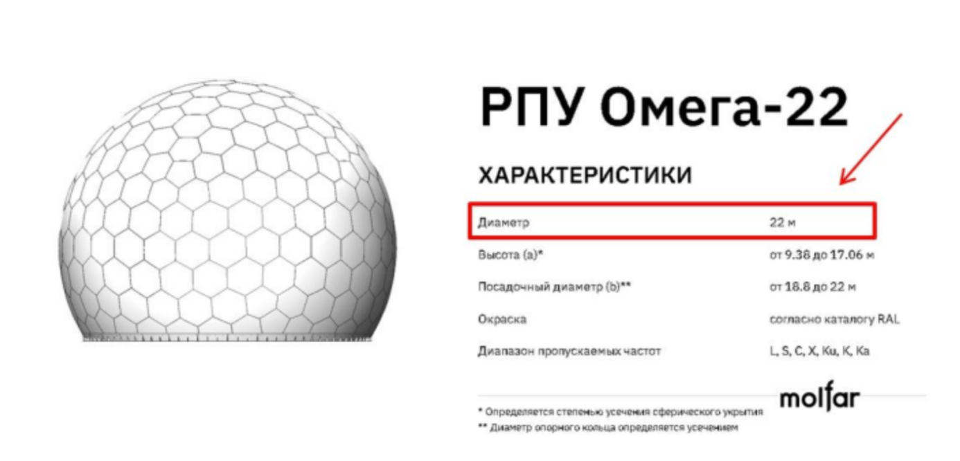
The second dome on Cape Tarkhankut is slightly smaller. Using a standard ruler from Google Maps, we determined its approximate diameter — almost 22 m.
“Radiovolna” is a Russian enterprise in the radio engineering industry, which specializes in the development and production of products made of radio-transparent materials for both civil and dual purposes. The main products of the company are radio-transparent shelters. The company’s office is located in St. Petersburg, Kozhevennaya line 1-3 years. P, note 1N.
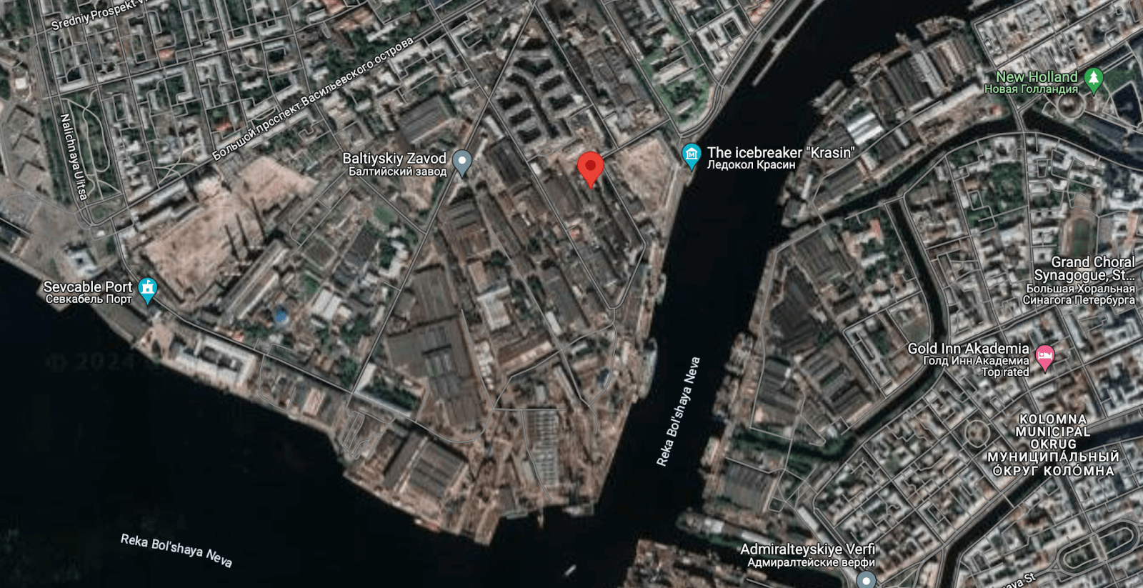
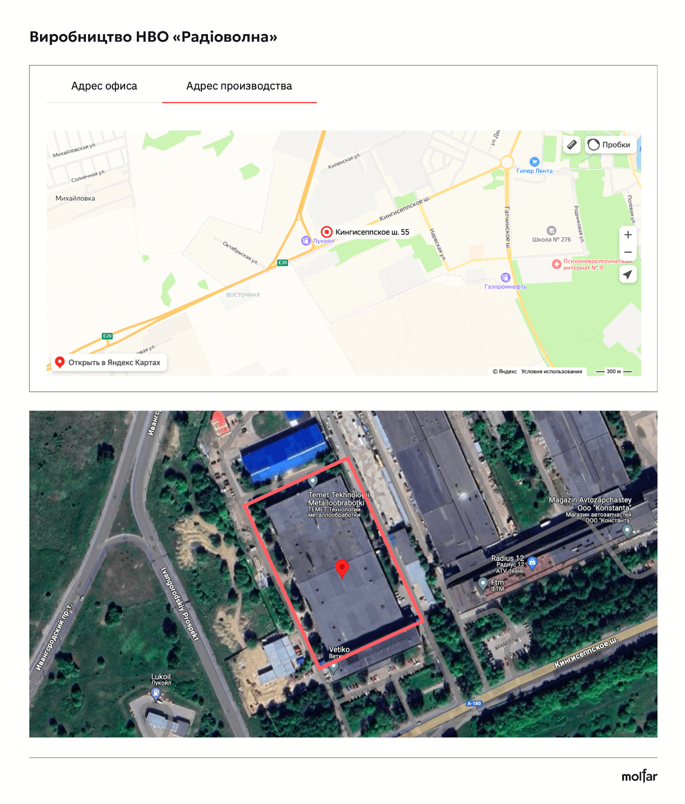
Production of NPO “Radiovolna” — St. Petersburg, Krasnosilsky district, Kingiseppske shosse, 55.
 How was the dome on Tarkhankut damaged? One of the last attacks was the night operation of April 28, 2024. According to the propaganda resource “Rybar”, the attack was carried out by ATACMS operational-tactical missiles with a cluster warhead. The target of the attack was probably air defense units located in the area.
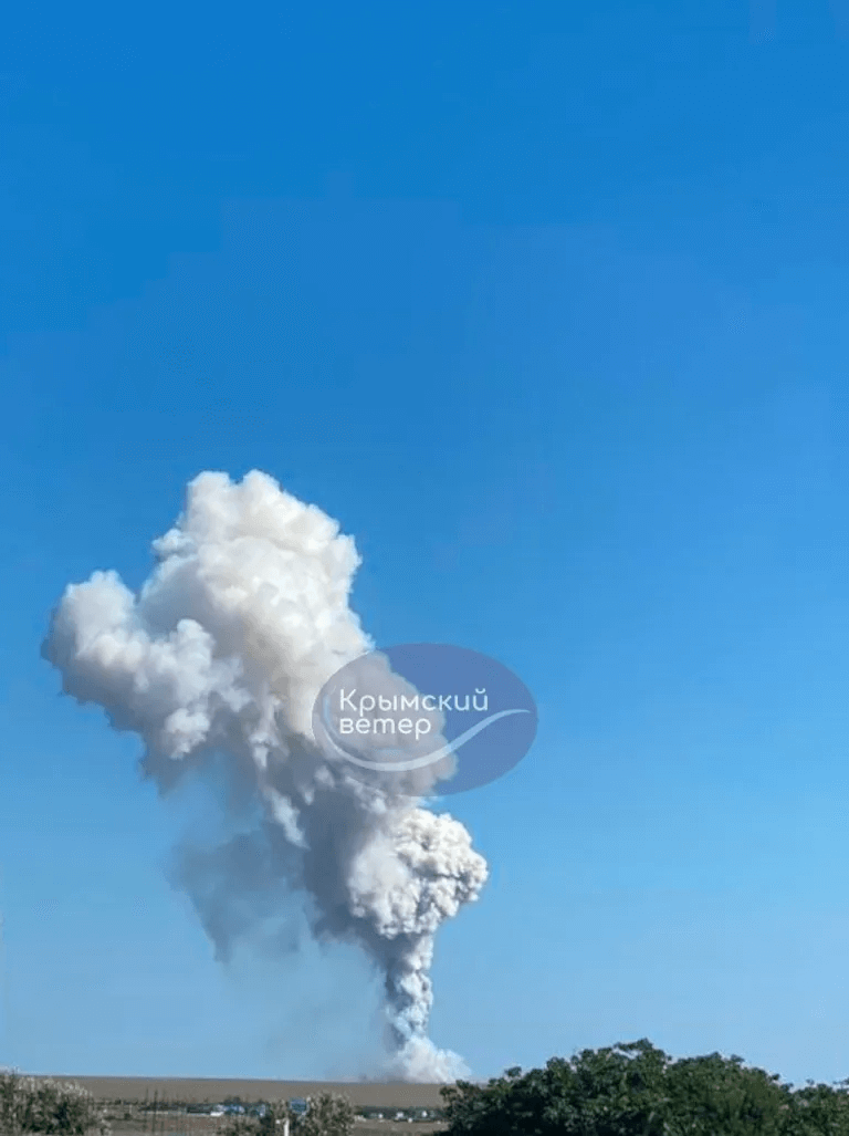
On August 23, 2023, explosions occurred at Cape Tarkhankut. Local telegram channels reported that Russian military facilities were damaged around 10 am. Eyewitnesses from the Olenivka settlement, located nearby, said that after the explosions, four Russian fighter jets flew in the direction of the cape.
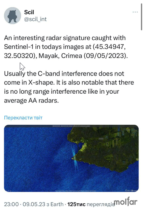
At dawn the next day, August 24, Ukrainian military personnel from a unit of the Main Intelligence Directorate landed in the area of Cape Tarkhankut. On June 11, 2023, Radio & Nukes tweeted satellite images from June 5, 2023, showing a black spot on the larger dome. These are probably traces of damage.
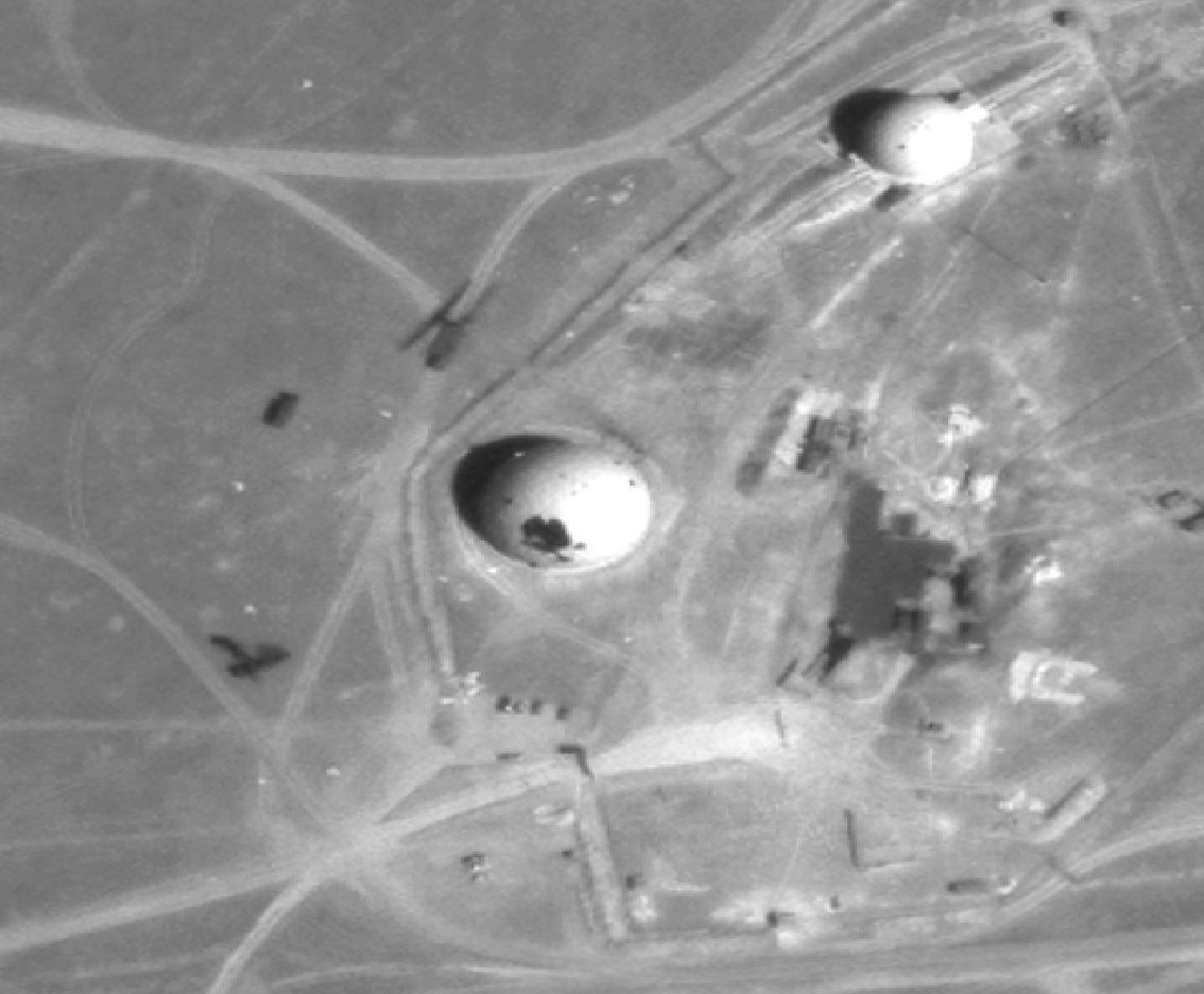
At the same time, other users reported optical distortions on satellite images as far back as May 2023. The dome was probably shelled in April 2023. At that time, it was also reported about shelling in the Feodosiya area, where there are similar domes under which the 55Zh6U “Nebo-U” radar, 57U6 “Periscope-VM” and “Nebo-T” radar are located. Nearby is the radar site of the 3rd Radio Engineering Regiment on the Tepe-Oba Ridge.
As mentioned earlier, next to this object there is a tourist location that attracts dozens of visitors who take pictures near the “Monument to the Thinker”, and the “dome” is often included in these photos.
.
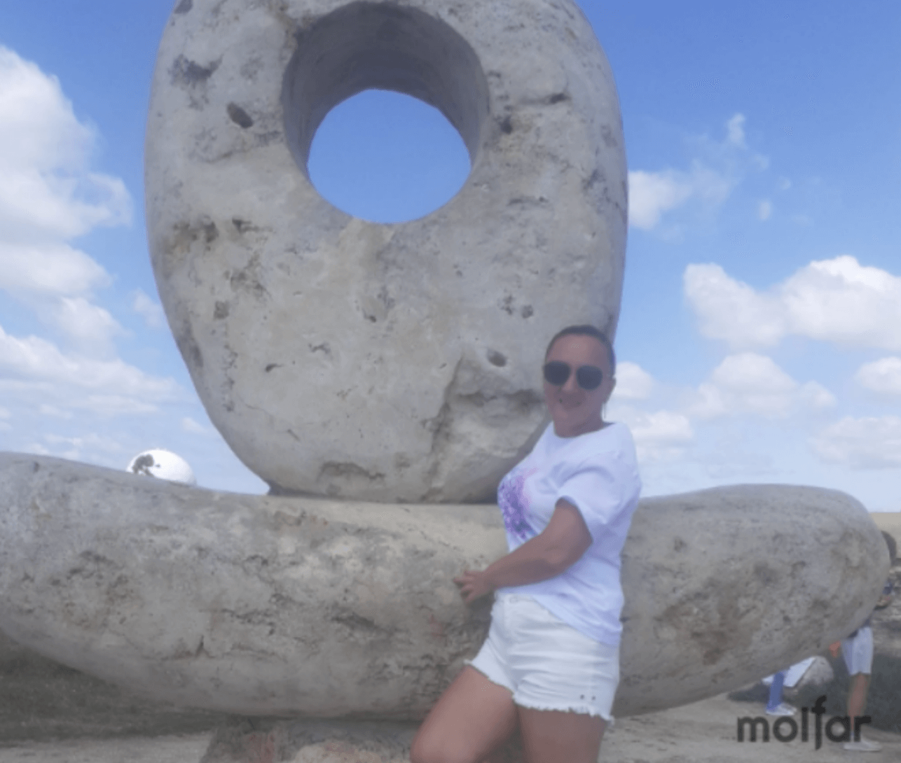
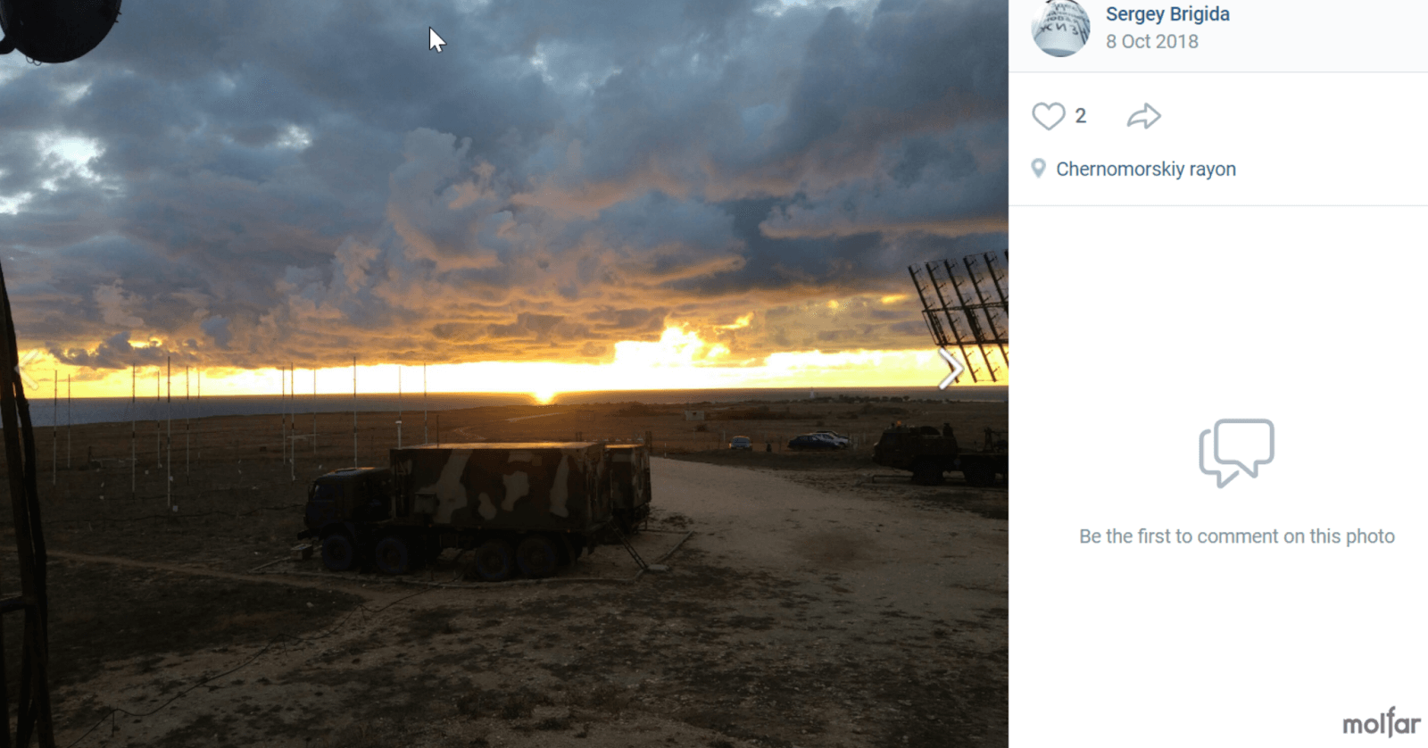
Another Russian, Sergey Brigida, in October 2018 published on his VKontakte page photos in which he is in military uniform standing next to the tourist attraction “Monument to the Thinker”. This is the same sculpture near which the Russian Lesya Volodymyrivna was photographed.
In June 2018, Serhii also published several photos, noting the geolocation on the territory of the military town. In October 2018, he posted a geo-located photo next to the domes.
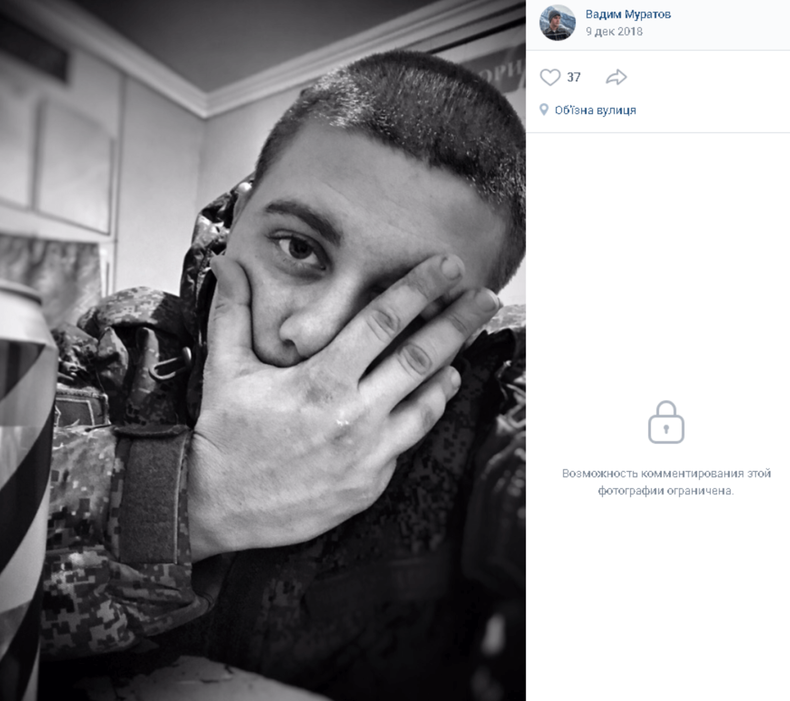
Russian military officer Vadim Muratov published a photo in a military town with a geolocation point.
Anatoly Kozyrev, a user of the Russian social network, in August-September 2022 published a photo showing the Tarkhankut lighthouse against the background of a military town. The pictures also show satellite dishes that could be used by the Russian military, confirming their presence during the invasion.
Cape Tarkhankut, where the Nebo-M and Nebo-SVU complexes are deployed, is an important element of Crimea’s air defense. The features of the terrain allow radar to be placed here under radio-transparent shelters, which ensures control of the airspace of the Black Sea and NATO countries, such as Turkey, Bulgaria and Romania. A similar situation with the radars on Ai-Petri affected by Storm Shadow. The Russians are trying to protect their air defense, but will they succeed?