11.10.2023
6 min
1846

You will learn how to use open intelligence (OSINT) and geographic information processing (GEOINT) methods for deep analysis of the geolocation of 5G bases. With the development of 5G networks, there is a need for a detailed study of their location and impact on the environment. You will also learn how OSINT helps collect data from open sources, and GEOINT helps determine the exact coordinates of base stations. This article will show how these techniques can be used to create a complete map of 5G networks and analyze their impact.

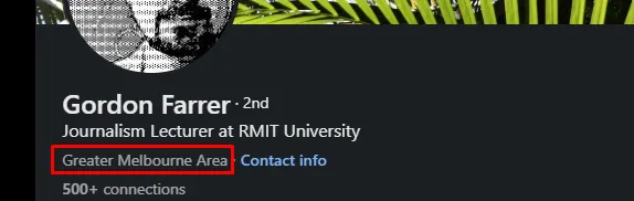
In today’s blog we will dive into the OSINT/GEOINT research we conducted to determine the exact geolocation of the 5G base as part of the OSINT challenge that Gordon Farrer posted on his X account.
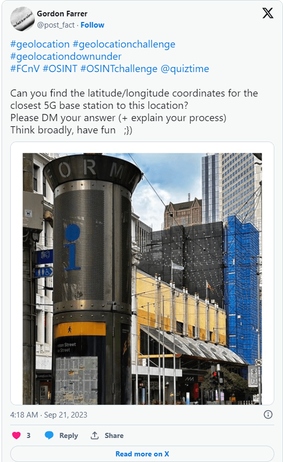
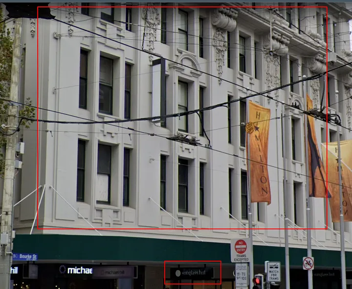
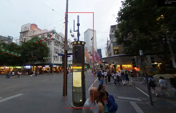
First of all, we started our research by uploading an image to find more details about it. Now let’s try to get some clues and indicators in the image to reveal the approximate location.
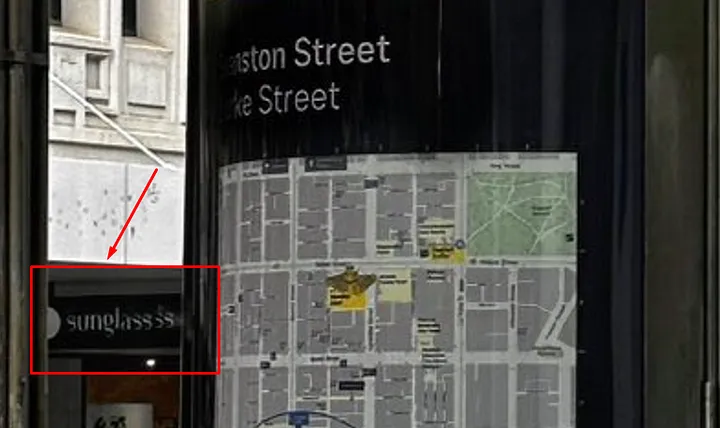
Indicators:
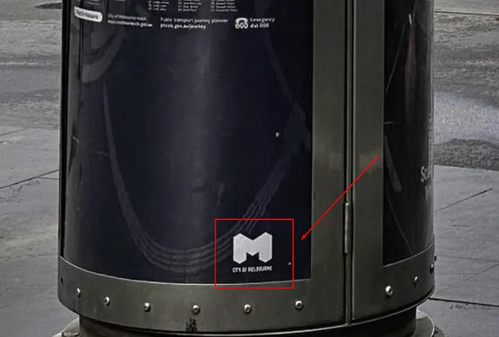
Yellow – We see repeating “M” logos, which may hint at the location of this city.
Orange – City Map.
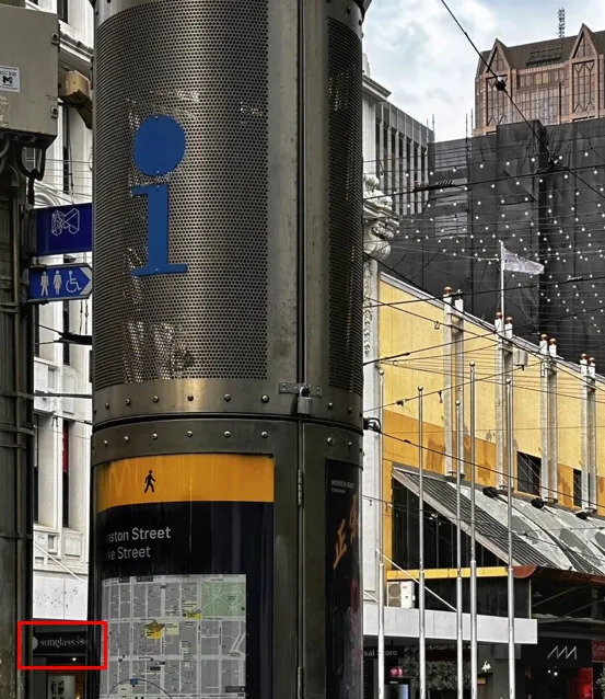
Red – I noticed that there is a Sunglasses Shack store that might help us find out the town where this photo was taken.
Green – we see tall buildings/skyscrapers.
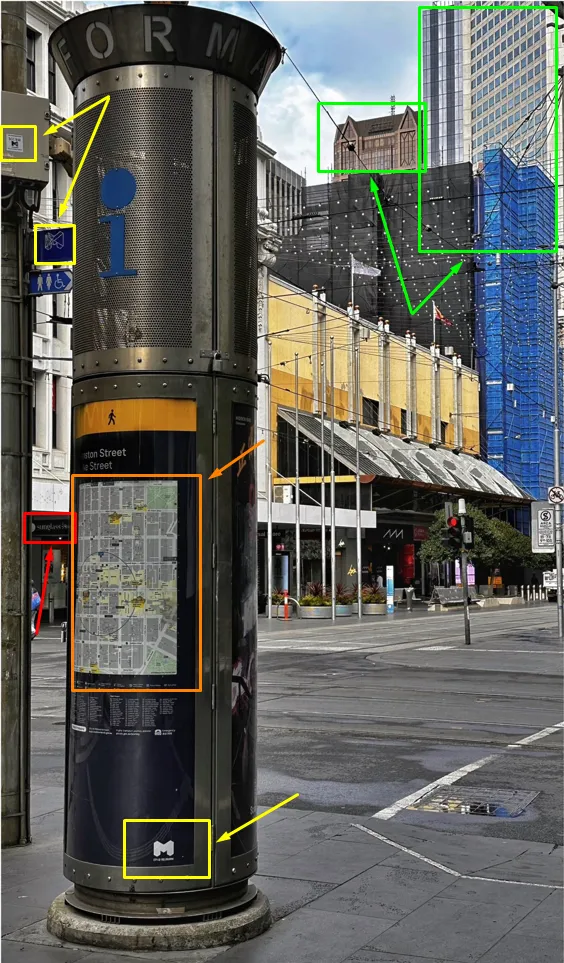
Also, for me, the OSINT investigation process starts with analyzing the profile and doing SOCMINT (a little dumpster diving) from where the image was downloaded, which means digging into the profile and looking for indicators that might give us the location of this user, it could be him hometown or place of residence.
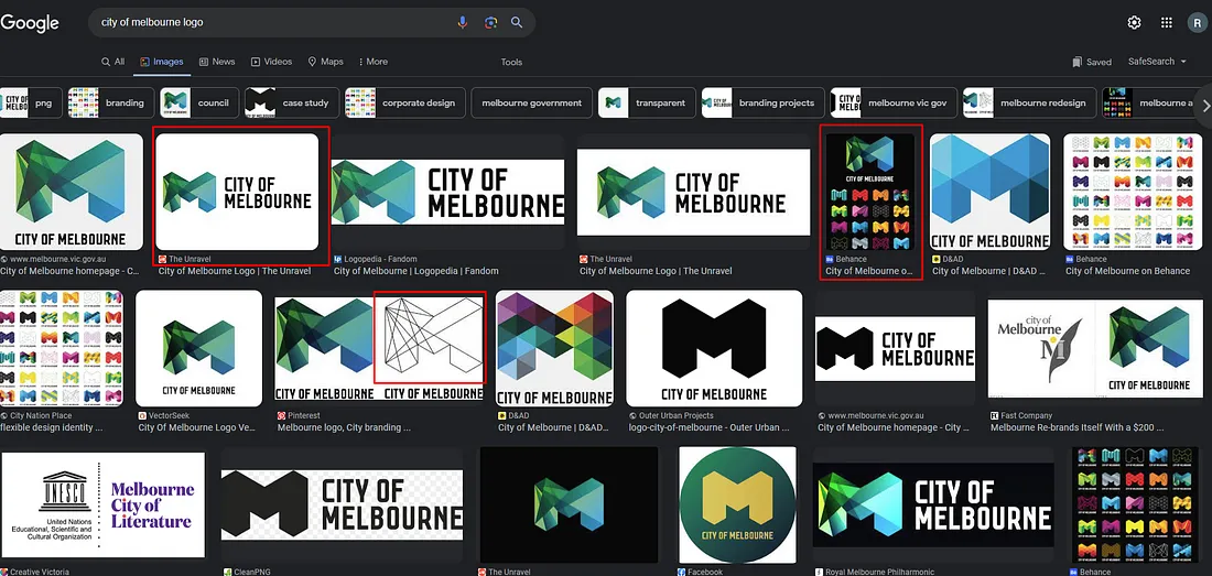
Well, that was too easy, I discovered that its location is Melbourne, which could be the “M” logo from the image.
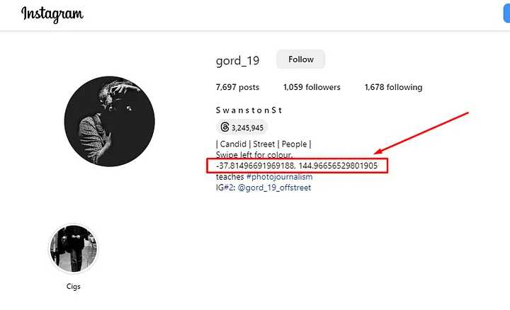
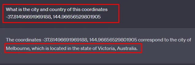
Asked ChatGPT what the location is based on coordinates.
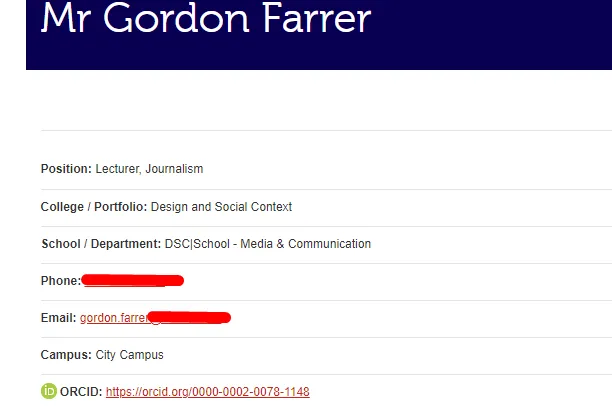
Also found some interesting information about him:
So let’s focus on the city of Melbourne.
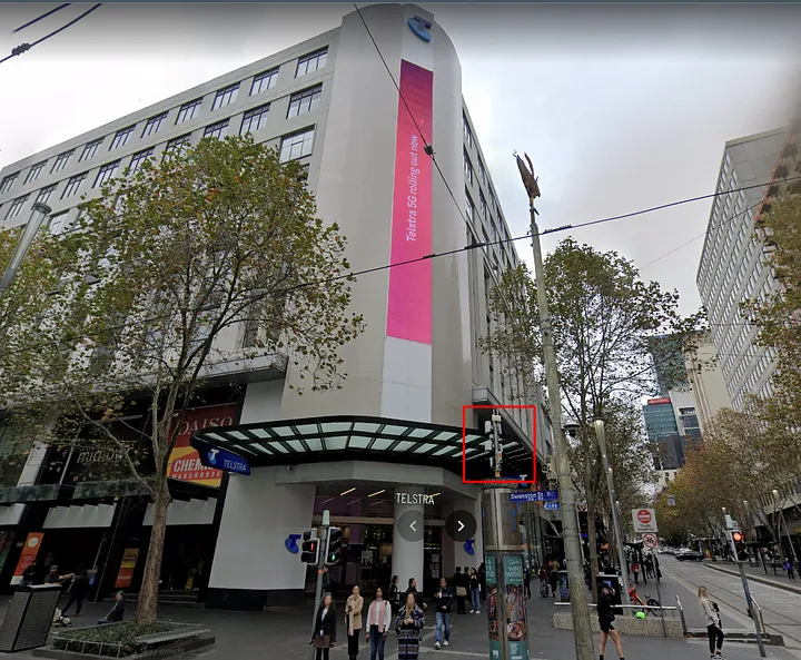
First things first, let’s check if the city logo matches the image of Melbourne. Indeed, a quick Google search revealed that it was the Melbourne logo.
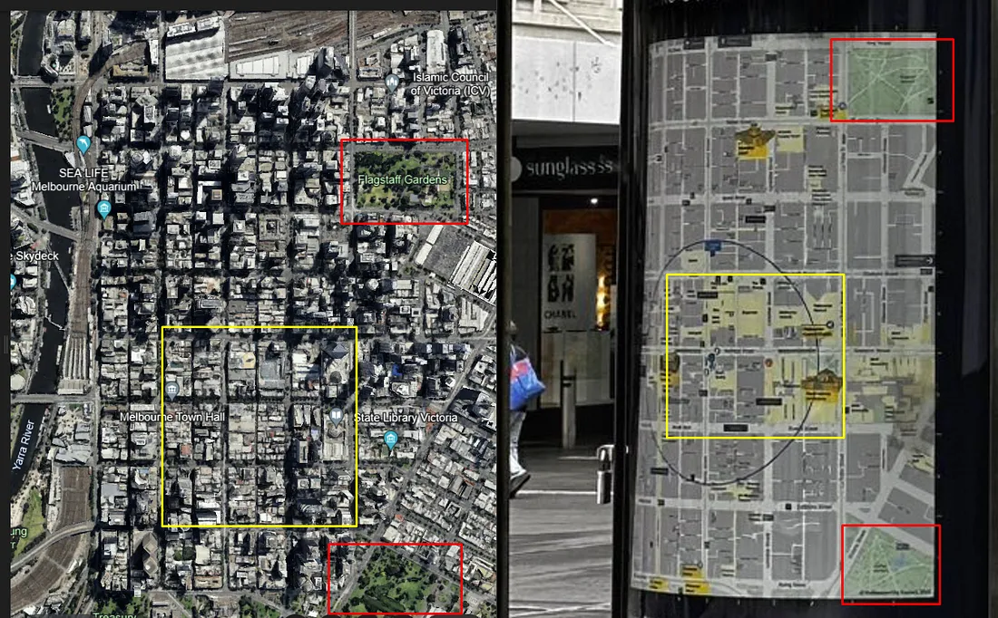
Now for the second indicator, the map from the street sign. We decided to compare the map on the plaque with a satellite image of downtown Melbourne. There were indeed similar objects on the map and we have a match.
Now let’s focus on the logo of the sunglasses store, which we can partially see in the image.
In this case, we already know the name of this chain of sunglasses stores, but let’s assume you don’t. We will be using ChatGPT which will help us to find famous sunglasses sellers in the world.
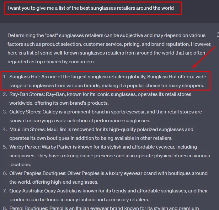
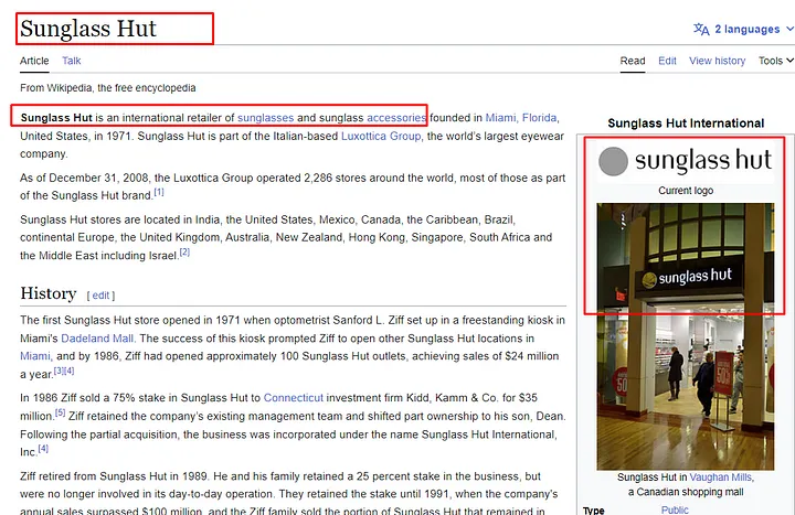
After ChatGPT gives us a list that you can go through one by one to find a match, you can check the first result on Google, we can see on Wikipedia that the logo matches the image of the task, the font and the circle on the left.
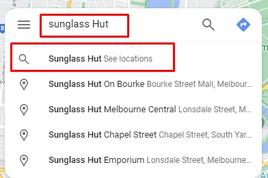
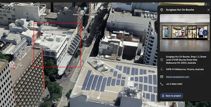
Now let’s go to the retailer’s official website and filter our search to store locations in Australia > Melbourne. We found 4 stores in Melbourne.
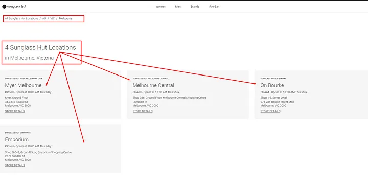
Now, to find the exact location of the store we see in the task image, we can use the Google Maps search box to find all “Sunglass Hut” locations. We’ll type “Sunglass Hut” into the smart search box that uses the Google platform.
We need to focus on Melbourne city center and use the map hint on the sign we saw. The city center is outlined in blue, and we can see that there are 2 locations of this chain inside.
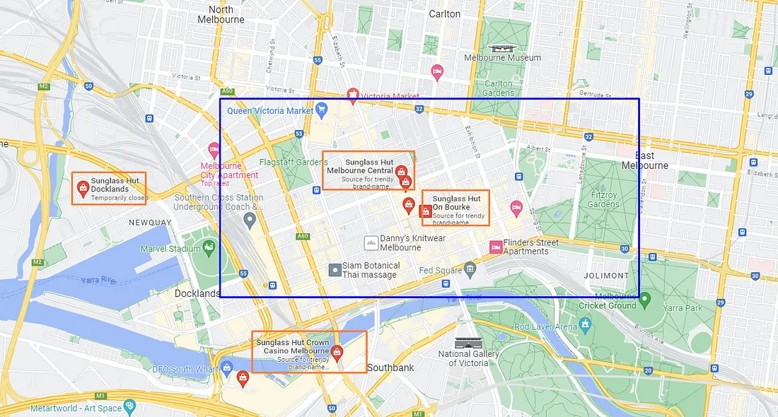
My intuition is that this will be a branch called « On Bourke » as the location is very similar to what is shown on the map on the sign.
In our opinion, the best way to visually check if a store is similar to the one in the assignment image is to check Google Maps, Street View, or Google Earth to check for potential matches.
In the challenge image, we can see that the store is located in a white building, so let’s try to google the image of the building. Found one image with the same building and Sunglass Hut signs.
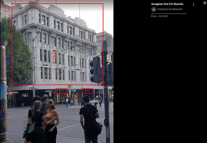
The second option is to use Street View. We can definitely see the match.
We can also use Google Earth to find satellite images of the white building and the shop.
Now let’s geolocate the information sign from the OSINT task image. We already know the location of the sunglasses store, so let’s find it using Google Maps.
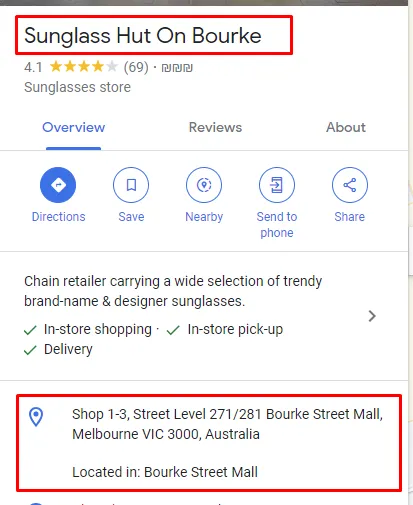
Shop 1-3, Street Level 271/281 Bourke Street Mall, Melbourne VIC 3000, Australia.
Now we’ll use Street View to check around to find the information sign.
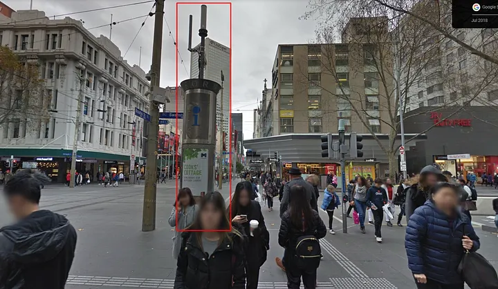
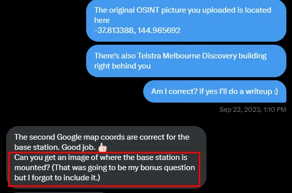
Exact location of Information Sign from OSINT call: -37.813386, 144.965714
https://maps.app.goo.gl/2bcrpubChf71oG159
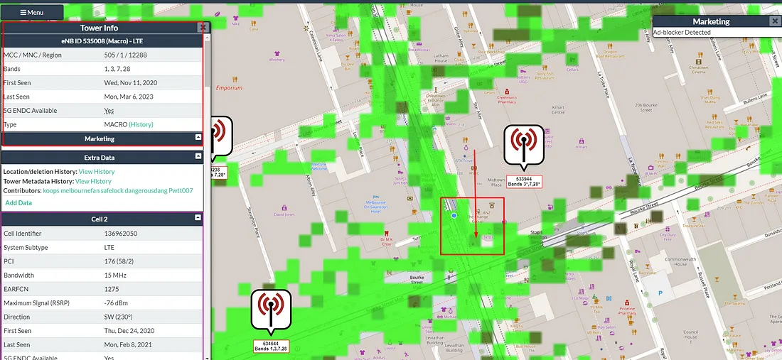
We also found full information about this 5G station:
eNB ID 535008 (Macro) — LTE
MCC / MNC / Region 505 / 1 / 12288 Bands 1, 3, 7, 28 5G ENDC Available type MACRO
Found through cellmapper.net
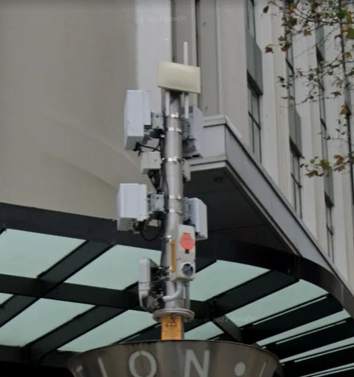
In addition to the OSINT challenge, he gave a bonus question. The mission is to find where the base station is installed.
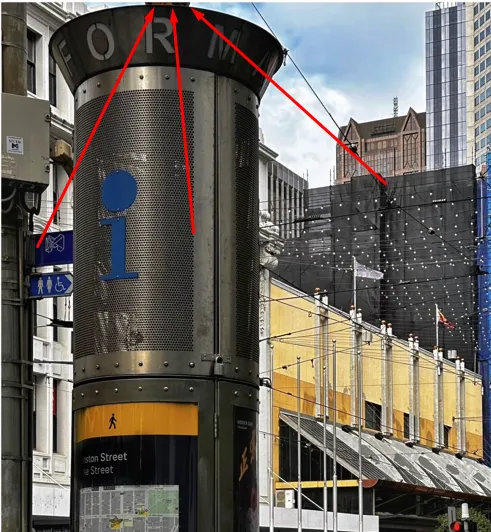
Since we have seen the Street View image, we can say that the base is mounted on top of this sign, it is partially visible in the task image.
Keep in mind that your creativity and ability to think outside the box are most important, as always. We wish you a pleasant research!