24.04.2023
4 min
2265

High-precision image analysis has become the main tool for solving geolocation tasks. Identifying a photo location without obvious landmarks requires the use of unique tools and knowledge of topography, climate, and architectural features. The article reveals how to conduct a thorough analysis of a photograph, from initial recognition of key features to narrowing the search area based on environmental details, vegetation, and characteristic features of urban objects such as shopping malls and high-rise buildings.

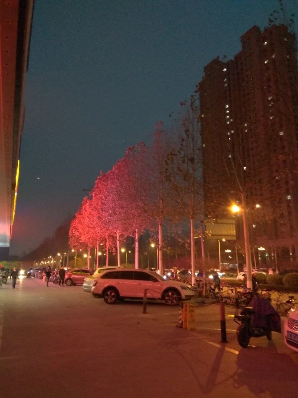
The task is to find the shooting location in the photo below:
Did a google image search but no results. Various photo fragments were used to emphasize individual objects, brightness was changed and image quality was improved – such manipulations increase the chances of a successful search. However, there are still no results (as the author of the task predicted).
The image does not contain clear or unique objects that could become a reference point for search engines. However, among the output there are some useful links to similar images from China. One of the first interesting finds leads to the tripadvisor page: https://www.tripadvisor.ru/LocationPhotoDirectLink-g1017000-i228902805-Cangzhou_Hebei.html, which presents photos of the city of Cangzhou, Hebei province in northern China: houses and trees along the roads look like those , which is in the original photo.
If we suspect China, then it is more logical to use https://www.baidu.com/ – Google’s analogue for China.
Let’s take a look at Cangzhou.
With a high probability, China is depicted in the photo. The next step is to take a closer look at the image, as it shows the car’s license plate. This number can be compared to Chinese license plates for further location identification.
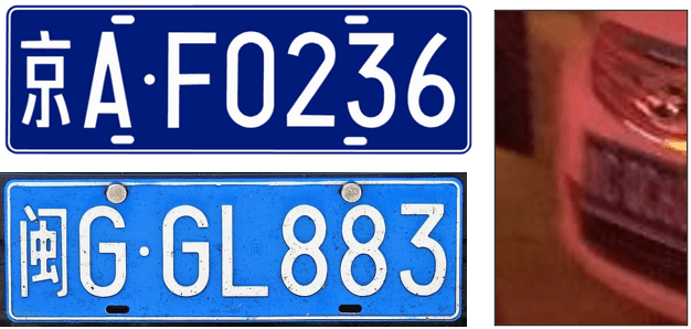
Let’s play a little with the photo editor:

The following characters are recognized: *С∙0С6~, which correspond to Chinese license plates. This may be useful in later stages of research.
So, the approximate location is determined – it is China. However, China is a huge country, so you need to narrow your search area. It also becomes clear that for an effective search in China it is more appropriate to use Baidu (with the help of an online translator).
Looking for information about car license plates, we find an article on Wikipedia:
https://en.wikipedia.org/wiki/Vehicle_registration_plates_of_China#List_of_prefixes
Through Baidu, we also find a page with a detailed table of national car numbers: https://baike.baidu.com (More detailed information about cities, regions and the combination of the 2nd and 3rd number symbols is presented here).
It is worth making a list of territories that may interest us, given that we have the number *С∙0С6~. There is a high probability of determining the area you are looking for, but this does not give a 100% guarantee, because the car could have come from another region. According to the last article, there are 31 administrative regions in China, each of which has its own designation on the license plate, which is indicated by the first character – a character (which is illegible on our license plate). However, all is not lost: the available list shows that different territories of the same province can have unique 2nd, 3rd and even 4th symbols. For example, the following areas are located in Hebei Province:
Luquan City: 冀 A·A
Zhengding County: 冀 A·B
Jingxing County: 冀 A·C
Luanchen District: 冀 A·D
Etc. Thus, it is possible to exclude territories that do not correspond to the value of *С∙0. By the way, there are no letters O and I in Chinese license plates (to avoid confusion with the numbers 0 and 1).
Beijing 北京市(京)
CEFG (counties in outer suburbs 远交区县, 0, 1, 2 Fangshan District 房山区
C, N, P Shunyi District 顺义区
Tianjin 天津市(津)
A, B, C, D, E (taxi) F, G, H, J
Shanghai 上海市(沪)
ABC (remote suburban districts, entrance to the outer ring is prohibited)
Chongqing City 重德市(渝)
C-Yongchuan Vehicle Management Office:
Yongchuan District, Jiangjin District, Hechuan District, Tongnan County, Tongliang County, Bishan County, Dazu County, Qijiang County, Rongchang County
Hebei Province 河北省(冀)
C – Qinhuangdao 秦皇岛
Shanxi Province 山西省(晋)
C – Yangquan C-阳泉
Henan Province 河南省(豫)
C – Luoyang 洛阳
Liaoning Province 辽宁省(辽)
C – Anshan 鞍山
Dalian 大连: City District: 0~4, 9, A, B, C, D, E
Jilin Province 吉林省(吉)
C – Sipin 四平
Heilongjiang 黑龙江(黑)
C – Mudanjiang 牡丹江
Inner Mongolia 内蒙古(蒙)
C – Wuhai 乌海市
Jiangsu Province jiangsu省(苏)
C – Xuzhou 徐州
Wuxi 无锡市: Jiangin City: 苏B·83, C, D (Huasi Village), E, F, H, P, X 江阴市
Shandong shandong province(鲁)
C – Zibo 淄博
Jinan City 济南: Huayin District: 鲁 A·3, C, N, Y 槐者区
Weifang 愍坊: Changle County 昌乐县:鲁G/V·9、C、V
Jining 济宁市: Shizhong District: 市中区:鲁H・0、C、D、G、H
Binzhou 滨州市: Boxing District 博兴县:鲁M·7、C、F
Anhui Province 安徽省(皖)
C – Benbu 螌埠
Zhejiang Province 浙江省(浙)
C – Wenzhou 온주
Wenzhou City 阿美州, Municipal District: Zhejiang 市达区:浙C·0~9
Fujian Province 福建省(闽)
C – Quanzhou City: 泉州市 Municipal Districts: C 0, 1, B, E, K, M, N, W 市达区
Hubei Province 湖北省(鄂)
Hubei C: Shiyan 十堰
Hunan Province 湖南省(湘)
C – Xiangtan 湘潭: City: 湘 C 0~4 市达区
Guangdong Province 广东省(粤)
C – Zhuhai 珠海
Guangxi 广西(桂)
C – Guilin 桂林
Jiangxi Province 江西省(赣)
C – Yichun 宜春: City District: 赣 C·0 市达区
Sichuan Province 四川省(川)
C – Jigong 自贡
Guizhou Province 贵州省(贵)
C – Junyi 準义
Yunnan Province 云南省(云)
C – Zhaotong 昭通
Tibet 西藏(藏)
C – Shannan 山南地场
Hainan Province 海南省(琼)
C – Sansha 三沙
Shaanxi Province 陕西省(陕)
C – Baozi 宝鸡
Gansu Province 甘肃省(甘)
C – Jinchang 金昌
Ningxia 宁夏(宁)
C – Wuzhong 吴忠
Qinghai Province 청해성(청)
C – Haibei Tibet Autonomous Region 海北藏族论旅州
Xinjiang 新疆(新)
C – Shihezi 石河子
There are only 37 cities in which this car can live. But we are not satisfied with this, we need to narrow down the search circle, or at least define the most likely areas of this list. Why do we walk around the cities of China from different regions.
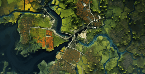
The vegetation and general conditions in the cities of the western, central and southeastern parts of China are different from what is shown in the photo. Let’s take a closer look at the physical map and the vegetation map.
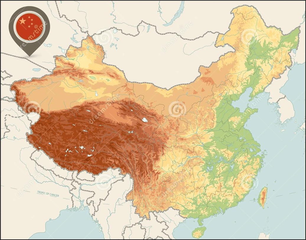
In the southeast of China, a subtropical monsoon climate prevails, which ensures dense vegetation and preservation of leaves on some trees even in winter. However, the trees in our photo do not have a tropical appearance; they more closely resemble temperate species (probably maples?) that appear to drop their leaves in the cold season.
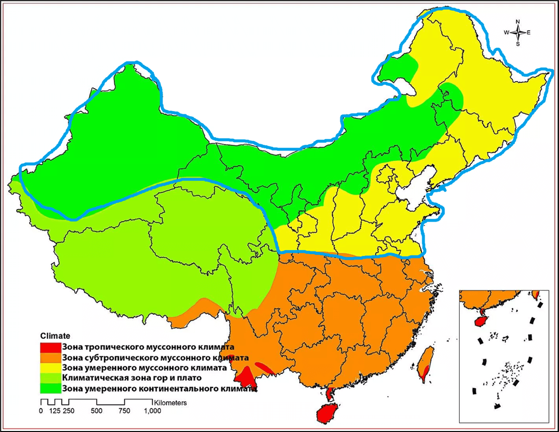
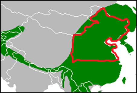
We superimpose a list of potential cities on this territory and sort them by probability: 1) the most probable in the north, 2) the less probable – further west and south, 3) the even less probable – further south.
1) The most likely (in the north) are 16 cities:
Beijing 北京市(京)
Tianjin 天津市(津)
Qinhuangdao 秦皇岛 (Hebei Province 河北省(冀))
Yangquan 阳泉 (Shanxi Province 山西省(晋))
Luoyang 洛阳 (Henan Province 河南省(豫))
Anshan 鞍山 (Liaoning Province 辽宁省(辽))
Dalian 大连市 (Liaoning Province 辽宁省(辽))
Siping 四平 (Jilin Province 吉林省)
Mudanjiang 牡丹江 (Heilongjiang Province 黑龙江(黑))
Wuhai 乌海市 (Inner Mongolia 内蒙古(蒙))
Zibo 淄博 (Shandong Province shandong 省(鲁))
Jinan City 济南市 (Huayin District 槐者区) (Shandong Province shandong省)
Weifang 愍坊市 (Changle County 昌乐县) (Shandong Province shandong省(鲁))
Jining 济宁市 (Shizhong District 市中区) (Shandong Province shandong省(鲁))
Binzhou 滨州市 (Box County 博兴县) (Shandong Province shandong省(鲁))
Baoji 宝鸡 (Shaanxi Province 陕西省(陕))
2) Less likely (more western and southern) – 4 cities:
Xuzhou 徐州 (Jiangsu Province jiangsu省(苏))
All 无锡市 (Jiangsu Province jiangsu省(苏))
Benbu 螌埠 (Anhui Province 安徽省(皖))
Wuzhong 吴忠 (Ningxia Province 宁夏(宁))
3) Even less likely (even further south) – 2 cities:
Shiyan 十堰 (Hubei Province 湖北省(鄂))
Shanghai 上海市(沪)
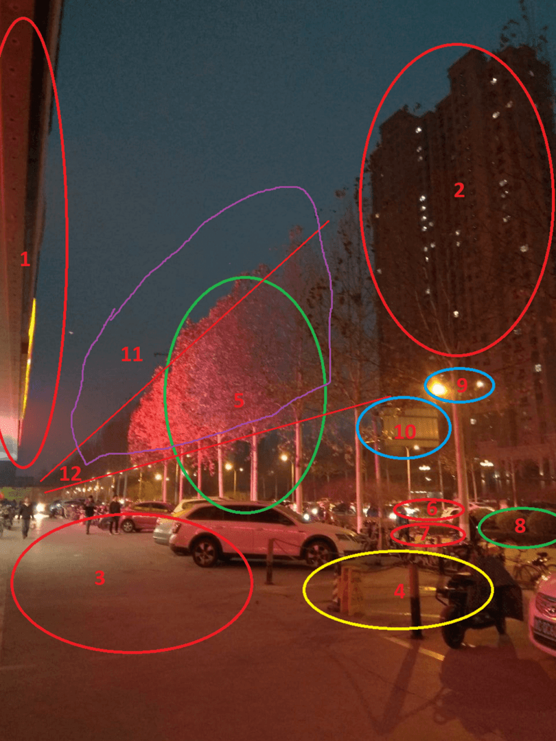
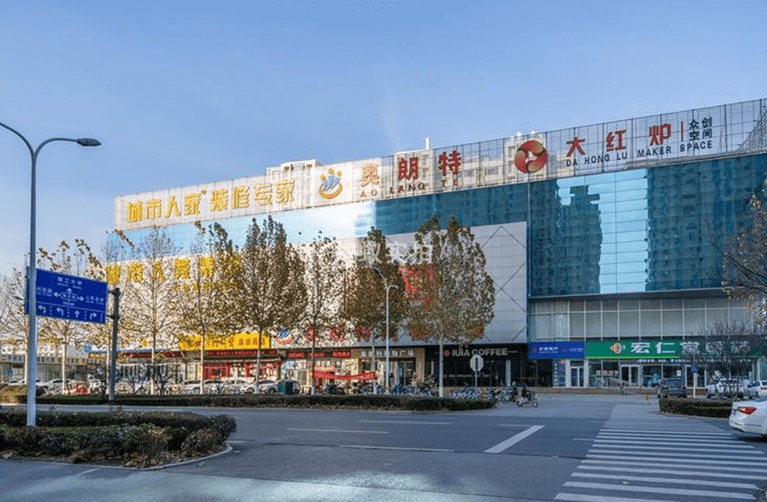
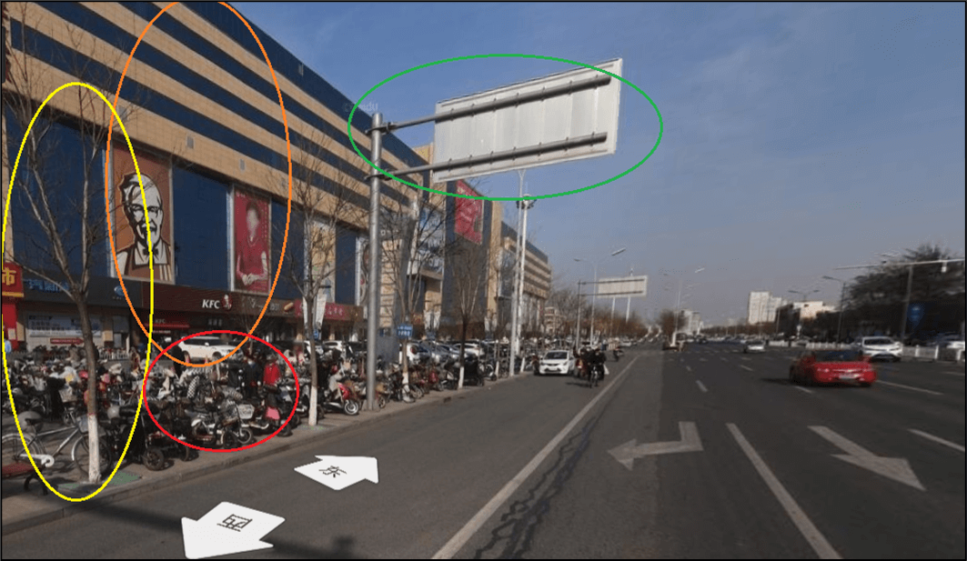
A shopping center with a characteristic projection on the second floor
The residential building opposite (we will dwell on it in more detail below)
Parking near the shopping center
Fire protection passage
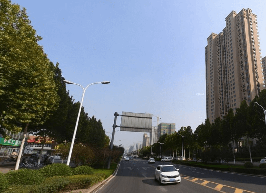
Even tall trees
Main road with two lanes in each direction
A backup road that is used to exit the main road and turn right
A green dividing zone with spherical bushes
Lampposts with double lanterns
Road sign (usually shows the direction of travel and street names, which probably means an intersection is behind)
Area without tall buildings (although a crane is visible, which may indicate active development)
A long straight avenue of trees that indicates a long enough straight road
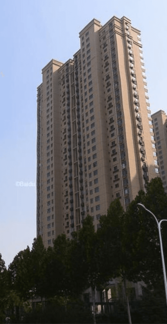
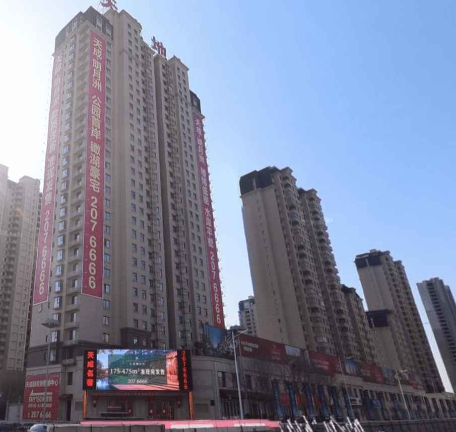
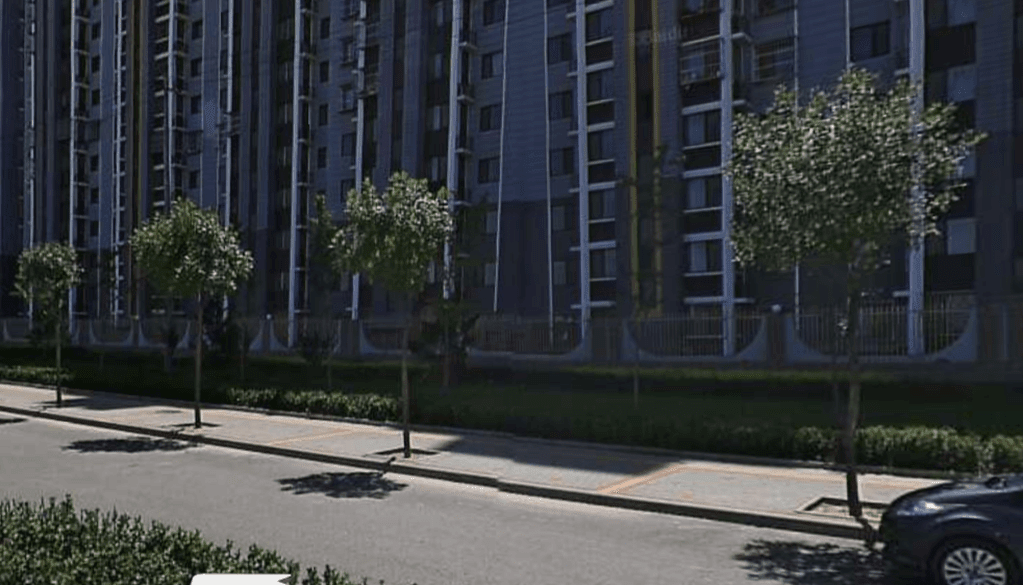
A residential building is one of the main landmarks for location identification.
Studying the panoramas, you can see that in China, the construction of residential buildings with 32-34 floors, i.e. no higher than 100 meters, is common. This is because taller buildings have stricter requirements for construction, strength and materials. But wait, there are thousands of such houses! And they are all very similar!
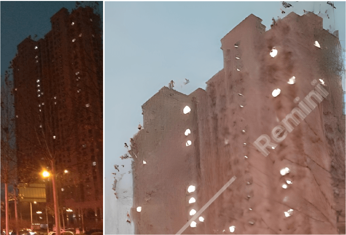
Let’s note individual features:
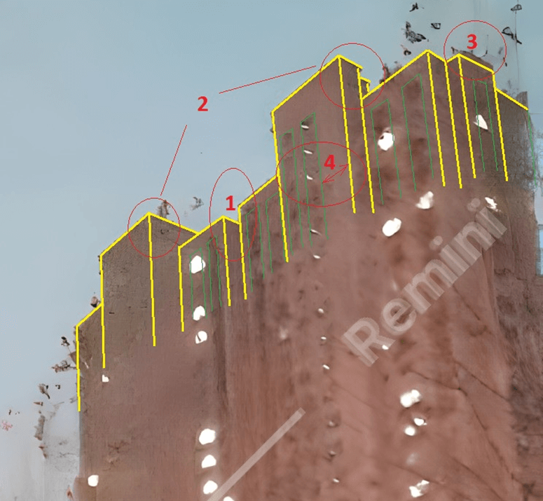
A gap or “cut” in the central part of the house.
Two symmetrical ledges: an internal ledge with a flat edge that extends beyond the roof of the building, and an external ledge that ends at the level of the facade.
A projection from the end of the house, similar to balconies. Most buildings do not have end windows, and if they do, they do not protrude beyond the walls.
Location of windows: two rows on the front ledges and two on both sides of them. On the very protrusions of the window, it is closer to the inner part, while there is a space to the outer edge.
The number of floors is 33 or 34.
These features will help with the visual identification of the house.
Another aspect of Chinese residential buildings is the choice of apartment and the orientation of the house. The Chinese pay special attention to the living floor and the orientation of the windows. The location with windows to the north and south, which provides the so-called “transparency” of the apartment, is considered ideal. Most of the new Chinese residential areas are designed according to this principle.
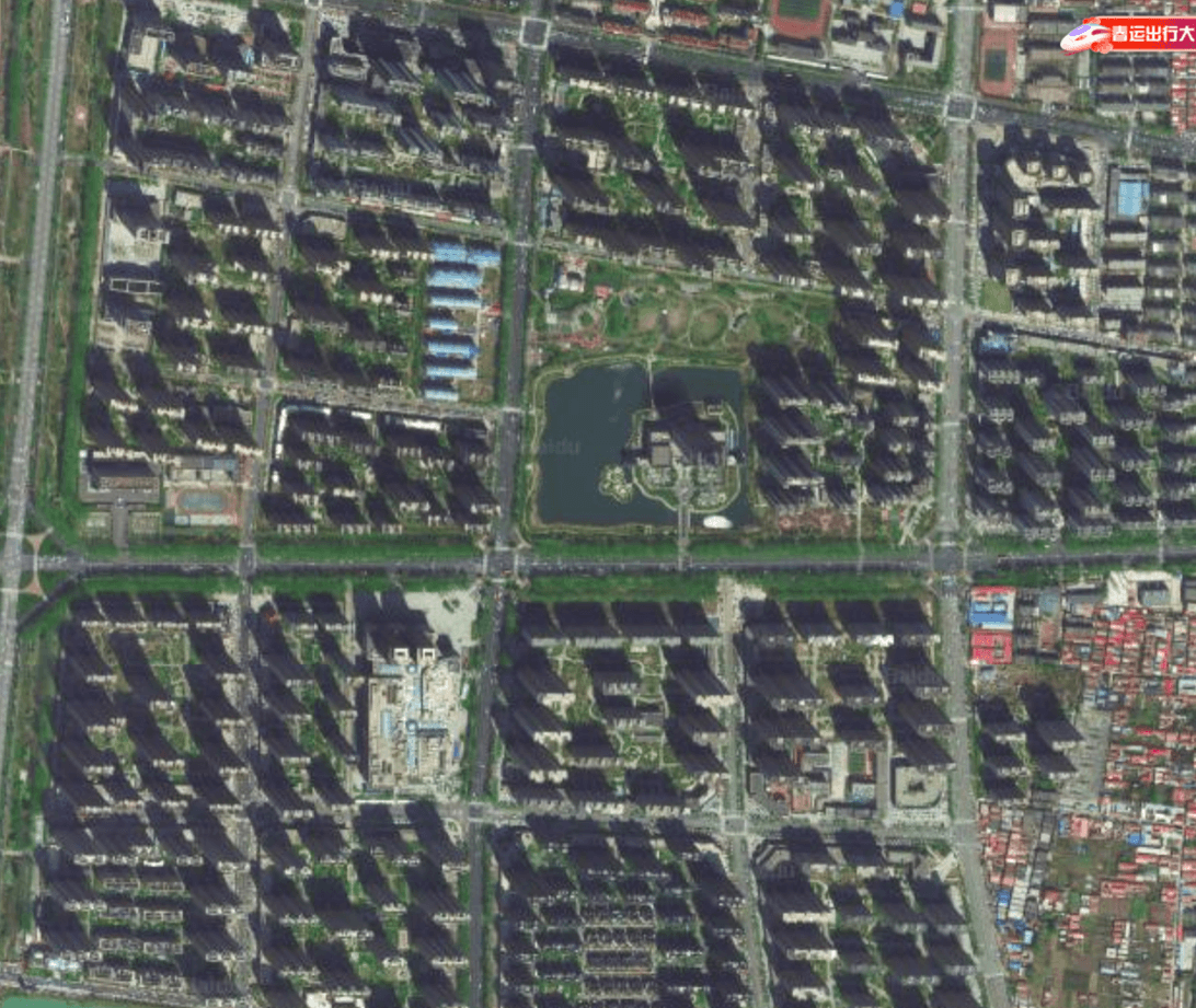
Let’s take this into account and now try to imagine how the place of our photo will look on the diagram:
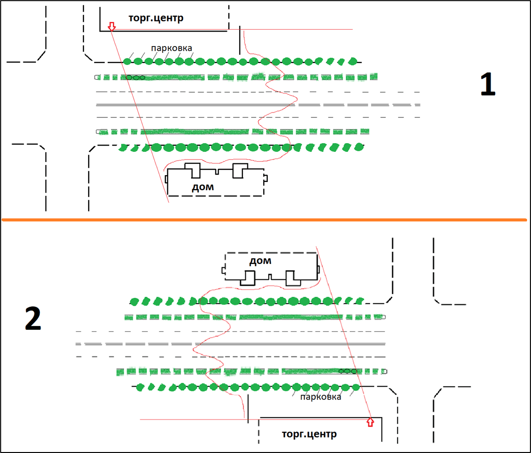
So, the road probably runs from west to east, and the house and shopping center are located opposite each other with a slight offset, near the intersection. This will greatly facilitate further searches on satellite images.
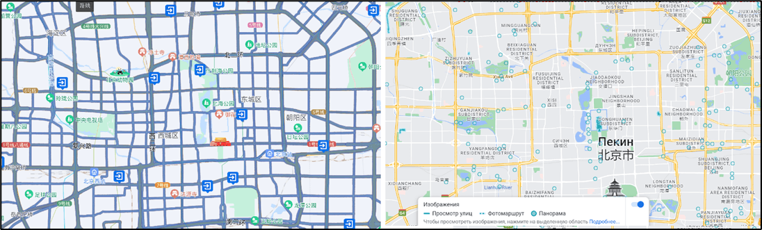
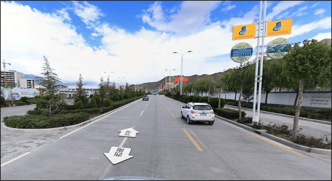
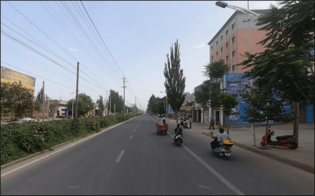
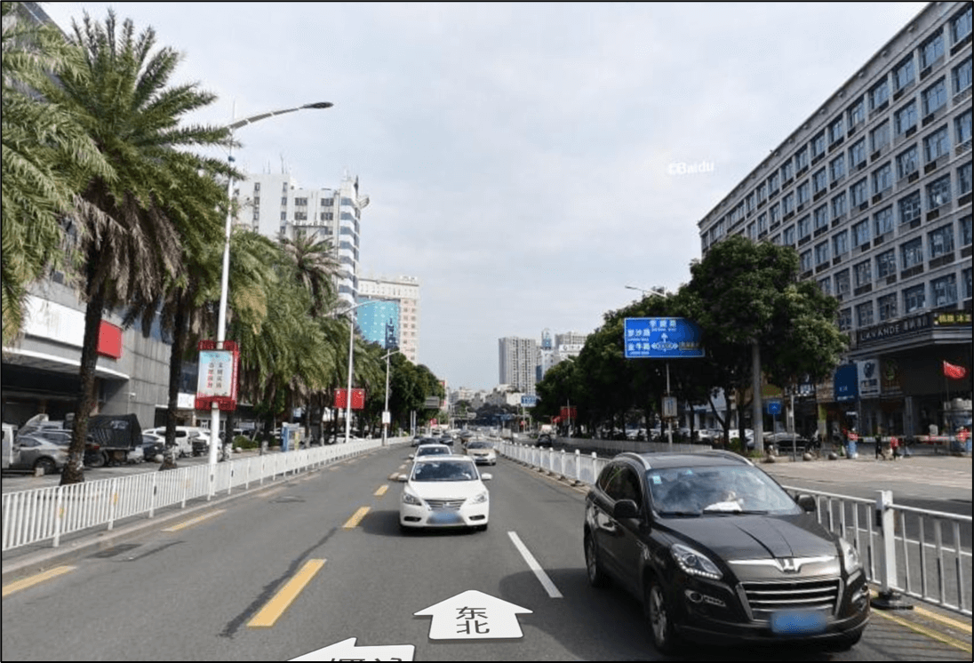
The location and type of objects to be searched are defined. What’s next? Option — quarterly viewing of satellite images of all 22 specified cities.
This method will take time, but it is the most reliable: by viewing the zones on the panoramas, you can quickly narrow the search, having an idea of the object you are looking for. This will certainly lead to a result, since the entire area is recorded by satellites.
The house and shopping center must have already been built at the time of the satellite capture. Given the rapid pace of construction in China, it is possible that satellite images show a field instead of our house. How to check it?
The photo shows mature trees, and even if mature trees are planted in China, their age indicates that they were planted at least 5-7 years ago by the time the photo was taken. This increases the probability that the area is already recorded by the satellite in the desired period.
Conclusion: the method is 100% effective, but takes time.
Uploading images of similar houses to the search engine will help you find the right one sooner or later. Baidu is quite good at recognizing Chinese buildings and suggests similar images. We go on a “walk” in China, looking for similar houses. We take screenshots and upload them to Baidu. Next, we select the most similar results and start the search based on them. In theory, if a photo of a building is in Baidu’s indexes, it can be found.
In practice, the chance of finding a specific image among millions of similar ones is not very high, but this method works well for finding the right architecture that can point to a specific city.
The method is effective, although the result depends on luck.
If the desired images of this area exist somewhere on the Internet, they are usually accompanied by a text description. The task is to understand where these images can be placed and to match the appropriate text queries. Open Baidu Images and form queries. Here’s what to look for:
Photo of a residential building. The most affordable option is photos of new houses from real estate agencies, but this house is no longer new. It and the surrounding area could be discussed on forums or blogs. Given the list of possible cities, we use the translator and search for:
“<city name> real estate”
“<city name> real estate market”
“<city name> multi-storey residential building”
“<city name> residential building near the shopping center”
“<city name> 33/34-storey residential building”
Photo of a typical project. Queries: “project 34-storey residential building” with a combination of the name of the city.
Photo of the shopping center. We combine the name of the city and queries such as “shopping center”, “shopping center opening”, “shopping center infrastructure”.
News about violations and evacuations. The photo shows a fire escape. There are known cases when this passage was blocked, fenced with chains to prevent parking, as in the photo, which may be a violation. Such cases are sometimes discussed in the local media.
Requests: “blocked the fire escape route”, “chained the fire escape route”, “violation, blocking the fire escape route”, “parking on the fire escape route” + “near the shopping center” + name of the city.
On the topic of safety, malls can evacuate through prank calls or fire safety drills. We are looking for: “<city name> mall evacuation.”
The most effective method that helped solve the problem, but with a nuance. Baidu, like Google, can display search results on a map. We enter “shopping center” in the translator and get “资源中心” for search.
This method allows you to view all cities quite quickly. However, in the process of searching, another thought arose: there are certain peculiarities here. Looking at Baidu’s map of urban development, you can see that all shopping malls are marked in purple, but not all of them have “资源中心” (shopping center) in their name.
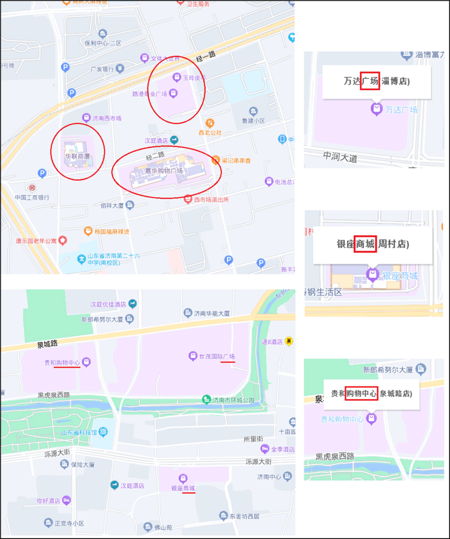
Delving into the notation, as well as researching articles about shopping centers, it became clear that the following terms should be paid attention to:
联合地场 – a shopping center or “shopping plaza”, shopping plaza (in Baidu queries, it sometimes replaces it with “联合中心”, so some malls ending with “广场” may be missed).
Shopping center is actually a “shopping center”.
北京资源地场 – shopping center “public shopping square”, and 地场 – square (in the issue will be all places marked with “地场”).
商场 is a shopping center.
商城 is a shopping center.
超市 is a supermarket (there are a lot of them, so not all of them have been processed).
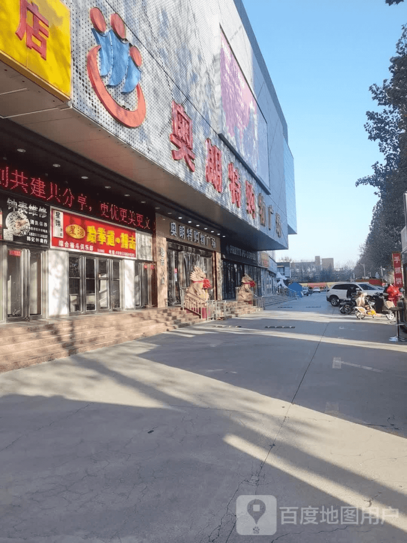
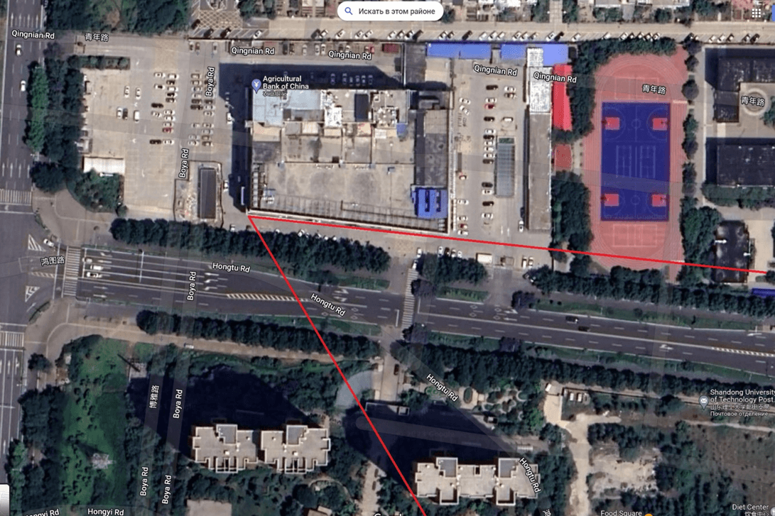
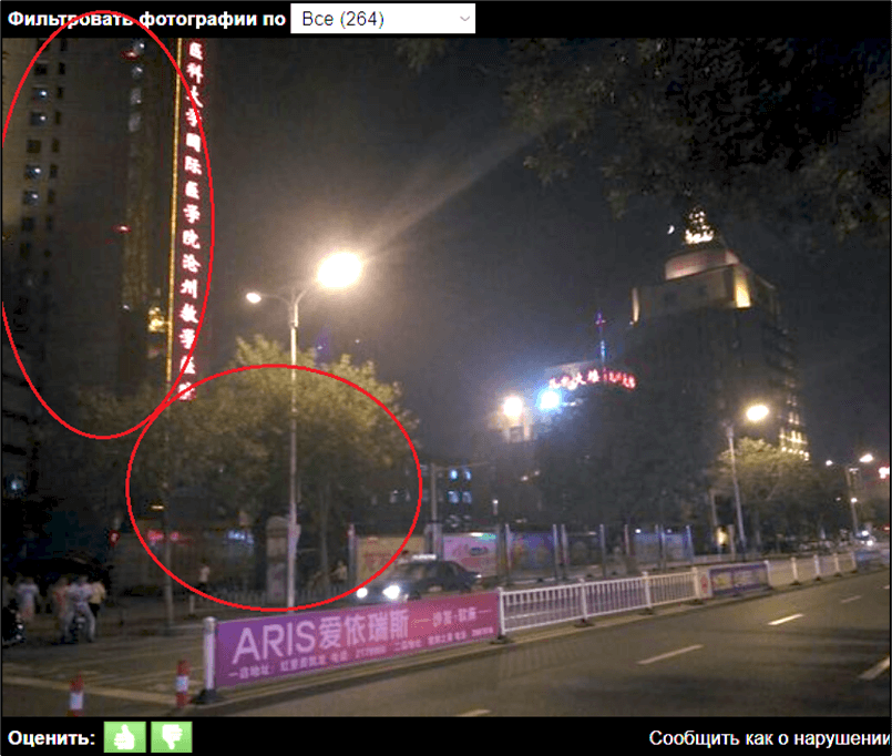
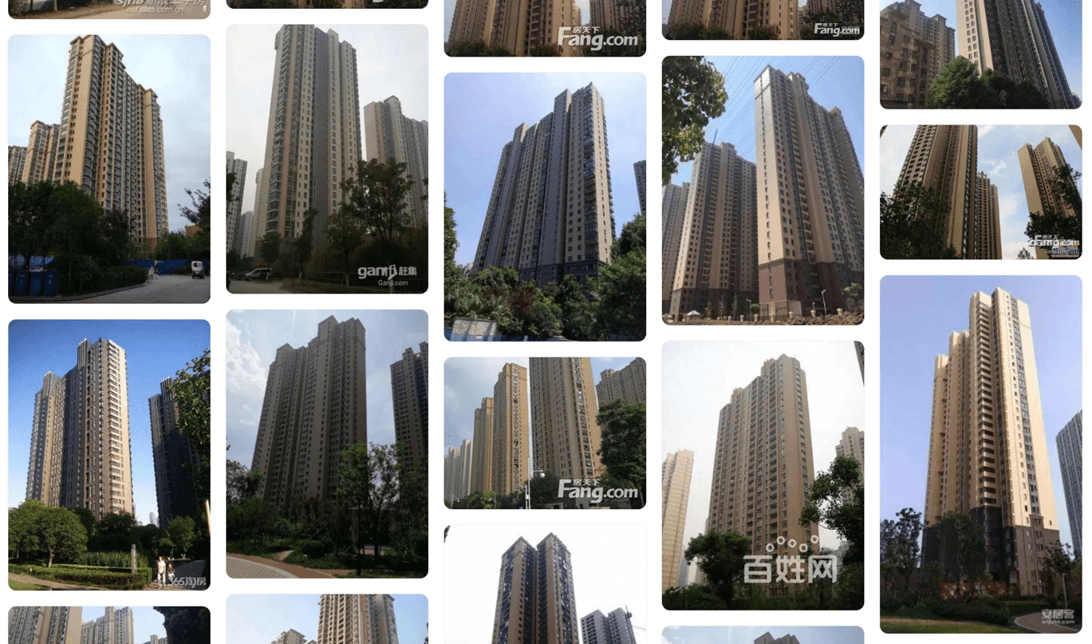
When browsing Zibo (淄博), the right place was found.
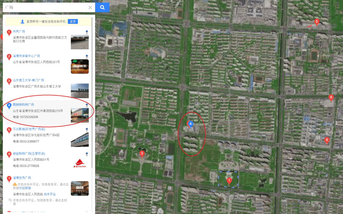
36.80980807701365, 118.00624199374103
奥朗特资源地场 (Olante Shopping Square)
shandong省淄博市张店区共青团西路270号 (No. 270, Western Communist Youth League Road, Zhangdian District, Zibo City, Shandong Province)
We open panoramas and photos of the shopping center, compare the area with the original photo: