25.04.2023
8 min
1673

The history of satellite images as a tool for observing the Earth begins with photography. At the beginning of the 20th century, photography underwent significant changes and also underwent social adaptation. Photographs not only offered humanity a new, accessible type of visual representation – they also offered a change in perspective. The use of color photography increased. Movies and television have evolved into what we know today. And humanity began to fly on airplanes, which for the first time in history made it possible to take pictures of the earth’s surface from above. It was a time of global changes in the creation of maps and the study of phenomena, and it was these changes that led to a completely new way of seeing the world. To see is to believe.
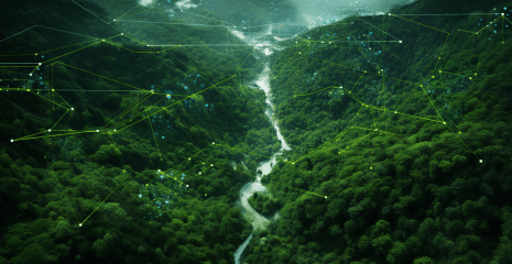
Observing the world through color satellite imagery offers a wealth of information and is available instantly, providing a complete visual picture and new insights. Satellite images take us much further than our eyes can take us – they also allow us to see the world as it really is. And they also enable us to look into the past and predict the future, to perceive and understand the Earth, its processes, and the effects and time frames of human activity. Even more amazingly, satellite imagery allows us to peer into the unseen, see visual representations of reflected energy across the full electromagnetic spectrum, and help make informed and informed decisions about the critical challenges facing Earth and all life on it. It’s already obvious that using pictures provides new perspectives and perspectives on the world and the issues you want to explore. There are many advantages to using snapshots.
A remote sensing program created by the European Space Agency that allows various enhancements and manipulations of remote sensing data. Allows you to view gigapixel images, work with layers, visualize statistics and build graphs.

Interactive service from NASA with a convenient interface. Allows anyone who wants to monitor the situation on the planet directly in the browser: monitor fires, dust storms, hurricanes, tropical cyclones, melting ice, volcanic eruptions or simply admire the night lights.

Here you can find open and freely accessible data from Sentinel-1, Sentinel-2, Sentinel-3 and Sentinel-5P. There is an API and you can create your own search scripts. There is a possibility of synchronous access to recent pictures and asynchronous access to information.

Database of images from Sentinel 2/Landsat. The database is updated every 5-10 days with new images. Various GIS variables such as NDVI or NDWO can be tracked here. EO Browser simplifies browsing in time-lapse mode. The resolution is 10 m/pixel.

ESA Earth Online brings together Earth observation data from the European Space Agency, covering topics such as temperature, agriculture and ice sheets, and provides visual tools for detailed real-time analysis of this data.

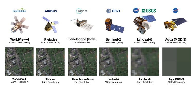
Satellite images and analytical database in open access. Almost any satellite image collected by NASA, NOAA, USGS, etc. is available. Medium and coarse resolution images compared to commercial high resolution images.

It was created because the world needs a scalable and collective knowledge base of all its maps and images. We create the world’s largest digital atlas based on maps and images from individuals and organizations.

More recent than Google, satellite imagery from places like Afghanistan and Iran. This service provides access to more recent data, which can be particularly useful for those looking for the latest information on remote.

A non-profit group that helps the global developer community find, explore, and analyze satellite, drone, and aerial imagery archives. Radiant Earth works with Code of Africa in particular.