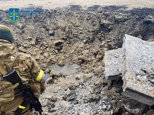
2 years have passed since the release of the Defenders of Ukraine from Azovstal. Currently, about 1,900 defenders of Mariupol who left "Azovstal" are in captivity, among them more than 900 fighters of the "Azov" brigade.

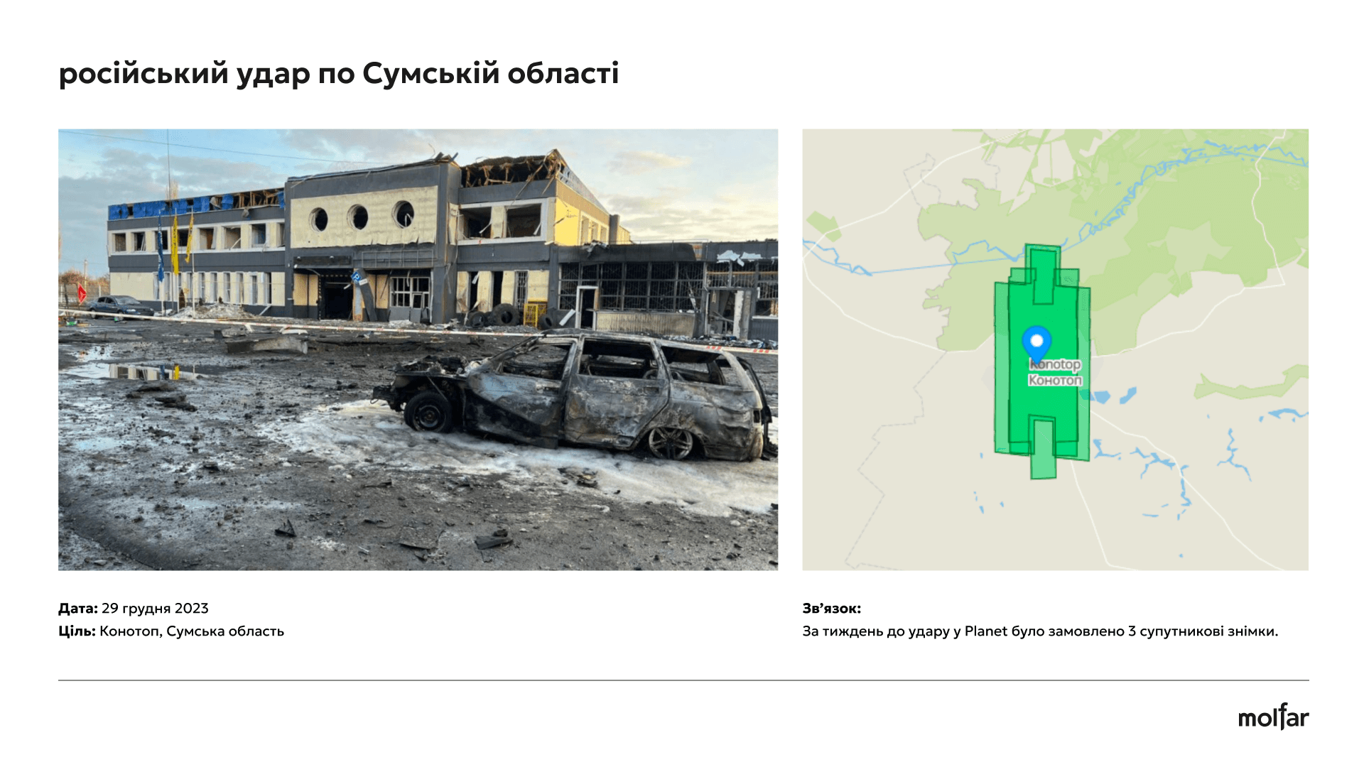
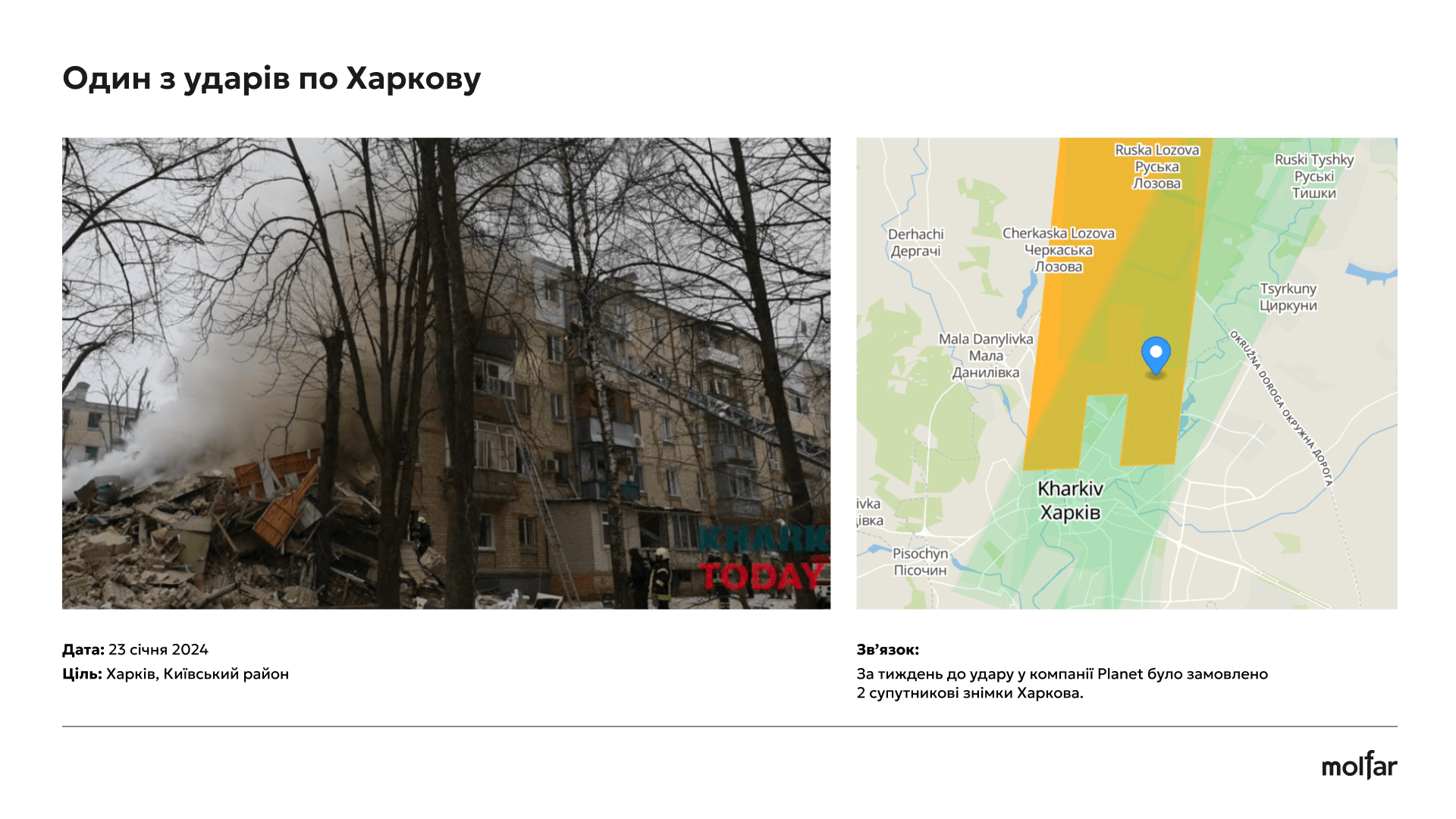
You will learn about the possible use by the Russian military of commercial satellite images from Maxar and Planet companies to plan missile strikes on Ukraine. The investigation indicates that the orders for the pictures often preceded the attacks, which may indicate the targeted use of this data for military purposes.
Journalists at The Atlantic examine the possible connection between the sale of commercial satellite images and Russian missile strikes on Ukraine. The author of the article, Graeme Wood, contacted a company that analyzes such photos, and the company discovered a certain trend. First, someone buys satellite photos of a certain area, and a few days later a Russian missile arrives there. This situation was repeated several times during 2022.
The head of a firm working with the analysis of satellite photos identified 350 Russian missile strikes in the first year of the war, which took place in the depths of Ukrainian territory.
“I showed a selection of cases to Jack O’Connor, who teaches geospatial intelligence at Johns Hopkins University, and he said, ‘The evidence suggests that the Russians are doing what the Ukrainians suspect.’ However, he was cautious about what can be done with certainty, regardless of what patterns you see. “There is no direct causal relationship that can be proven based on these data.”
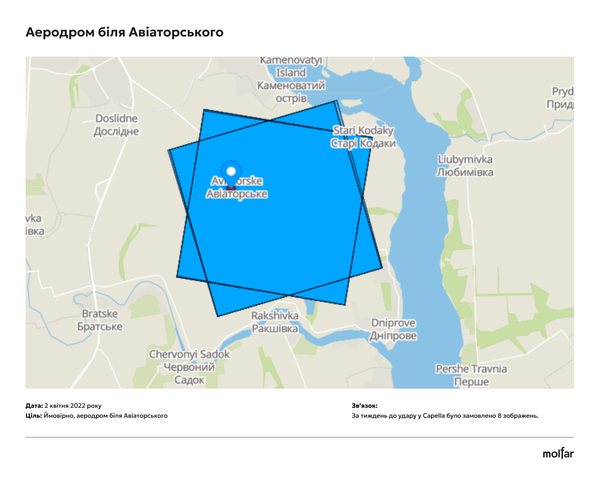
As an example, a week before the missile attack on Milhorod, there were at least 9 requests for images of the airfield near Milhorod. On April 2, a Russian missile got there. A similar order preceded the strikes on Lviv and other cities of Kyiv, writes The Atlantic.
Maxar and Planet, the companies that allegedly provided the satellite images, have thoroughly vetted their customers and say they are in compliance with US laws barring transactions with Russia from 2022 to 2022.
Maxar claims that the company has stopped all cooperation with Russian organizations, including resellers. Planet reports that they provide images to responsible parties such as governments, humanitarian organizations and the media.
An article in the Atlantic talks about the relationship between the orders for satellite images and the attacks. We decided to check the facts presented in the investigation. This article presents the results of these studies using HUMINT, IMINT and GEOINT methods. Let’s try to figure out whether there is really evidence that the Russians can buy such satellite photos.
The discovered pattern, which The Atlantic writes about, applies to 2022: satellite images of the area were often ordered days before the area was hit by missiles.
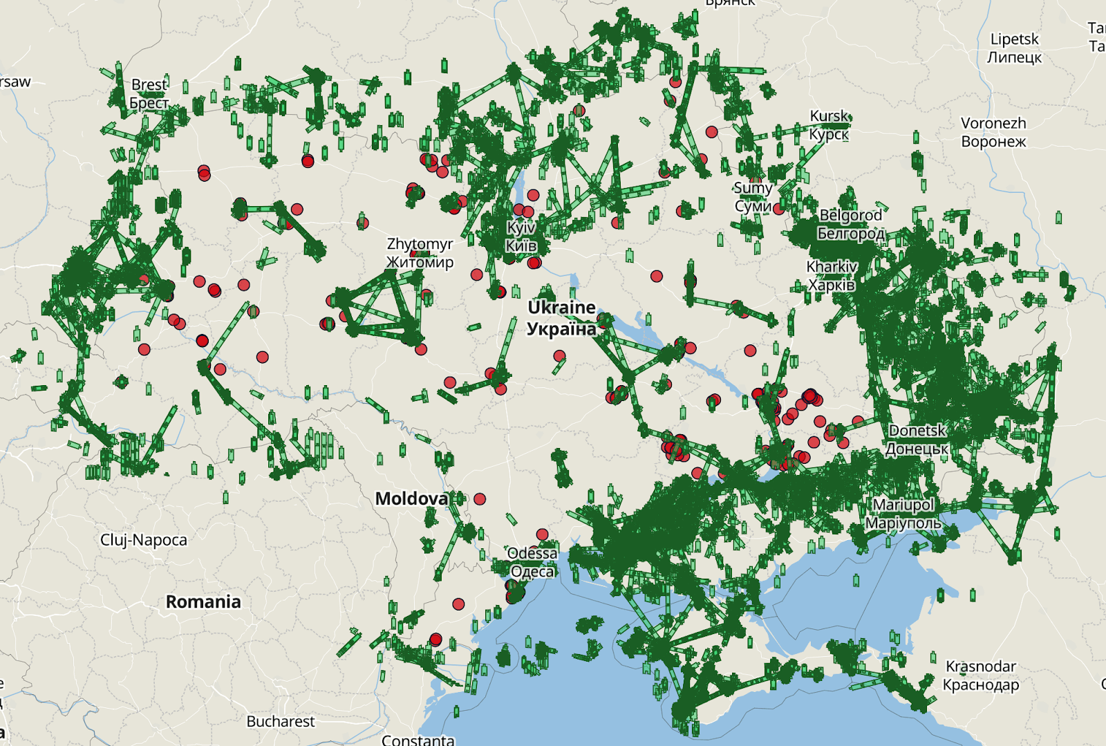
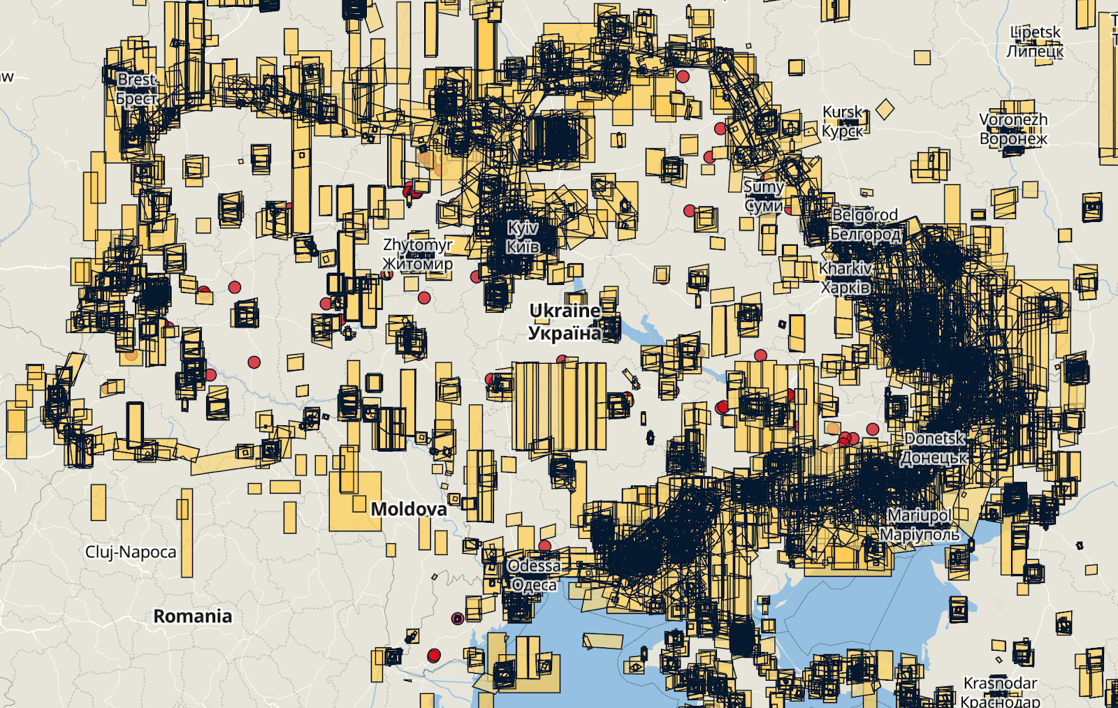
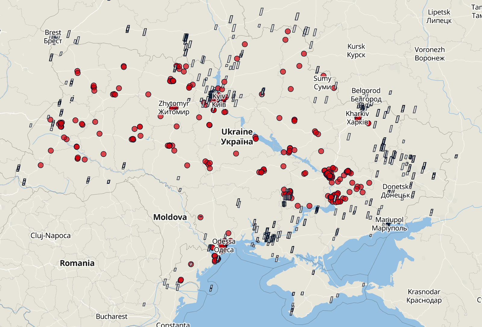
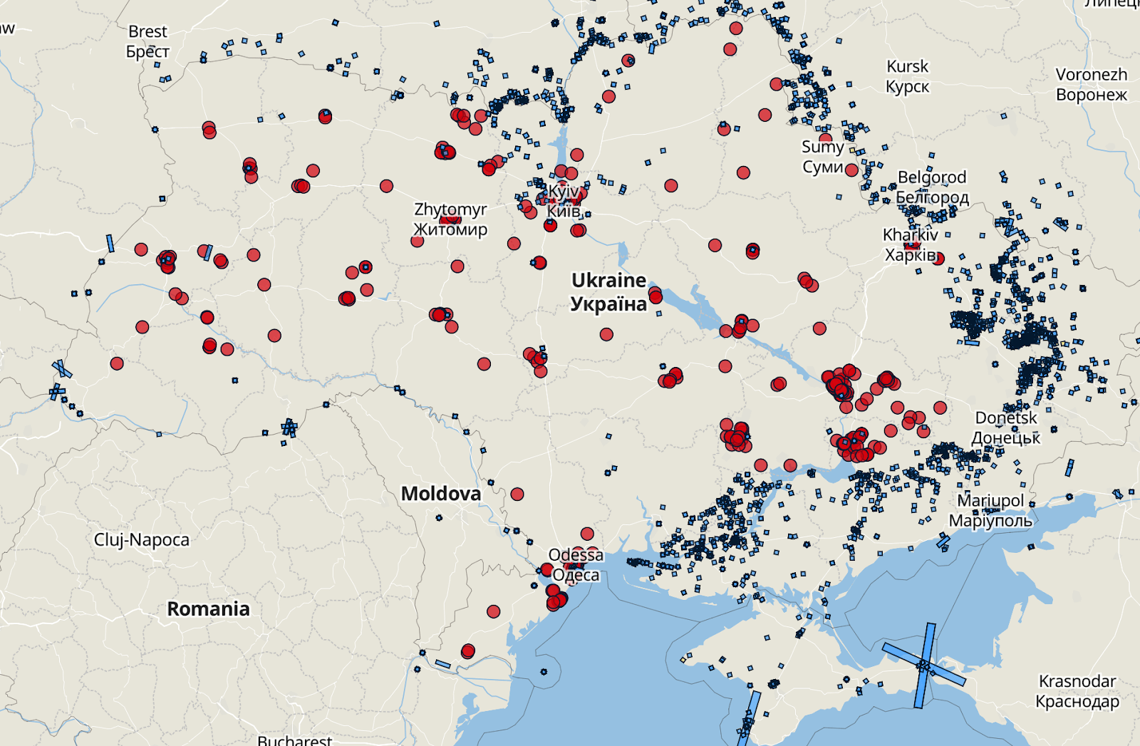
Having analyzed 321 cases of Russian missile attacks on Ukraine that took place from February 24 to December 31, 2022. Especially revealing in this analysis will be pictures of the territories of Ukraine where there are no active hostilities.
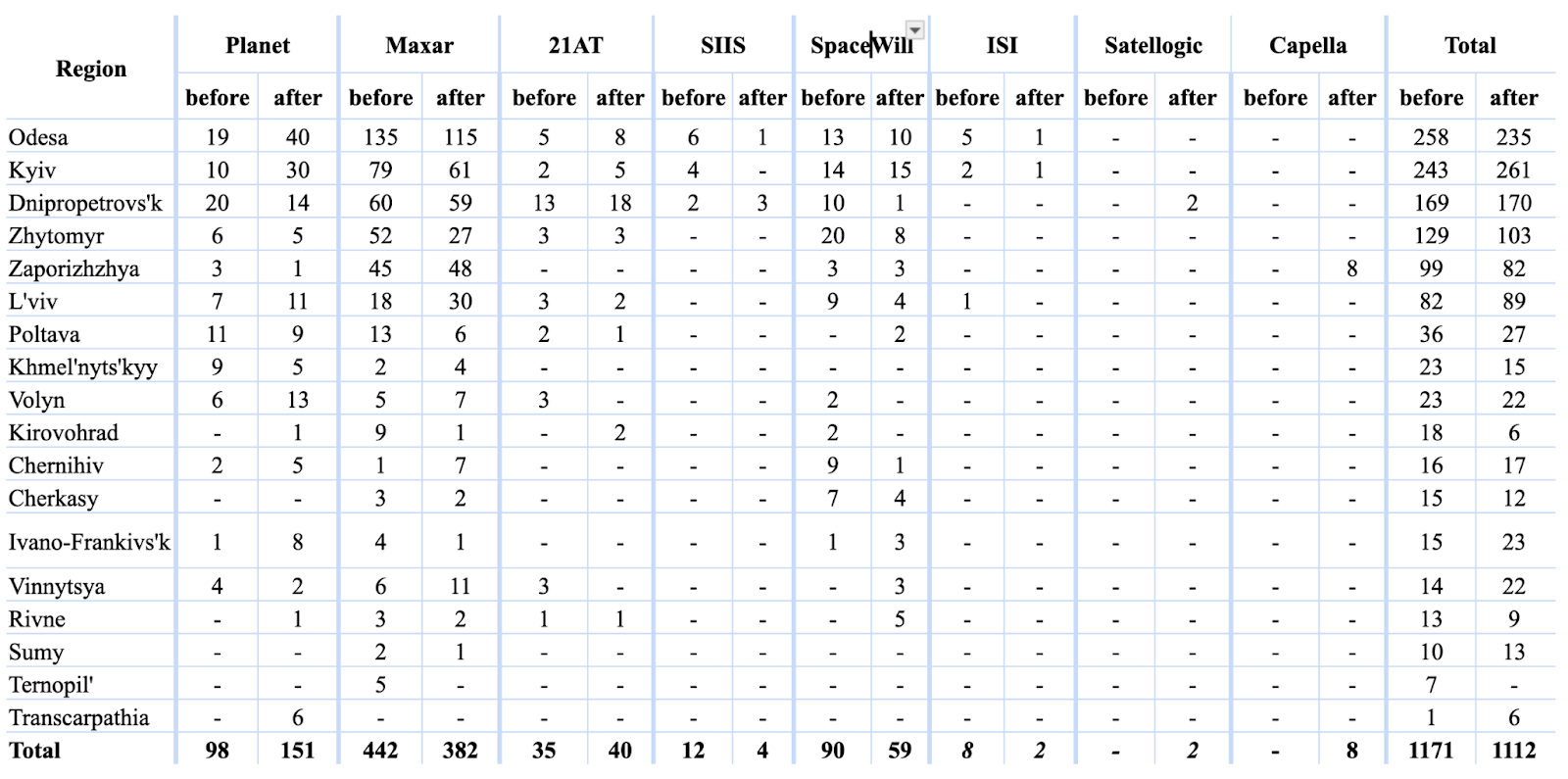
To detect a pattern, we compared available satellite images with actual collision locations and selected only images taken in the week before or after the collision. We also accounted for post-impact photo purchase data, but this is not very important to the study.
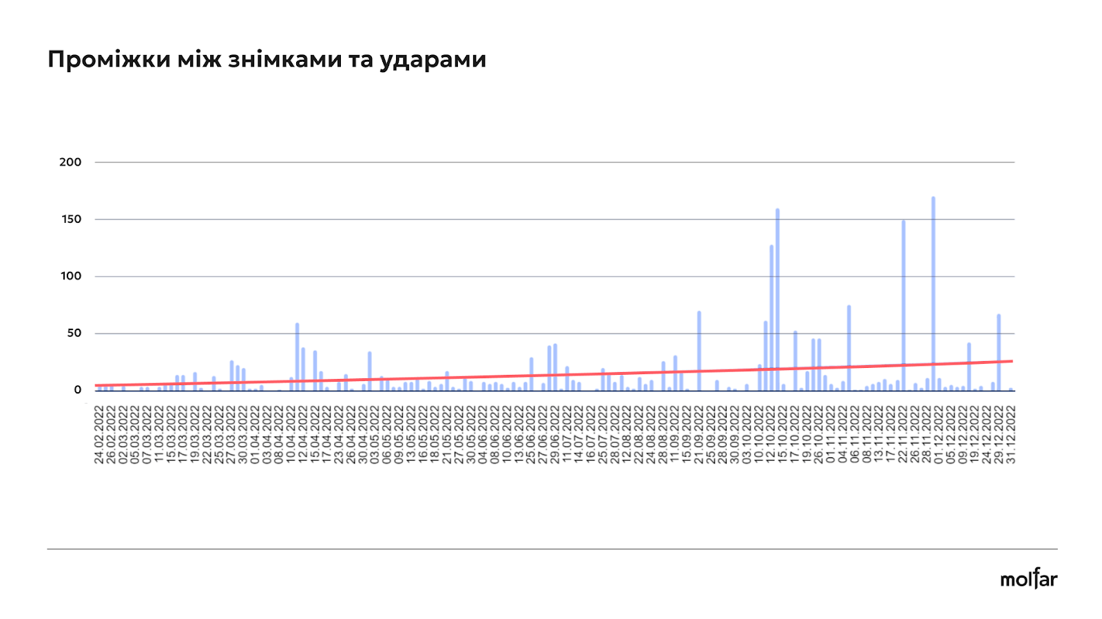
As you can see from the graph above, at the beginning of a full-scale invasion, the average time between the ordering of satellite images and the missile strikes was 2-3 days. But between April 4th and the end of May, this period was longer, so the correlation between ordering pictures and strikes was less, and it is not possible to say with certainty that the Russians ordered pictures for intelligence purposes. At the same time, in July and August, the Russians intensified their attacks, and the average time decreased again. In the first week of October, the Russians almost did not shell the infrastructure, because of this the time interval between the order and the shelling increased again. In November and December, there are long periods of short lags between hits followed by a long pause, but overall the lag is short.
An important aspect of the study was the accuracy and quality of the images. Satellite photos with a resolution of 30 cm to 1 m are most useful for planning missile strikes. They allow you to see objects on the ground in detail – buildings, vehicles and infrastructure elements.
Of the 321 cases analyzed, 277 confirmed that a few days before the shelling, satellite images were ordered of the exact place that was subsequently hit.
At the first stage, we sorted the images by date (taken a week before the impact), the second factor was the location where the satellite photo was taken. Statistics on relatively “peaceful” regions will be indicative. That is, where there are no active hostilities.
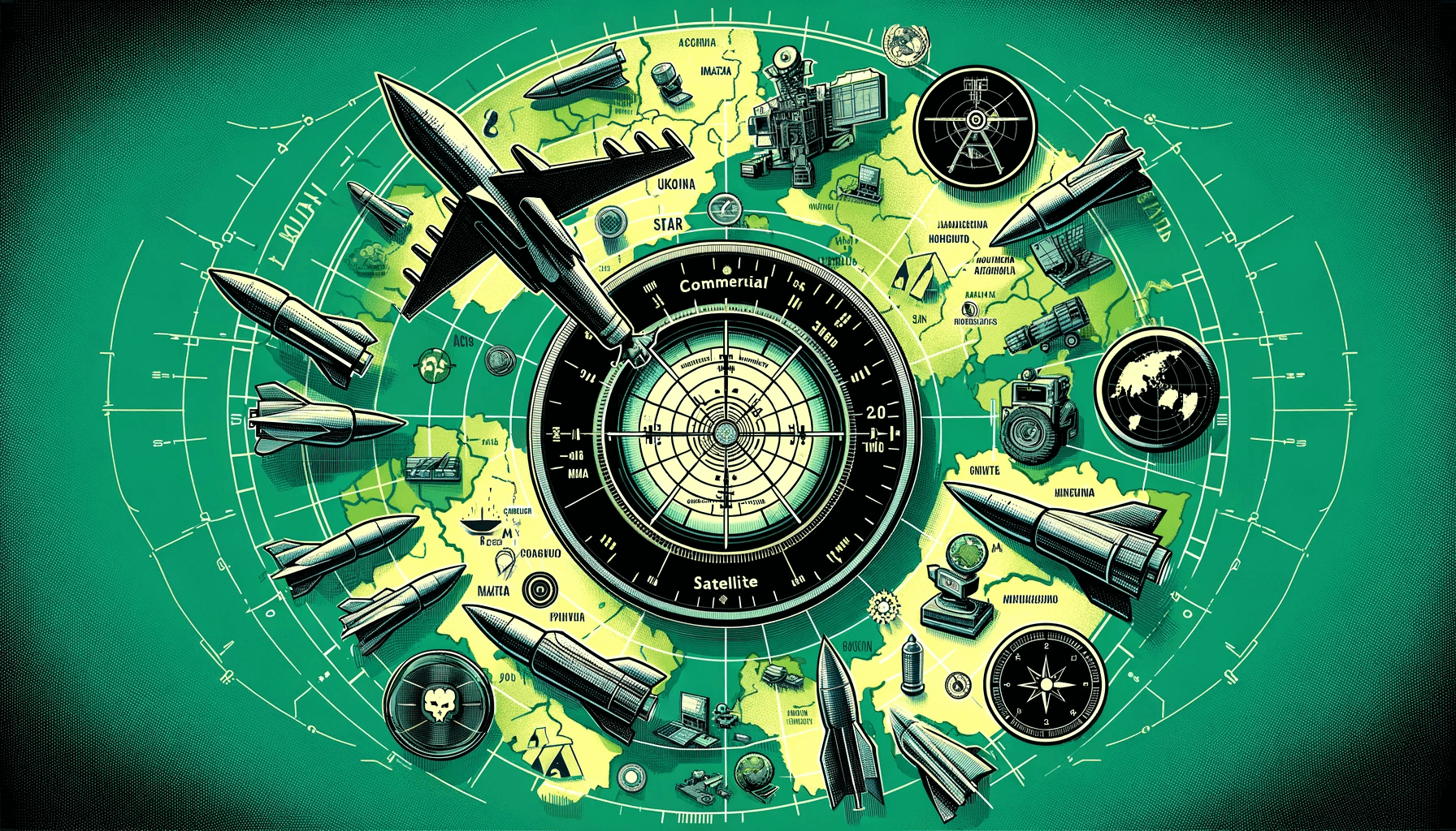
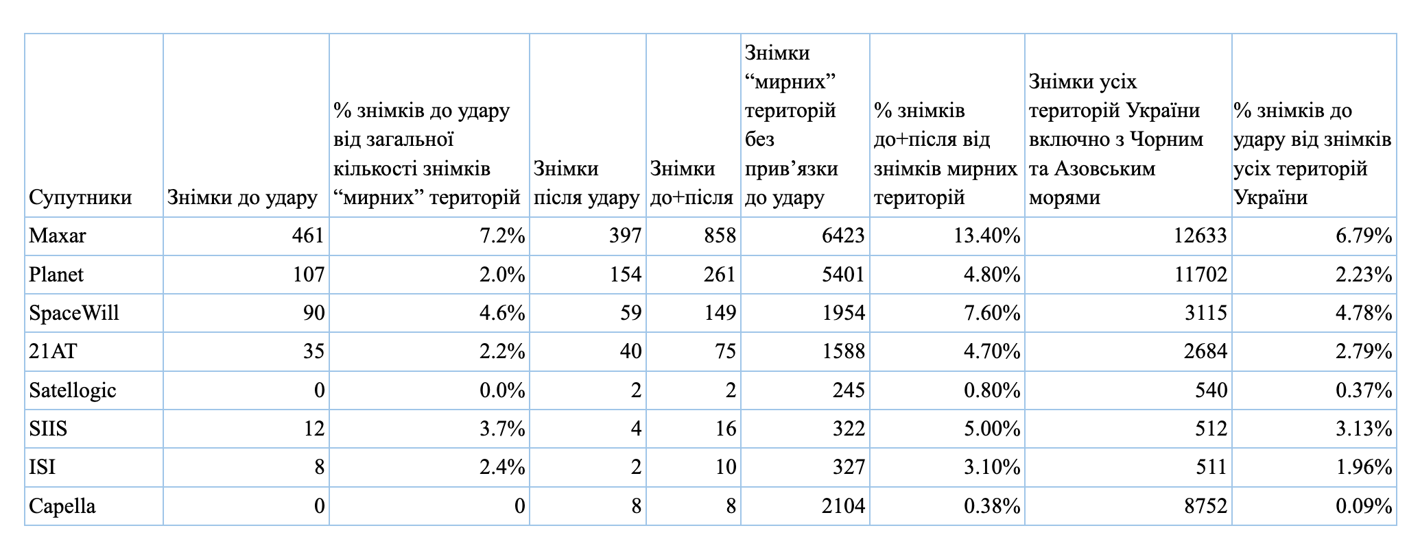
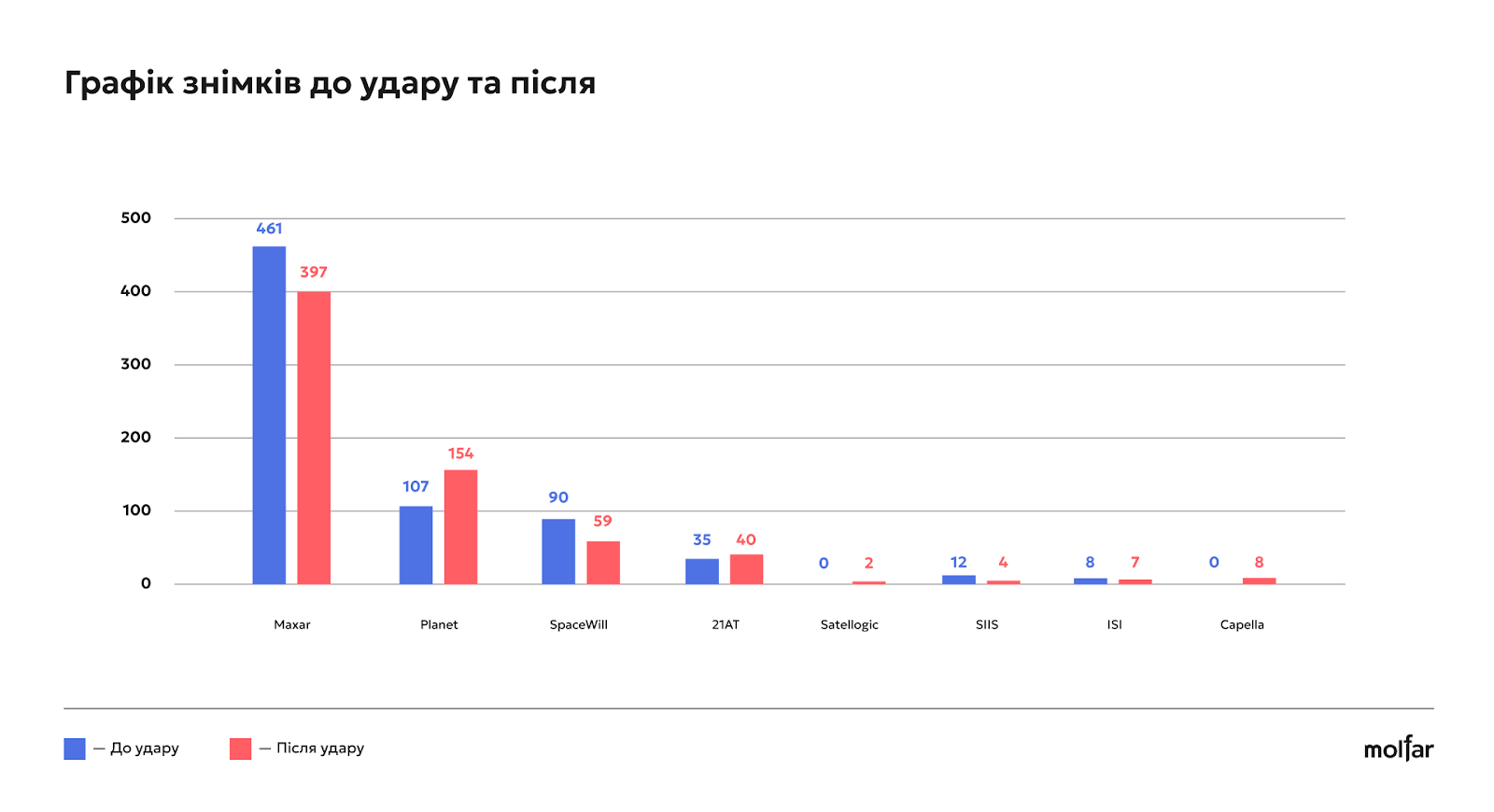
Our analysts managed to gain access to a large number of space image providers. Here are some of them:
Planet is an American company that specializes in satellite imaging of the Earth. Provides data for monitoring changes on a global scale.
Maxar Technologies is a leading provider of aerospace products and services, including high-detail Earth imagery.
21AT (Twenty First Aerospace Technology) is a Chinese space company that provides satellite imagery.
CNSA (China National Space Administration) is China’s national space agency responsible for China’s space program.
Satellogic is an Argentinian company that launches high-resolution Earth imaging satellites.
KARI (Korea Aerospace Research Institute) is a South Korean state-owned aerospace research institute.
Kazakhstan Gharysh Sapary (Kazcosmos) is the national space agency of Kazakhstan that coordinates space projects and scientific research.
Chang Guang Satellite Technology (CGST) is a Chinese company specializing in the development of satellites and satellite imagery.
SIIS (SI Imaging Services) is a South Korean geospatial data and Earth imaging company.
SpaceWill is a Chinese company providing satellite data and earth observation solutions.
ImageSat International (ISI) is an Israeli company that provides satellite imagery for military and civilian purposes.
Capella is an American company specializing in Synthetic Aperture Radar (SAR) Earth imaging.
Liveuamap.ua service was chosen to mark the places of strikes on the map. The analyzed pictures confirmed the regularity described in the article of “The Atlantic”. We also present several specific cases from different periods for illustration and clarity.
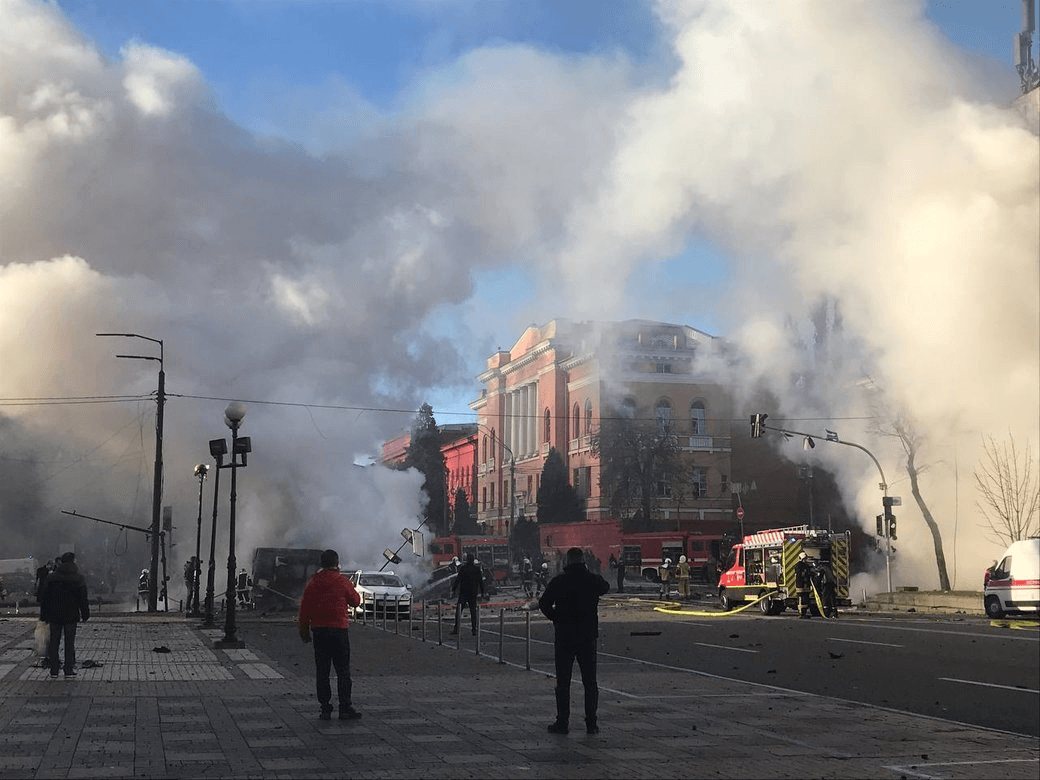
On October 10, 2022, Russian forces launched one of the most massive missile strikes on Ukraine’s energy infrastructure. the Russians used Shahed-136 drones and missiles.As a result of shelling, 23 people died and 105 people were injured. As a result of the attack, 11 important objects in 8 regions and in the capital were damaged. A blackout occurred in some areas.
The incident occurred in the administrative building of the school on Zhilyanska Street. Next to the administration building is the business center “101 Tower”, the office of the energy company DTEK, which occupies 5,000 square meters. As a result of the attack, a part of the window in the business center was broken.
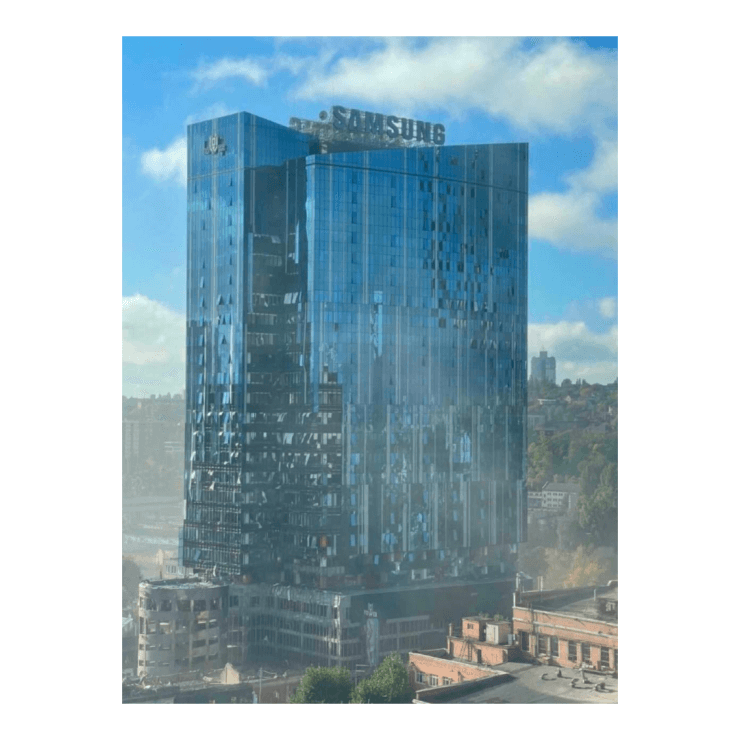
In the three weeks before the strike, someone orders 6 satellite images from Maxar that include the affected area.
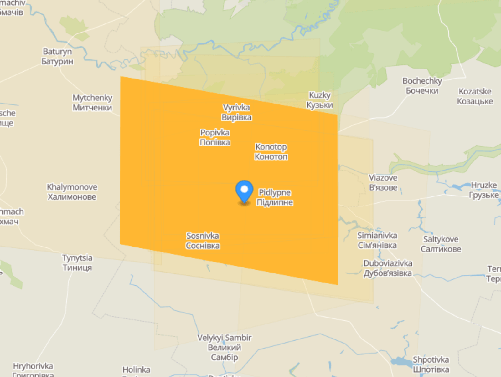
Privokzalne, Sumy region. October 10, 2022. The small village of Pryvokzalne, home to about 600 people, is located in the Sumy region. There is a railway station nearby. There are no special strategic objects here, but this particular location for some reason interested the client of the Maxar company. 2 days before the shelling, someone bought 1 picture of this place from the company.
For example, on March 5, 2022 at 21:00 they hit the city with 10 missiles. As a result, three servicemen were injured, one died.
The day before, the Capella company sold 12 pictures of this location to someone.
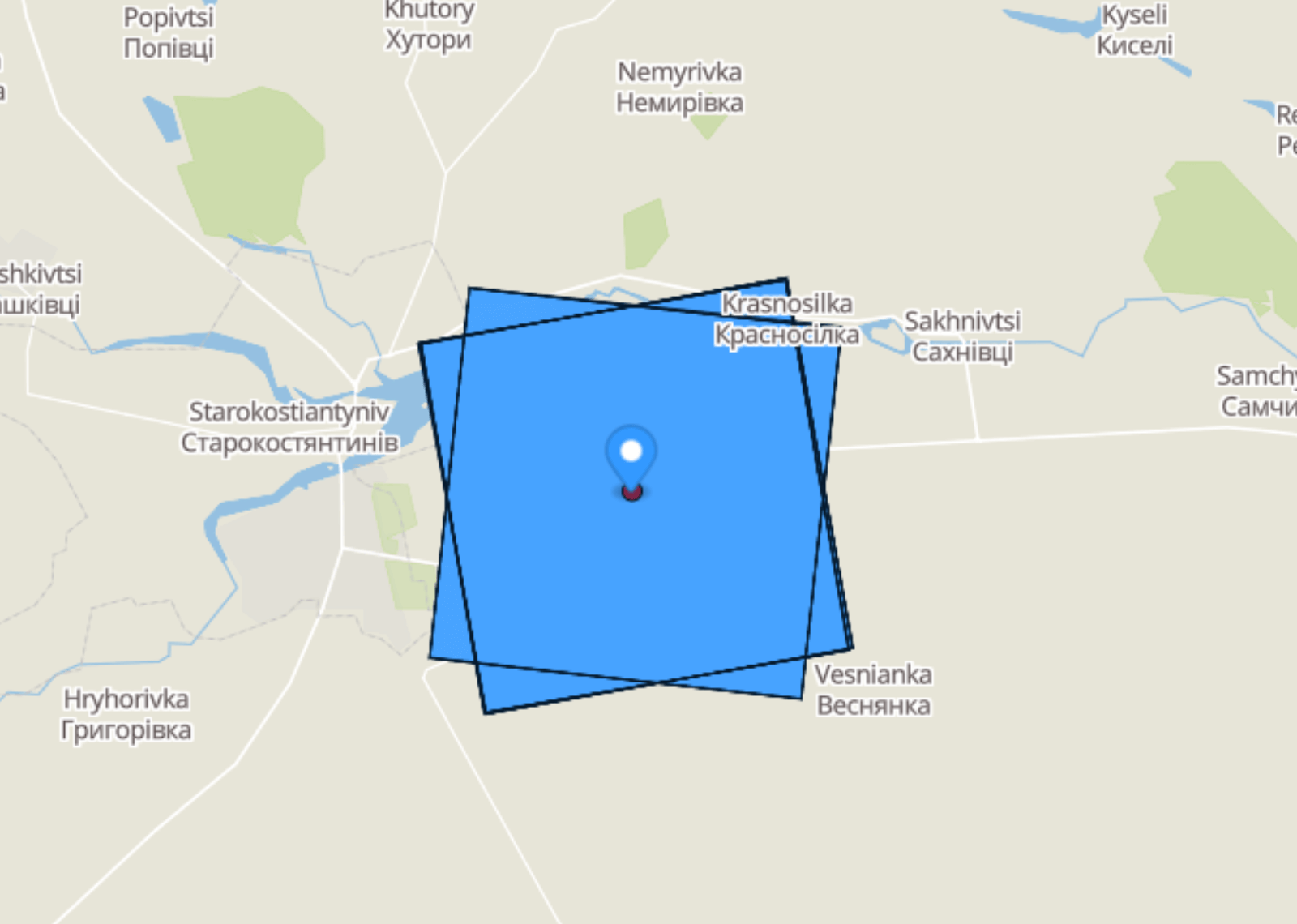
Another attack on Old Constantine was on March 29. After the attack, the mayor of the city, Mykola Melnychuk, said that the Russians had destroyed the city’s strategic reserves of fuel and lubricants.
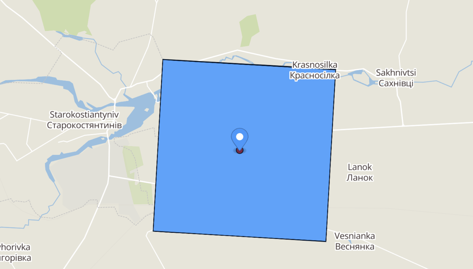
Another attack on Old Constantine was on March 29. After the attack, the mayor of the city, Mykola Melnychuk, said that the Russians had destroyed the city’s strategic reserves of fuel and lubricants.
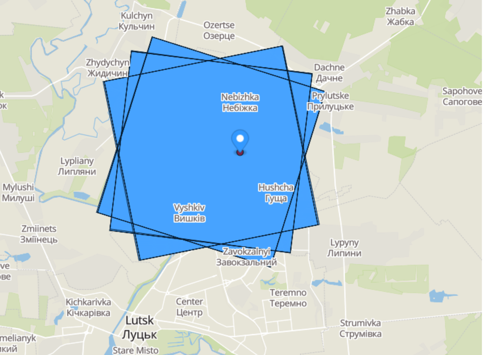
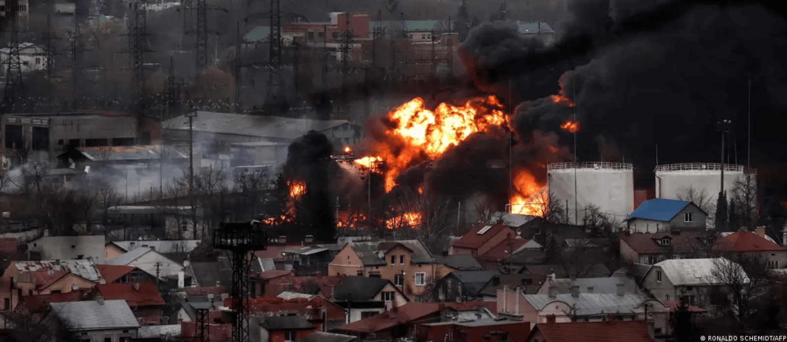
Destruction of tank and aircraft repair factories in Lviv.On March 18, 2022, six Kh-555 cruise missiles flew to Lviv from the Black Sea. Debris of two missiles fell in Odesa region. Others hit an aircraft repair plant.
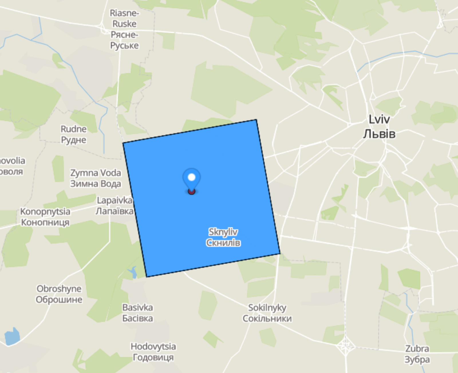
Within a week, Lviv was again under attack. On March 26, 2022, the Russians destroyed a tank factory and an oil depot with two missiles. At the same time, US President Joe Biden visited the Polish city of Rzeszów, about 100 km from the Ukrainian border.
Eight satellite images containing the coordinates of the strike were ordered from Beijing Space View Tech and 21AT a few days before the attack, on March 23-25, and two more images two days after the strike, on March 28.
As stated in the article of The Atlantic, American satellite providers assure that they do not sell images to Russian buyers. But is it possible to buy photos through their distributors? HUMINT specialists set out to verify this by purchasing satellite photos.
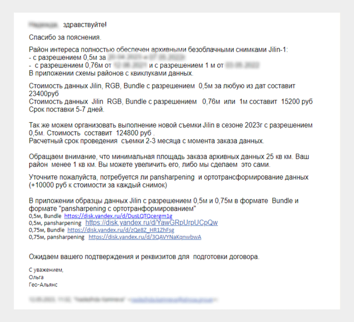
Geo-Alliance.ru.In the letter, they introduced themselves as citizens of Kazakhstan. They assured us that they would like to purchase fresh photos of the Congo (choosing the territory of Ukraine would be too suspicious). We were told that we could buy photos through foreign legal entities, but the next day they refused and offered a Chinese satellite.

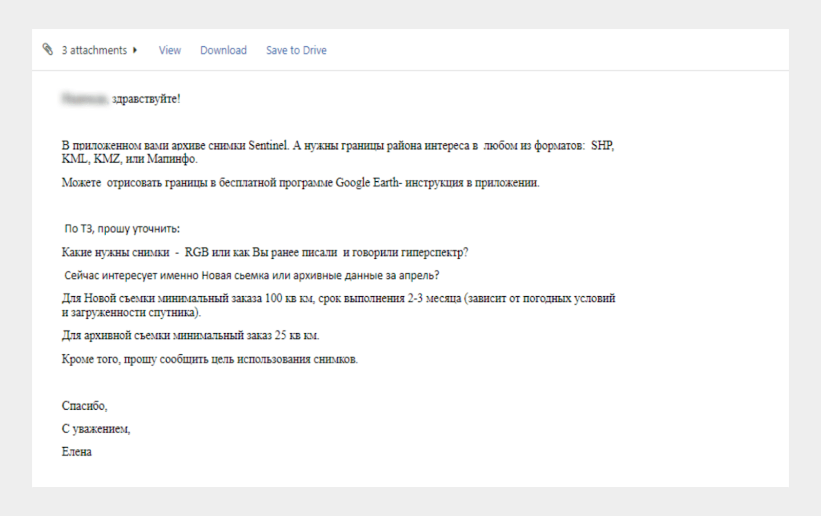
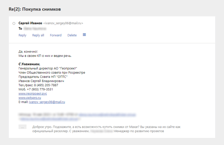
Geoproject. Then we wrote to the company “Geoproject”, resellers “Maxar”, and they agreed to sell us their pictures.
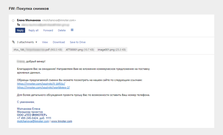
Innoter. We also wrote to Yelena Molchanova, the project manager of the Innoter company. She offered us the archives of the Worldview-2 satellite, where there are photos dated November 16, 2022.
That is, if you pretend to be, for example, a representative of a Kazakh company, using a completely fake name, title and corporate email, and contact resellers from other countries, there will be no checks by American providers. At least, this is exactly what our experiment demonstrated.