
24.04.2023
7 min
1949

The article tells about how the organization finds military targets using social networks, using the example of a destroyed railway bridge in the village of Dronivka, Donetsk region. Also discussed are methods of identifying important enemy military facilities, such as ammunition depots, military equipment, headquarters, and other key logistics points by analyzing photos and videos posted on social networks.
These include BC bases, weapons depots, temporary barracks and residential premises, enemy equipment bases, enemy control points, refueling points and refueling points, critical logistics facilities (railways, intercity routes, height control, operational bridges, etc.), objects of radio-electronic warfare of the enemy, air defense systems (launchers) and fortified defense areas.
If the object is valuable, its location must be accurately determined.
Enemy news sources and propaganda media, especially military correspondent broadcast channels, must be monitored. Due to the constant need for propaganda, the enemy publishes a large number of photo and video materials, which can be used to identify the exact location of personnel, the deployment of combat units, armored vehicles, etc.
Of course, it is also worth studying the social networks of Russian servicemen. There is always at least something interesting. It is necessary to view hundreds of photos and dozens of videos before discovering more or less significant military objects.
Let’s analyze the video. Is this an important target for defeat? Can we accurately identify the coordinates of the target? What happens if the target is hit/ignored?
In certain cases, the answer to the first two questions is “yes”. The answer to the third question is that if the target is hit, the logistics supply chain of the invasion force is disrupted. If the target is ignored, the enemy can quickly accumulate armored vehicles, weapons and personnel, replenish supplies and form new offensive groups in the Donetsk and Luhansk regions. We have determined that this is an important object that deserves the attention of investigators. We move on to the next stage.

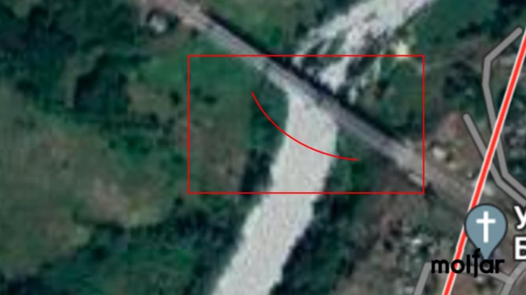
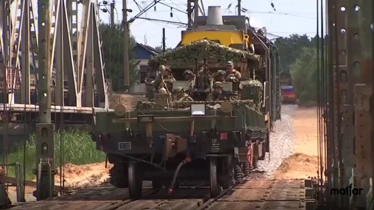
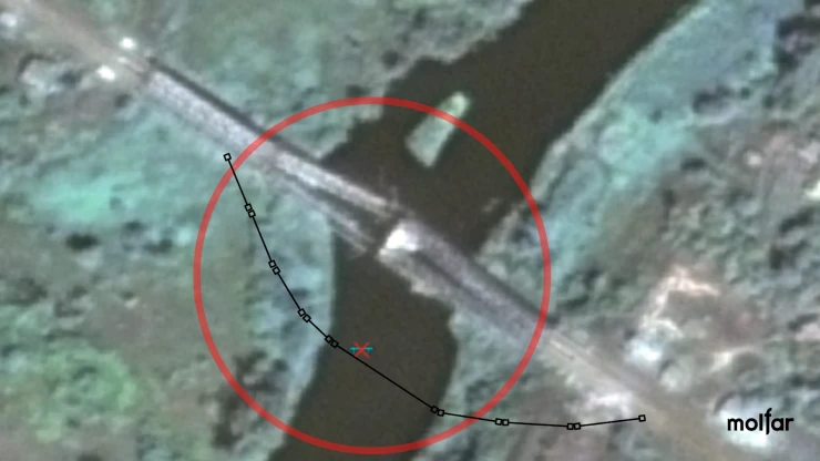
On July 5, 2022, a video report was posted on the tvzezda.ru website. The Russian military has built a pontoon railway bridge across the Siverskyi Donets River, which is used to transport troops and military equipment. The new bridge is located near the old bridge, which was destroyed by the Armed Forces. It is also noted that the greatest amount of effort was spent not on lowering the bridge, but on repairing the 700-meter long railway track.
Video Release Date: July 5th.
Location: Dronivka village.
Current Facility: Yes.
Object assessment: Railway pontoon bridge across the Siverskyi Donets River, 1 pc.
Risk to civilians: Low.
Object coordinates: 48.9236502, 38.036339
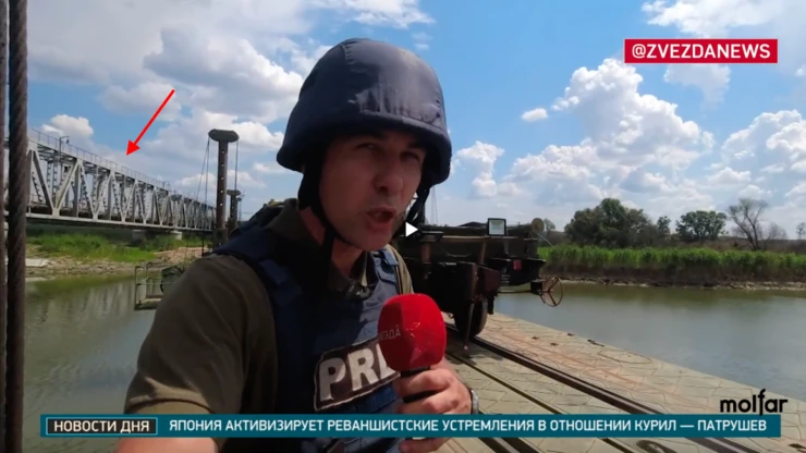
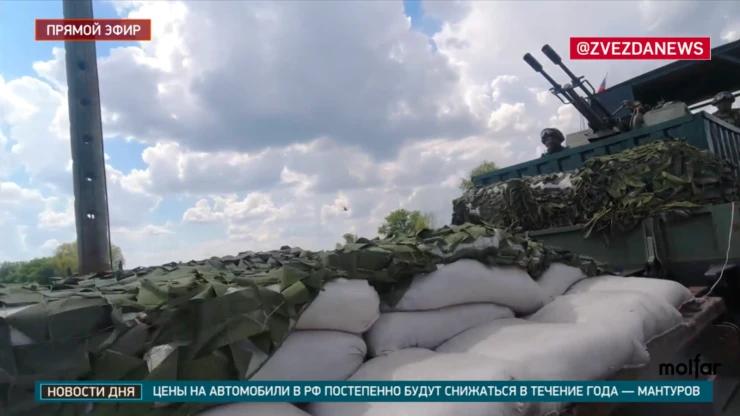
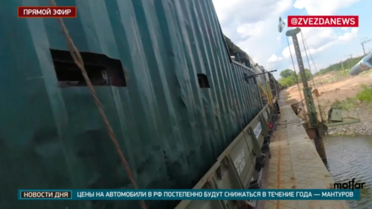
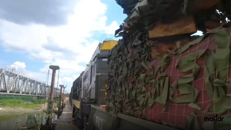
Heavy weapons and Russian troops are transported in wagons. The photo shows the Russian armored train “Volga”, which is intended for conducting engineering reconnaissance, demining and restoring the railway track in the zone of military operations. The train cars are protected by 10-20 mm steel armor, lined with sandbags inside. The armored train is armed with large-caliber machine guns and an anti-aircraft gun.
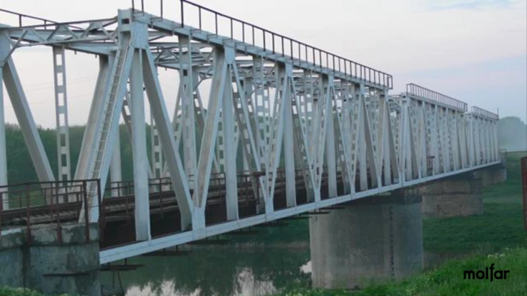
It is best not to check. Trust the Armed Forces of Ukraine and continue to do their job well. And carefully follow the messages of the spokesmen of the military command. In the case of the railway bridge in the village of Doronivka, the Molfar OSINT community ordered for a fee satellite images of the places mentioned in the report to show the strength of the Ukrainian resistance.
The release date of the video is July 5. The target identification date is July 6. The photo above is dated August 7. As they say, quickly built and quickly destroyed. Not even a piece of the pontoon crossing is visible in the photo.