27.04.2023
6 min
2586

Browsing the web, I came across this photo with the caption: Summer 2019, Middle East. There was additional context to the photo (the name of the military base), but it was deliberately not taken into account for a more complete investigation. I have never geolocated in the Middle East and thought this would be a good exercise. This study allowed me to establish a research methodology where we have access to photo metadata (date, phone model). I decided to explore different uses of this metadata to understand how it works and in what situations this data can be used effectively. Also, I needed to understand what tools would help me in my investigation. For example, you can use SunCalc to analyze shadows in an image or video and determine what year and time of day they were created.

Also using OnTopReplica – a program for pinning selected windows on top of other windows. This program helped me identify possible objects. Of course, no investigation is complete without Google Maps. This set of applications, which are based on a free mapping service and technology, provides answers to many questions that arise in the course of any metadata-based investigation. So, how I applied all this and how I determined the location of the object according to the metadata of the photo, I will tell you in more detail later in my article, which, I hope, will help you in your investigations.
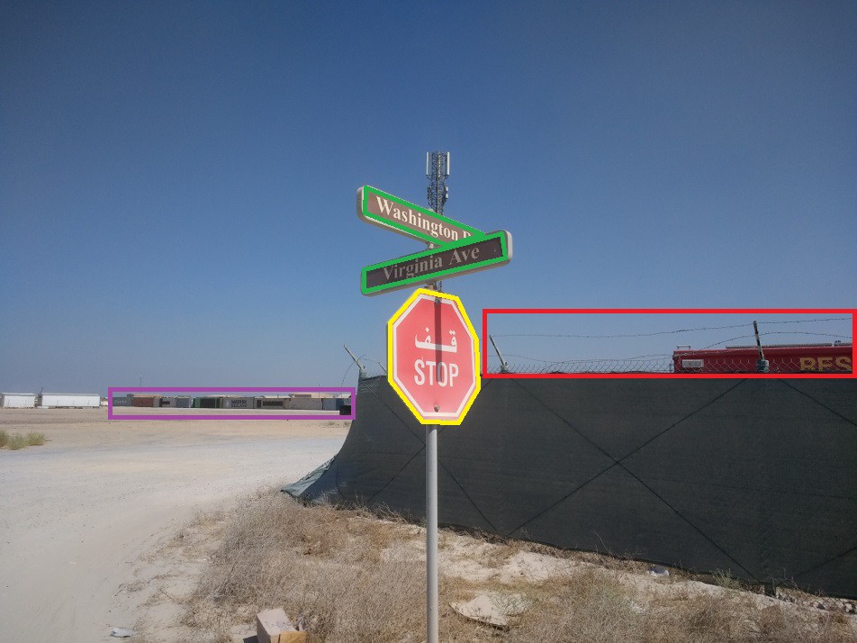
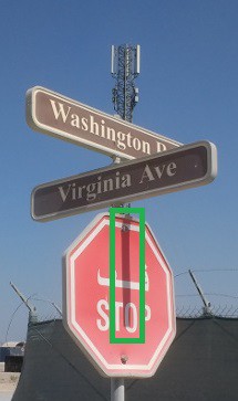
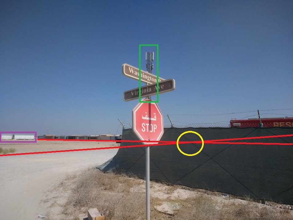
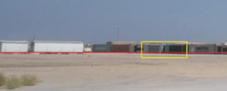
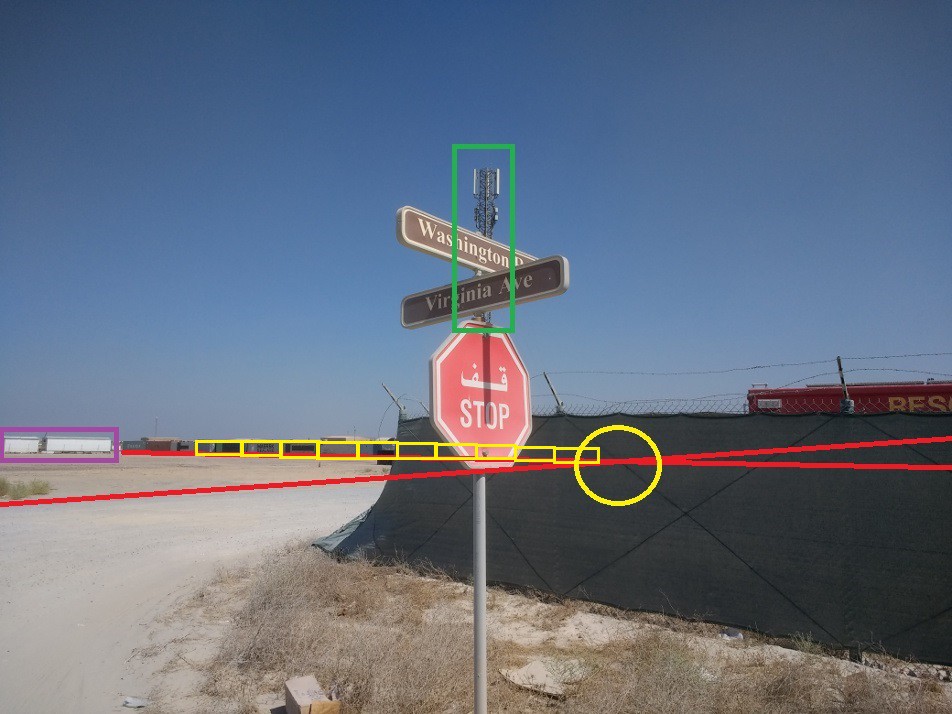
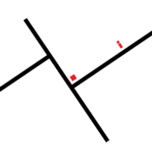
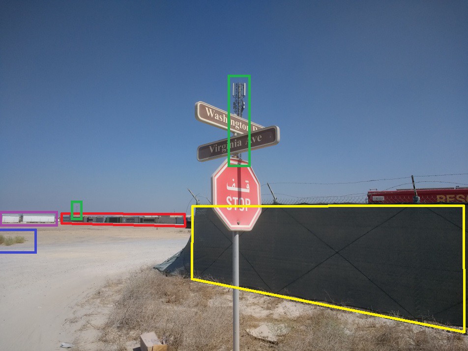
The first step was to determine the type of place where it might be and in what geographic area it might be located. According to the caption, the picture was taken in the Middle East. This can be partially confirmed because the stop sign (yellow) is in Arabic. In the background we can see the containers (purple) and in the foreground we can see the barbed wire on the fence (red). There also appears to be a rescue truck (“Rescue”?) behind the fence.
The next step was to determine which military base it was. To do this, I started by obtaining a list of US military bases in the Middle East from the American Security Project. We could wander through the maps of all the bases to find the exact location, but that would probably take too long and we could miss it if we weren’t methodical enough.
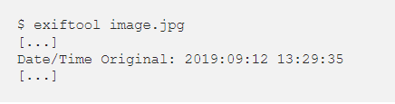
However, we can use the base spec visible in the photo and search for that spec only. To do this, we may use photo metadata to our advantage. Indeed, in this case they contain the date when the photo was taken.
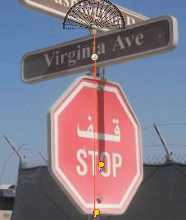
The date and time are interesting because there is a shadow in the photo. This tells us that the sun is almost aligned with the Virginia Avenue sign. Since the sign is parallel to the road we are walking on, this means that if we can determine the position of the sun, we can infer the orientation of the road.
Even if you don’t have metadata, you can try to use the context of the photo and the shadow to determine the angle of the road, as Nick Waters was able to do when investigating the Gaza strikes.
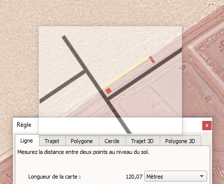
We can then use SunCalc to determine the position of the sun when the photo was taken. We just have to be careful with the timezone, since the time in the metadata is phone time (local time), not UTC-0 time. We use the city of Riyadh as a reference point.
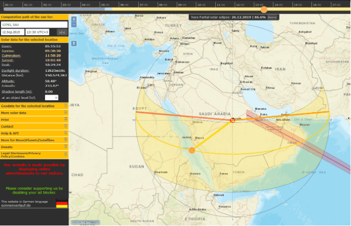
We can now measure the angle between the orientation of the sun and the horizontal line when the photo was taken. In our case, this perspective almost corresponds to the perspective of the road on which the photographer was. This simplifies our search and we quickly get the result.
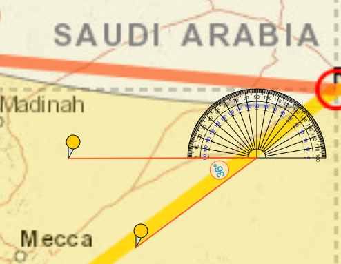
The angle is 36°, but the sun is not perfectly aligned with the sign, we must remove 2°. Now we know that the road on which the photo was taken makes an angle of 34° with the horizontal line. We can now create an image with road orientation to compare it with satellite images of US military bases.
We use the OnTopReplica tool to map road orientation transparency.
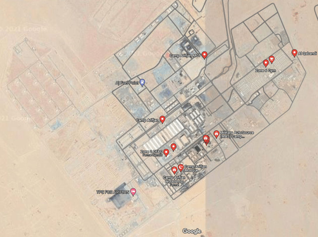
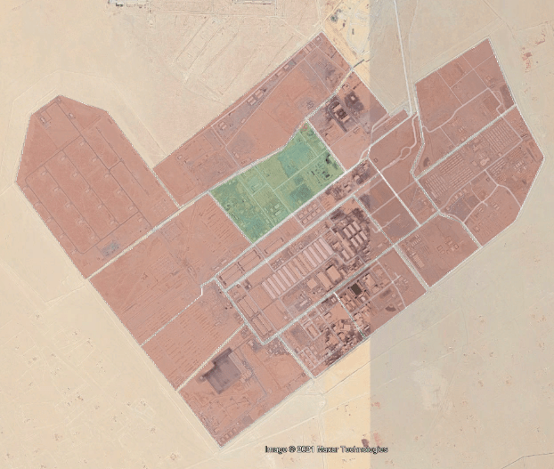
Some of the bases can be quickly removed from the list because the environment or language does not match. The last 3 remain to distinguish them, we can use street names using Google Maps and OpenStreetMap. Camp Arifjan uses a naming convention similar to the streets in the photo. This is the only base on the list that does this. Unfortunately, Washington Road and Virginia Avenue are unknown.
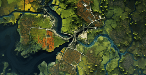
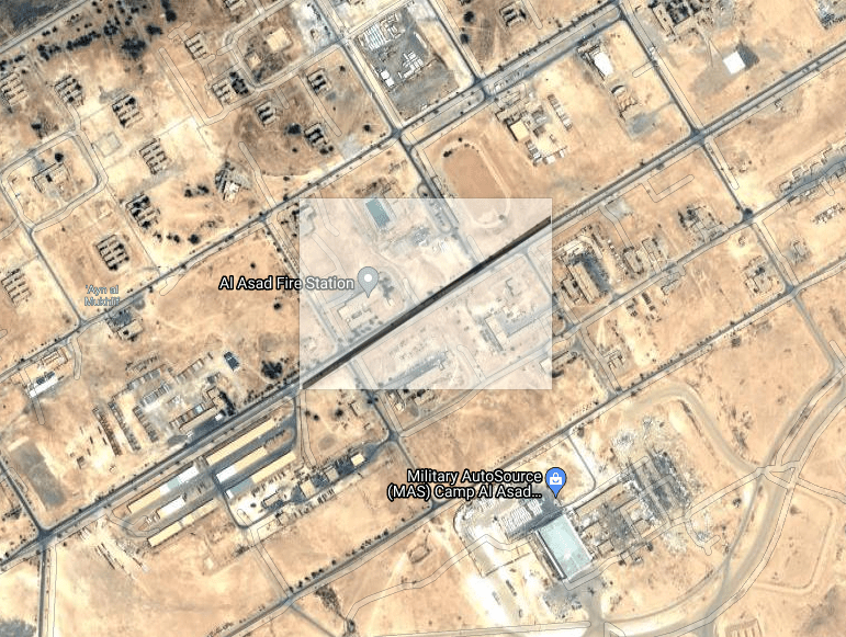
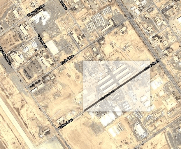
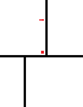
Now that we have a base, we need to determine the location where the photo was taken. The base is quite large and has many roads corresponding to the angle we have defined. To simplify the visual search, we can draw a more complete top view, which we will overlay on the map.
To draw a top view, we need to determine the distances between the elements present in the photo. The two small white buildings (purple) and the cell tower (green) might be interesting for an overhead view, as well as the road along the containers and its intersection with “Washington Road”.
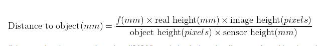
To calculate the distance between the camera and the object, we need the focal length of the camera and the height of the sensor. This data can be obtained indirectly from metadata.
Focal length: 3.6 mm
Sensor height: 3.5 mm
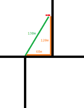
Before we can calculate the distance to an object, we need to know its actual dimensions. For the two buildings we can compare them to nearby containers, the container is 2.59m tall, so we estimate a height of 3m.
We are only missing two values, if we can identify one of them we can calculate the other since we are in a right triangle.
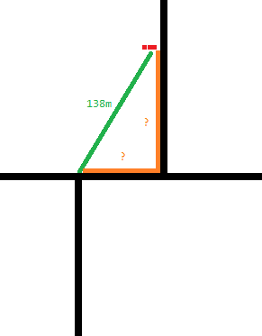
Based on the containers, we can extrapolate and estimate the distance between the two buildings and “Washington Road”. The buildings appear to be in front of the grey-green container. And we can estimate the distance between the transition and the gray-green container equivalent to 10 containers, or 120 m.
Using the Pythagorean theorem, let’s calculate the side of the triangle 68m.
Now we can resize the image to have the correct proportions.
It remains only to orientate according to the terrain.
We need to calibrate the shot with the ruler tool so that it is the correct size on the map.
Next, we divide the map into several areas in Google Earth, which we process while driving.
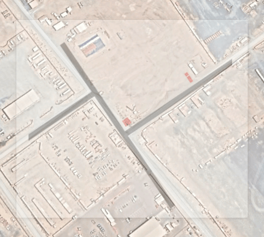
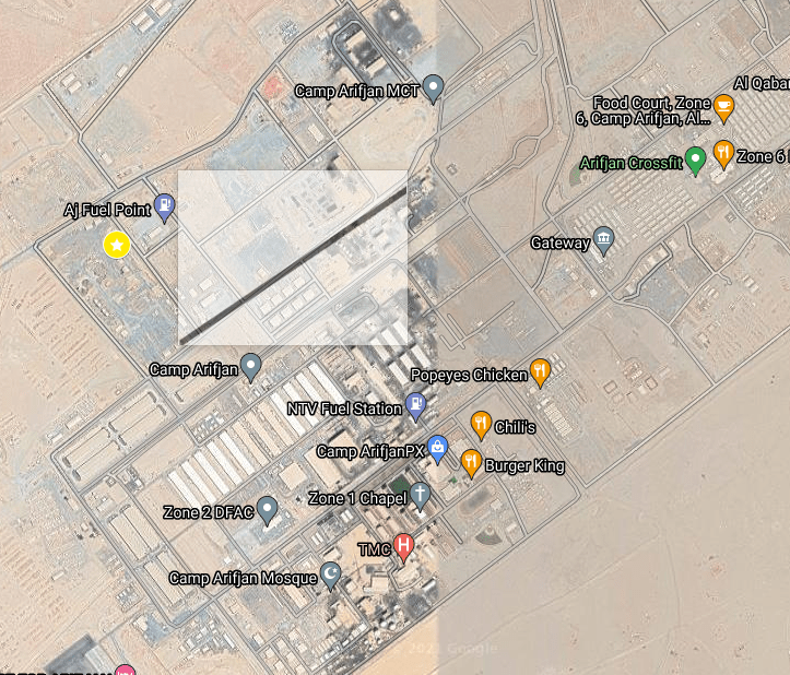
We can then confirm the location with the following items:
wall (yellow)
Houses (purple)
Cell towers (green)
Bushes (blue)
Containers (red)
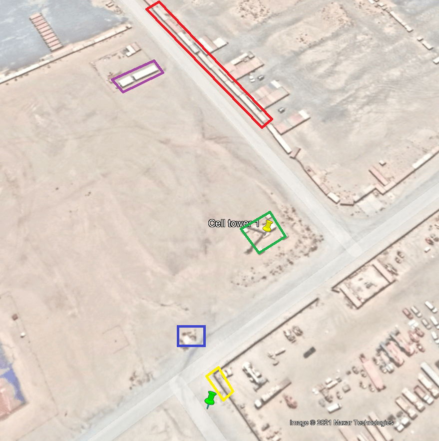
In summary, despite the various assumptions made when creating the top view, the proportions were not too far from reality, but there was a difference of several tens of meters. However, it made it easier to find a shooting location. The area to be surveyed was relatively small (4.5 km x 2.5 km) and could be conducted without an aerial survey. This was mainly the reason for me to apply this methodology, which could be useful when searching in larger areas.
I hope this technique helps you in your investigations!