26.04.2023
5 min
2710

GeoGuessr is a web game developed by Anton Wallen, a Swedish IT consultant, released on May 9, 2013. Using semi-randomized locations from Google Street View for paid subscribers and Mapillary for free, the game requires players to guess their location in the world using only visible clues. The website received hundreds of thousands of unique visitors in just the first week of the game’s existence. GeoGuessr is a geography game. The user gets to a random point on Google Maps in the street view mode and must indicate his location on the map. For most people, it’s an exciting way to kill time, and for others, it’s an opportunity to set a record and get on the leaderboard.
GeoGuessr places the player in a series of five algorithmically determined semi-random locations around the world. Locations are limited to roads and other paths that have been photographed by Google Street View cameras for paid subscribers. When you start the game, the first thing you need to do is look around. In addition to seeing everything there is to recognize a country/region, you should also pay attention to those metagame tips that are also listed for each country when you click on them on the Geotips map. The Google Street View car comes to the rescue. The Google cars used to create Street View were different in different countries. Some of them have characteristic “bars” or “roof rack” on the car. Some of them may be strange. And those that are quite ordinary can also have different colors.
If you’re moving, it’s important to move in the right direction. The truth is that there is no hard and fast rule that will always tell you which way to go, but there are some helpful tips that can help you get on the right track. The first tip is to drive in the opposite direction of where the Google car is going. You can work this out by looking at the back of the car or Google antennas, or by seeing other cars. Or simply by knowing which way they drive in the country you are in, or by looking at which side road signs are on. This works because the Google car always moves off the main road to cover minor roads, so this tip works on minor roads.
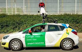
Players pay attention to a wide range of things, such as the quality of the camera on Google cars, which are used to create interactive maps. There are 4 generations of Google Street View cameras and they can be very useful for you to narrow down the country you are in.
A terrible “blurred”, “potato” camera where nothing is visible.
Better resolution and has a circle in the sky that is usually purple in color
сBetter resolution and has a circle in the sky that is usually purple in color
A new high-quality camera with vivid colors and often high exposure.

So after looking at these “metagame” hints, you should look at your surroundings and other things that aren’t related to just looking at the streets.
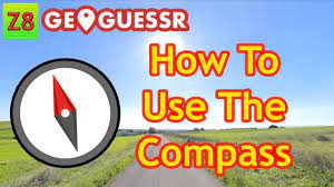
The Sun can be especially helpful in narrowing down which hemisphere you’re in if you’re not sure. Since you have an in-game compass on the left, you can tell where the sun is north or south of your location (the red end of the arrow points north). If the sun is in the north, you are in the southern hemisphere, if it is in the south, you are in the northern. It can be an unreliable clue at the equator, or the sun can be in the middle, or sometimes when the sun is low.
Another very useful tip for narrowing down the country is the driving side. Countries on the Geotips map are colored differently depending on whether they drive right (blue) or left (red). After that, you can view all the other tips listed in Geotips and more, whether you’re moving or playing without moving.
Another tip for which way to go is to go downhill. It’s quite simple – most settlements are located in valleys, not mountains. Once you’ve decided which route you want to take, there are usually 3 main things you need to find – the country or state/region you’re in, the road number, and the town name. Of course, you can find anything useful if it helps you achieve your goal. Don’t forget to remember which direction you were heading from the start and where you were going as this can be useful for reference later, as well as the name of the street/road at the start.
When you’re gathering certain information, another very useful thing for pinpointing a location, knowing exactly what road you’re on or what part of the road you’re on, is using road orientation. Point the camera directly north with the compass and see which direction the road goes. It must correspond to the direction of the road on the map. You can also use this at intersections to determine your exact location. You can determine your location by the orientation of the coast, the direction of the river, and in many other situations, so a compass is a great tool that should not be underestimated. Also, don’t forget that houses/buildings are on the map and in some countries they even have numbers.