
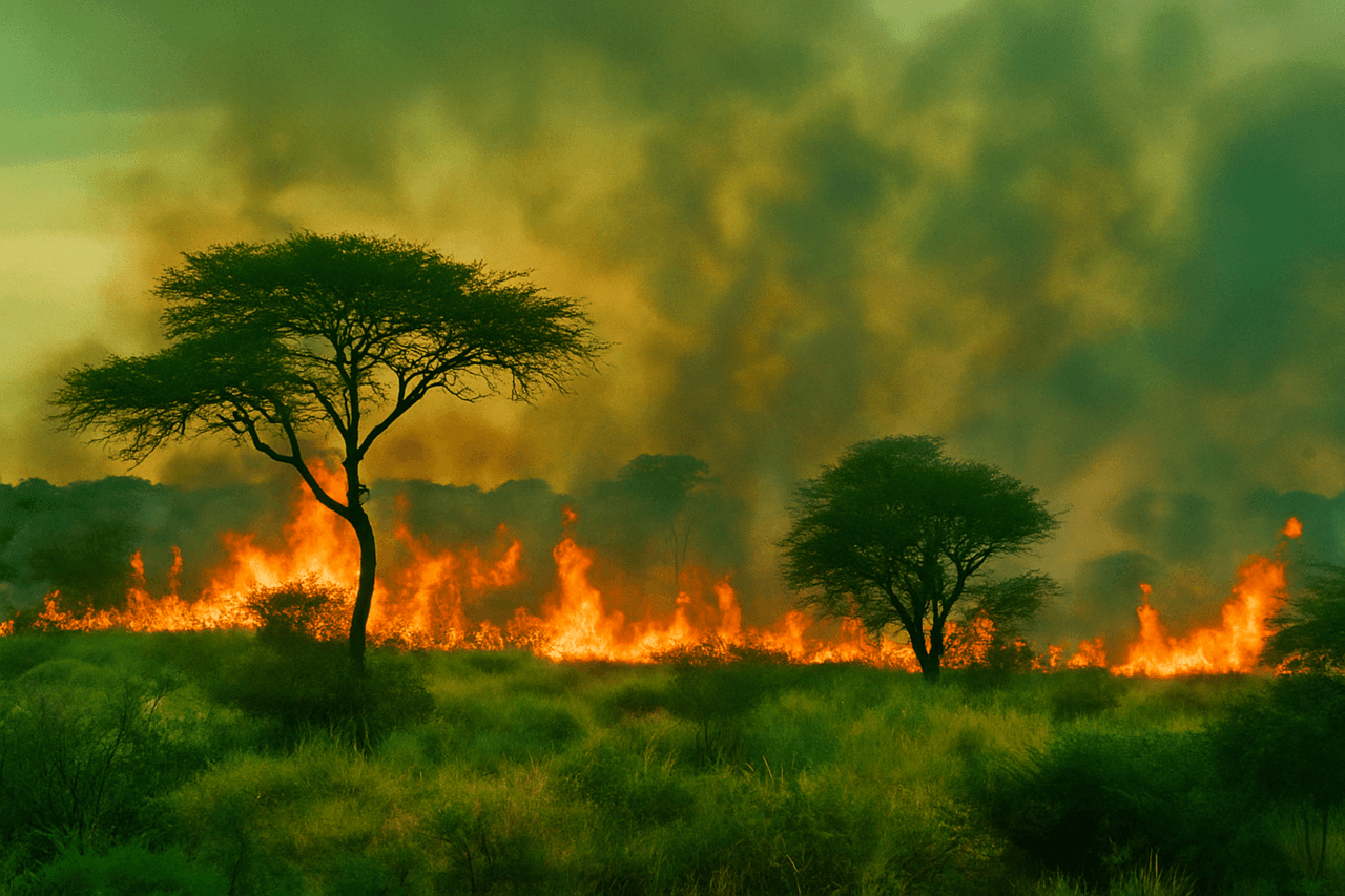
The article is about the massive fires that destroyed a significant part of one of the largest nature reserves in Africa. You will learn how the disaster occurred, which areas were affected, what is known about the causes of the fire and the consequences for wildlife. The authors talk about the losses among animals, the response of local authorities, the progress of rescue operations and why such disasters are becoming more frequent due to climate change.
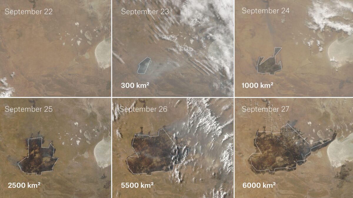
The wildfires began on September 22 and raged through the reserve and surrounding areas for five days before an emergency government meeting was held on Saturday, September 27. After several days of large-scale fires, the government deployed 500 troops to the region the following day.
NASA optical satellite images show that at least 6,000 km² had burned by the time the government convened the emergency meeting, including agricultural land near the northern border of the park.
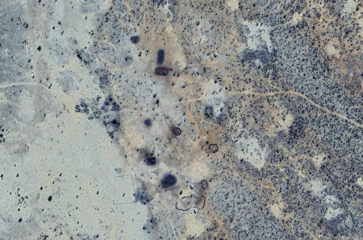
A satellite image from September 25 shows the traces of fires that have engulfed the northern border of the park, nearby villages and agricultural lands. In comments to local media, residents and volunteers noted that it is impossible to extinguish the fire without additional assistance, including fire trucks and helicopters.
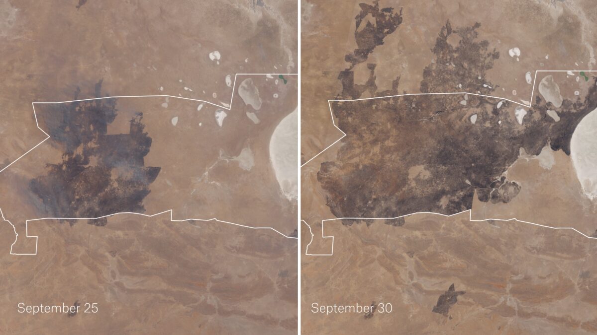
As of October 1, international media reported that the fire had burned between7500 and 8500 км² of the park. According to an analysis of NASA satellite imagery, at least 7,000 km² had been affected, more than a third of the entire area of the reserve.
In a press release, the ministry said: “The crisis caused by the forest fires in Etosha National Park and surrounding areas poses a serious threat to Namibia’s biodiversity, local people and critical infrastructure.”
In a Facebook post, Prime Minister Tjitunga Elijah Ngurare said the fires “started on September 22, 2025 in the southwestern part of the park due to suspected charcoal production on nearby commercial farms.”
NASA FIRMS data matches the Prime Minister’s statement, indicating that the fire originated just outside the southwestern boundary of the park. As seen below, NASA FIRMS uses a color-coded classification system to show how long ago an active fire was detected. The yellow box below indicates that the last wildfire in Etosha was first detected at 3:25 p.m. on September 22.
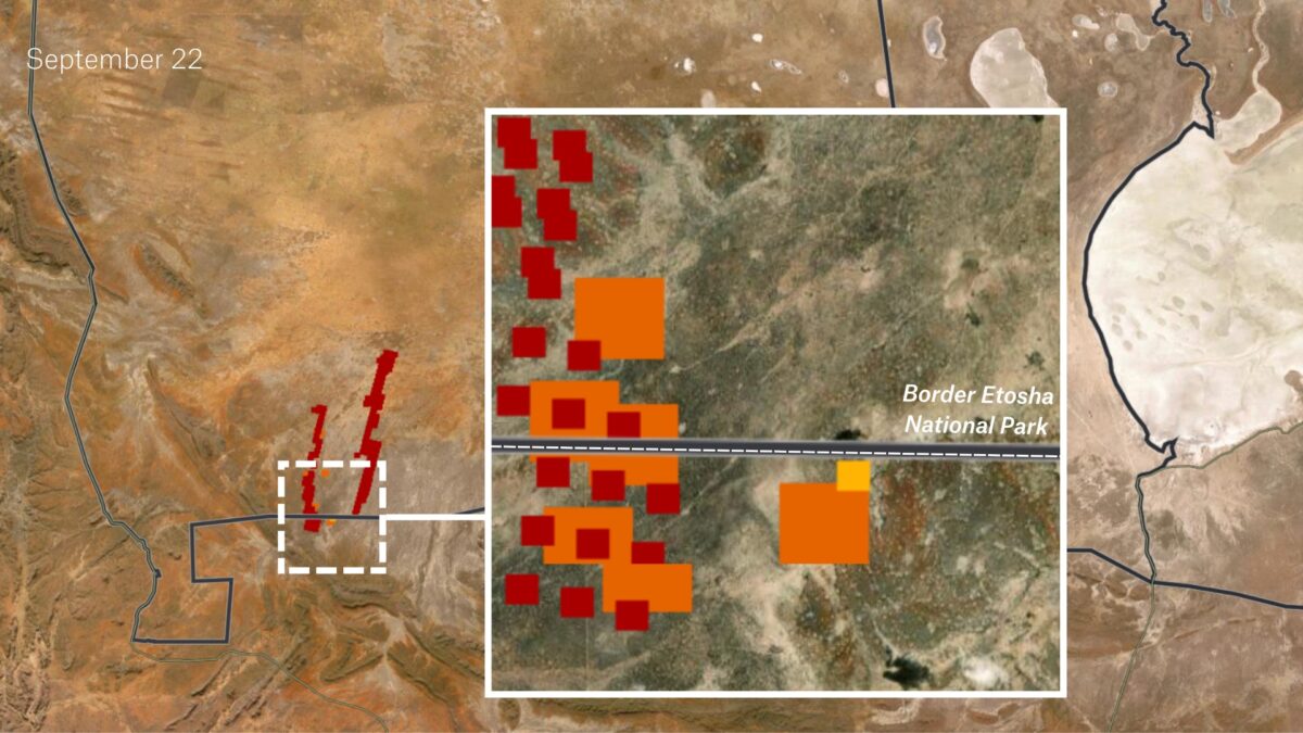
Further analysis of the location of the yellow square using satellite imagery confirms that the fire occurred on September 22, the first day of the event. Weather data from the same day, obtained via Zoom.Earth, also supports this, as the outward spread of the fire is consistent with a northeasterly wind direction.
Google Earth imagery also confirmed the presence of a small village and several charcoal pits near the site of what NASA FIRMS has identified as the oldest active fire. However, without a thorough ground investigation, the exact cause of the fire cannot be determined.
Within days of the fires ravaging large swaths of the park, images of an injured elephant with severe burns began to circulate on social media.
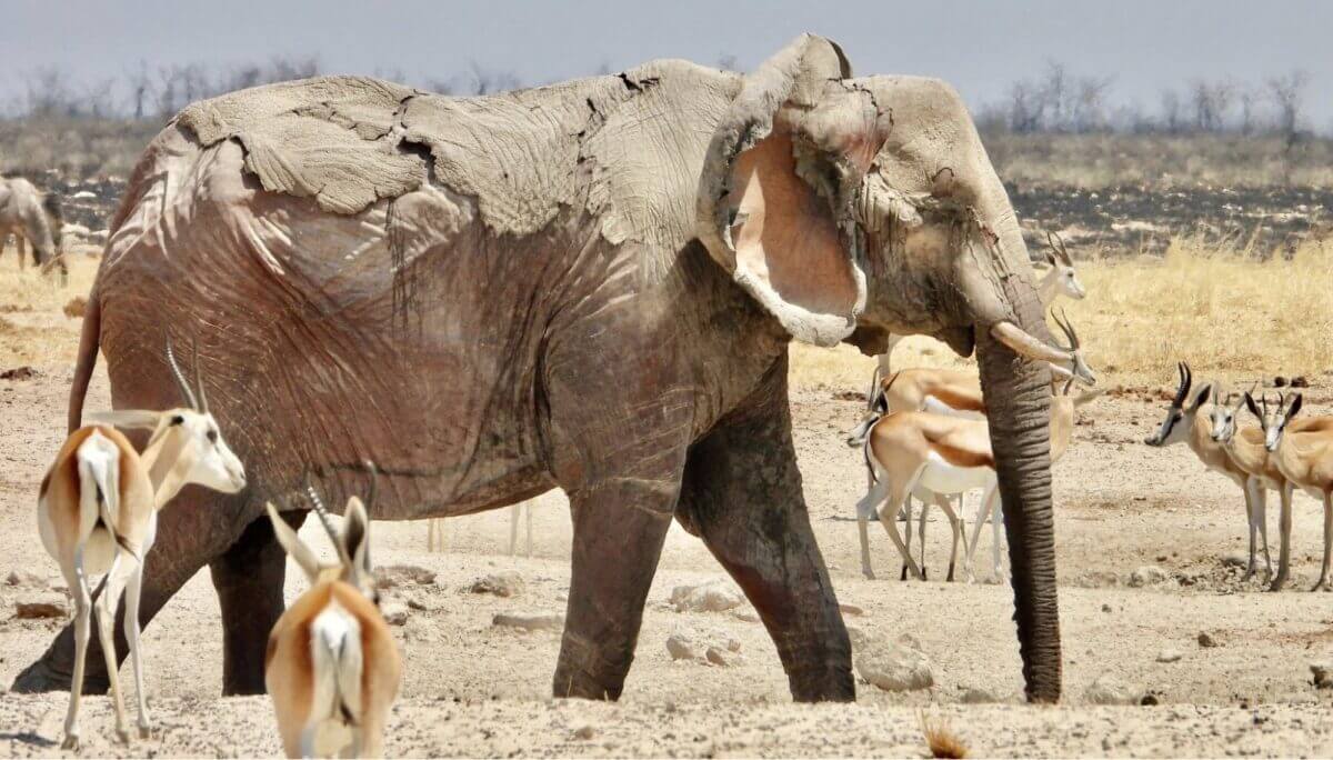
In response to a barrage of comments questioning the authenticity of the image, Minister of Environment, Forestry and Tourism Indileni Daniel told reporters at a press conference that they could not confirm that the image was taken in Etosha National Park, nor could they confirm that the elephant had died in the recent fires. At the time, the only confirmed animal losses identified by government helicopters monitoring the area were nine antelopes, one elephant and one injured pangolin.
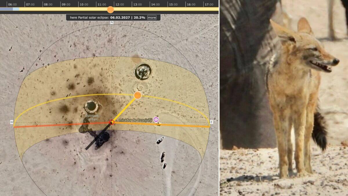
In an interview with local news outlet Network Media Hub, photographer Kus Reineke described how he took the photo of the injured elephant at a waterhole “just in front of the Charles Mare Dam.” The image was geolocated to the Ozonjuitji m’Bari area, a waterhole located near the Charles Mare Reservoir.
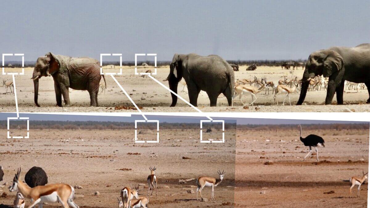
Three termite mounds are visible in both the photo of the burnt elephant posted to Facebook by the photographer and the 2023 video taken in Etosha National Park on YouTube. Termite mounds can take years to form and can last for hundreds of years. Additional matching features include the rising horizon line on the left, similar bush patterns, and a puddle of muddy water in the foreground that is an overflow from a nearby watering hole.
Shadow analysis using SunCalc, a tool that helps users analyze the position of the sun and shadows to estimate when an image was taken, matched the photographer’s claim that the photos, including the shot of the wounded elephant, were taken around noon on September 28.
Prime Minister Tjitunga Elijah Ngurare posted on Facebook on September 29: “All fires contained/extinguished, monitoring ongoing.” The ministry said it would continue to conduct aerial photography from a helicopter to assess the extent of the damage. NASA FIRMS continued to detect active fires in Etosha until October 5.
The fires in Etosha National Park have become one of the largest environmental disasters in Namibia. In a few days, the fire destroyed thousands of square kilometers of protected areas, causing damage to nature, animals and local communities. Despite the involvement of the military and rescuers, the scale of the tragedy showed the vulnerability of even the largest natural parks to climate change and the human factor. The events in Etosha reminded us that timely response and systematic management of natural resources are the key to preserving Africa’s unique ecosystems.