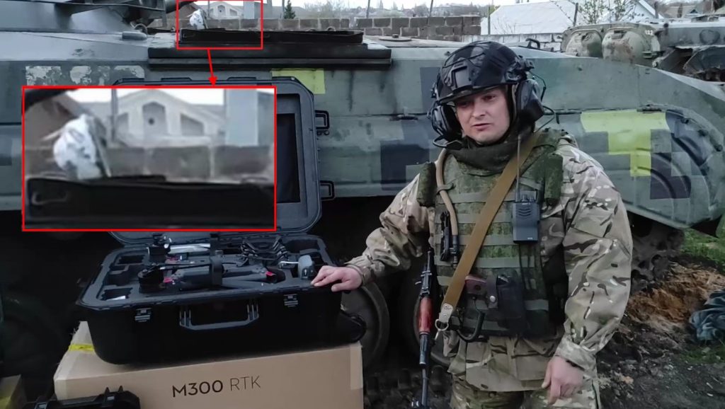
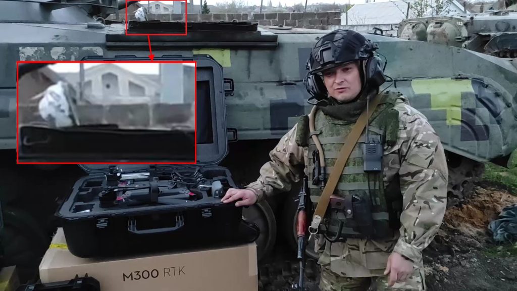
The war in Ukraine began on Thursday, February 24, 2022, at approximately 5 a.m. Kyiv time. Russian troops entered the territory of Ukraine from Russia, Belarus and the annexed Crimea, and the troops of the Russian-controlled DPR and LPR joined the hostilities. The troops began an offensive in four main directions — from the north in the direction of Kyiv, from the northeast in the direction of Kharkiv, from the southeast from Donbas, and from the south from Crimea. The events were preceded by the concentration of Russian troops near the Russian-Ukrainian border and the resulting crisis in relations between Russia and Ukraine. Analyzed video about how the “second army of the world” is handed over a drone, allegedly bought as a donation from rear orcs.

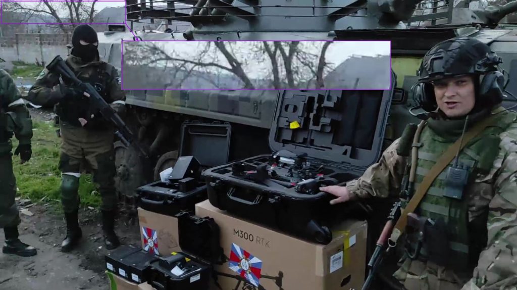
In the second month of the upcoming war, the armies are collecting donations to buy civilian drones… Thanks to all those who looted the budgets of this army, and the silly orcs are now collecting a penny to buy something. But, let’s help our armed forces by indicating the position of satisfied orks (satisfied so far) with the help of geospatial intelligence and OSINT, analyzing the video they published. Spoiler: the pig-dogs set up camp near the fire station (not the first time, judging by the news), and when something cheering arrives at their camp, their scum media will shout – “fire station fired, punishers”…orcs So, analysis… Determining the positions of Russia’s “army” in the occupied territory of the Donetsk region of Ukraine during a large-scale invasion in 2022. Source: video provided by our employee at the organization “MGO Viche”, thank you! Video from MRO “Veche”. Let’s imagine that we don’t know where the recording was made and try to determine the location…
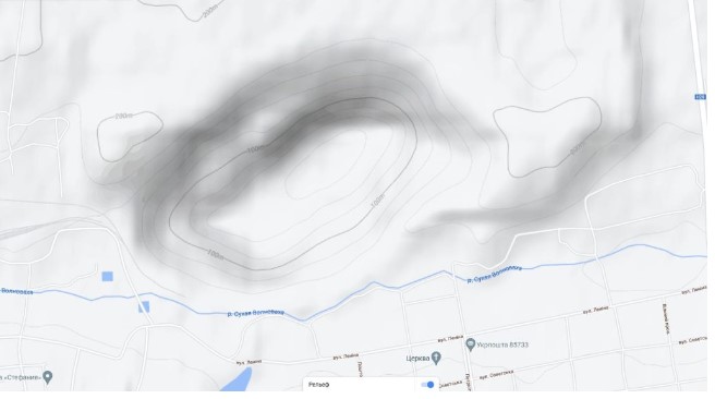
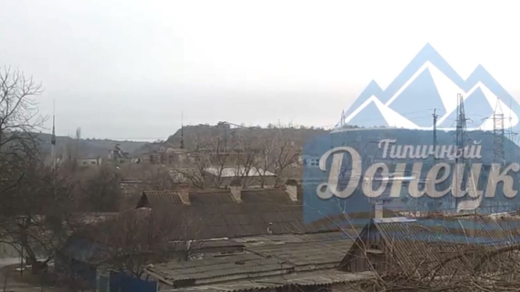
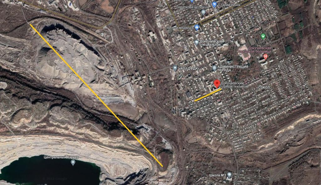
It follows from the description of the video that the place of filming is the Donetsk region, an occupied part of it. The natural relief of the Donetsk region is a plain, that is, the hill on the horizon is most likely artificial, most likely it is a rock dump or tericon, which is also indicated by the buildings on the top of the hill. Also, in order to reduce the search area, it is necessary to take into account which settlements are under temporary occupation on the date of filming and publication of the video. Using Google, we find a map with the names of settlements, the location of troops according to the version of the Russian Armed Forces:
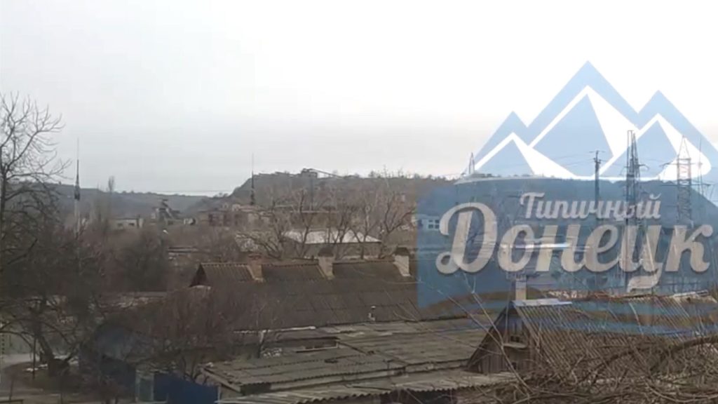
Using Google maps with terrain relief enabled, information on occupied settlements on the date of publication of the video, we select the most likely settlements. It can be seen in the frame that the slopes of the highlands are quite steep, that is, they should look like very contrasting spots on the map, something like this:
The most likely locations, then with the help of Google images, Yandex images, we look at photos from these settlements, we are interested in the shape of the relief:

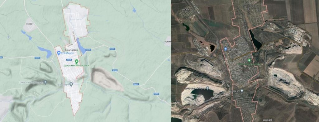
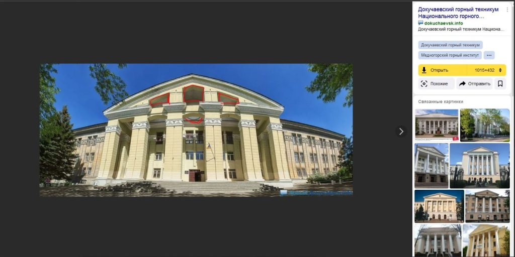
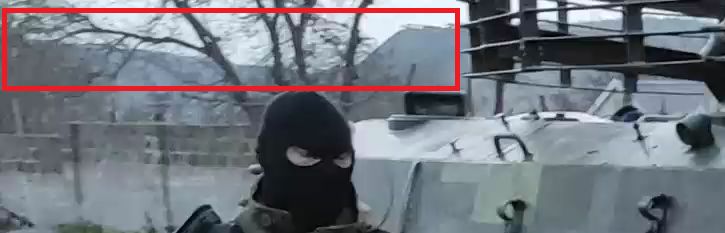

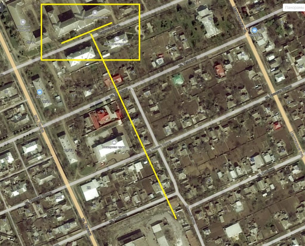
The pediment of the Dokuchaev Mining Technical School is very similar to the pediment of the building in the video. Confirmation that this is the same building is the location in relation to the elevation:
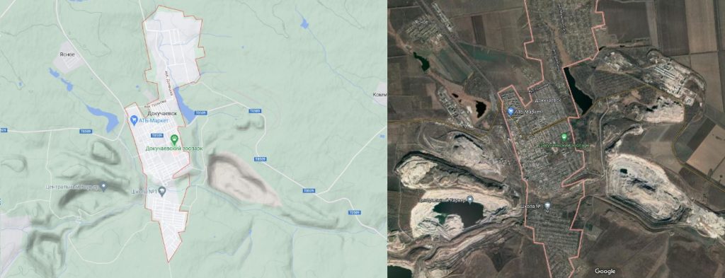
By reducing the scale of the map, we can see that the video was filmed along Sadovoy Lane:
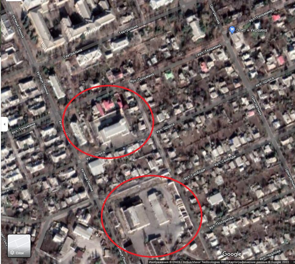
The most likely place of shooting and location of equipment: ATP or fire station:
This was an example of content analysis and finding geographic coordinates. If you received the coordinates, check them again. It is impossible to allow a situation where you take what you want for granted. If you have checked and there is no doubt that everything is correct, then send the result and the most important thing – the progress of your research to the bots:
from the Ministry of Digital: https://t.me/evorog_bot
from the SBU: https://t.me/stop_russian_war_bot
from the “Come back alive” fund”: https://www.findokupant.com/