28.04.2023
4 min
2193

Geolocation is your location on the map, given in the form of geographic coordinates or a postal address. The search can be carried out by network coordinates or by GPS satellites. The more observation and reception stations have recorded the signal from the object, the more precisely its position on the terrain map is determined. You can also check the authenticity of the location. In addition to one-click access to satellite OSINT, more and more tools are emerging to find out the exact location from where a photo or video was taken. Any detail—a road sign, a sign, power lines, the topography of mountains in the background, or even the length of a pole’s shadow—can be a clue to researchers. There are no unimportant details. We bring to your attention a selection of geolocation tools from leading OSINT researchers.

For example, there is an interesting tool that allows you to mark all the peaks on the camera, as well as photos from past outdoor adventures. The application also contains high-precision 3D maps that are useful for planning and navigating in the mountains. There are many databases and platforms that have information about buildings, names, communications, etc. You will be able to try your skills in an interactive game that will help you develop problem-solving skills for finding location coordinates with accuracy. It will be possible to create beautiful maps in 3D or 2D, interactive maps of local history and heritage, add any geolocated information in a minute and it will be posted. And you will learn a lot of interesting and useful information from this article, which is aimed at deepening the knowledge of tools related to geolocation.
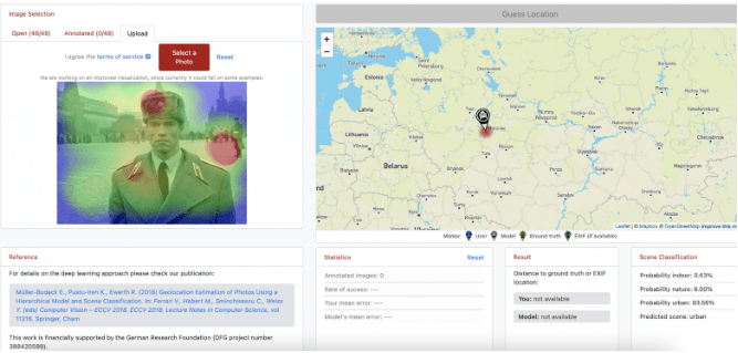
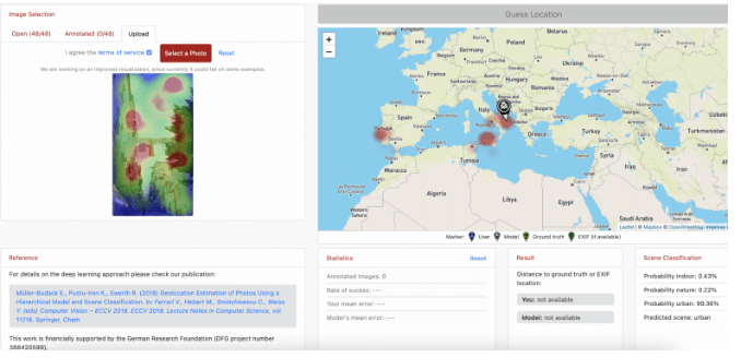
A platform that estimates image location using deep learning/AI. Here you can look at other people’s photos and manually kill their location, study the system, or you can upload your photo and ask the system to “guess” the location. But there was an experience when I uploaded my photo from the historical district of Istanbul – the system could not determine. The heat map shows the areas that had the greatest influence on the decision.
Contains data on over 1,000,000 mountains worldwide. Draws the contours of mountains, often used in investigations to recognize the location by the outline of the terrain in the background.

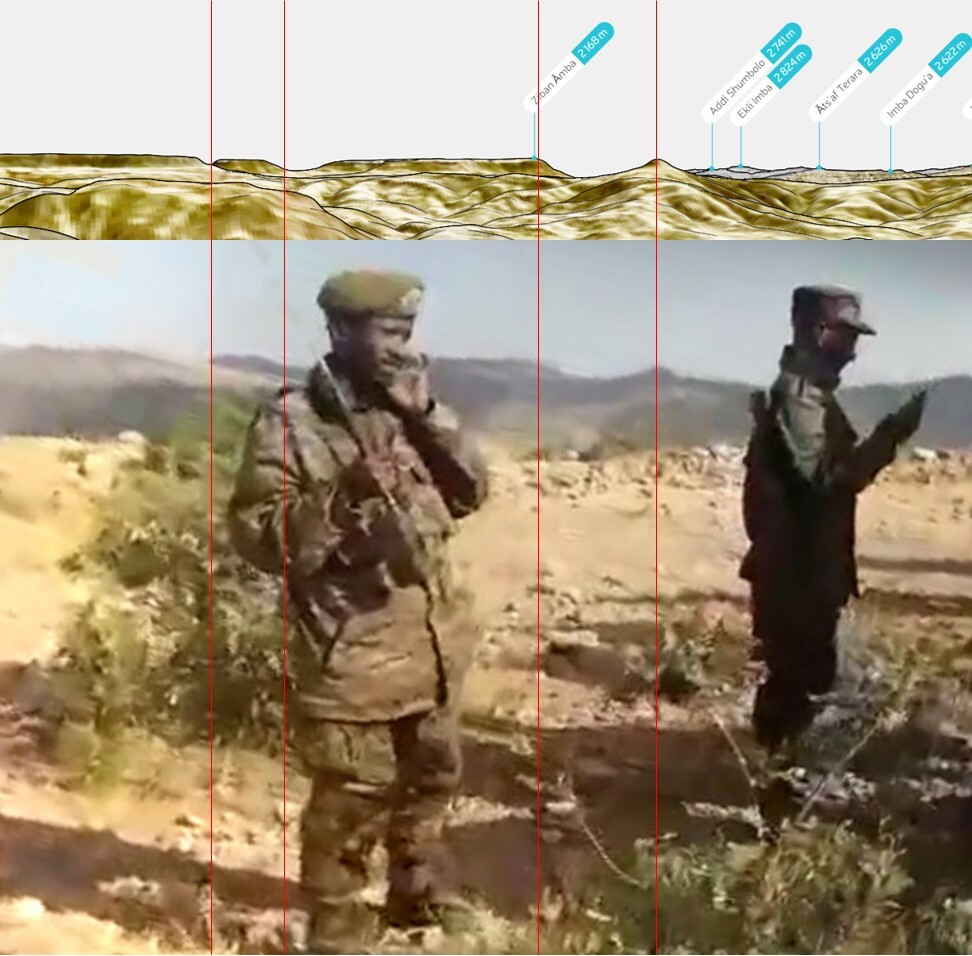
Geolocating a Plane Shot Down in Ethiopia – Case Studies on Mountain Profiling with PeakVisor
Махбере Дего: розслідування массового вбивства на скалі в Ефіопії
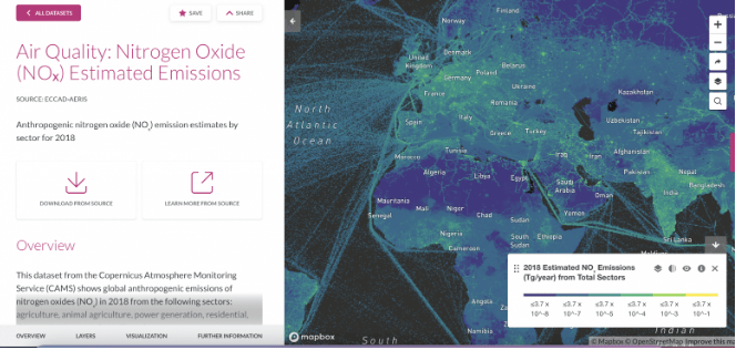
A non-commercial platform, still in beta testing, that provides hundreds of datasets about the state of the planet’s resources and inhabitants. Sponsored by the World Resources Institute and other organizations.
A free and open source GIS with many add-ons and plugins, such as creating 3D landscapes based on lidar data.
Enter the search query: geocode:[coordinates],[radius-km], for example: geocode:36.222285,43.998233.2km (works only with “km”, 500 meters = 0.5km). Be careful because it’s very easy to spoof your geolocation on Twitter.
Tips and life hacks from the best players in GeoGuessr (an international game-quest for determining the geolocation from a photo). Contains information on types of roads (pavement, posts, markings, bumpers), road signs (on both sides), license plates, road signs, power lines.
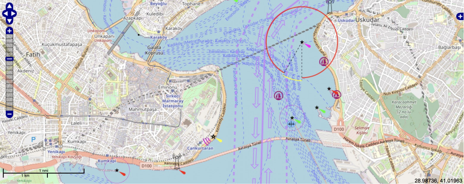
The main purpose of OpenSeaMap is to collect and add to OpenStreetMap information for sailors and yachtsmen. This includes information about lighthouses, buoys and other navigational signs, repair shops, shops, etc. Maritime map of borders, special zones, shipping lanes with the overlay of maritime communication lines.
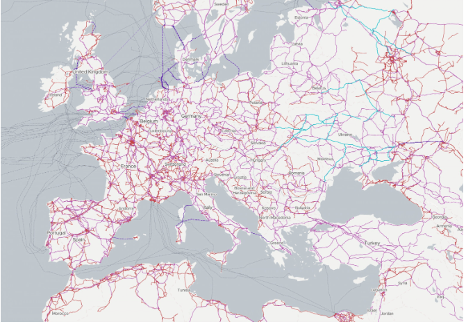
The map includes power lines, telecommunications, solar, oil, gas and water infrastructure around the world.
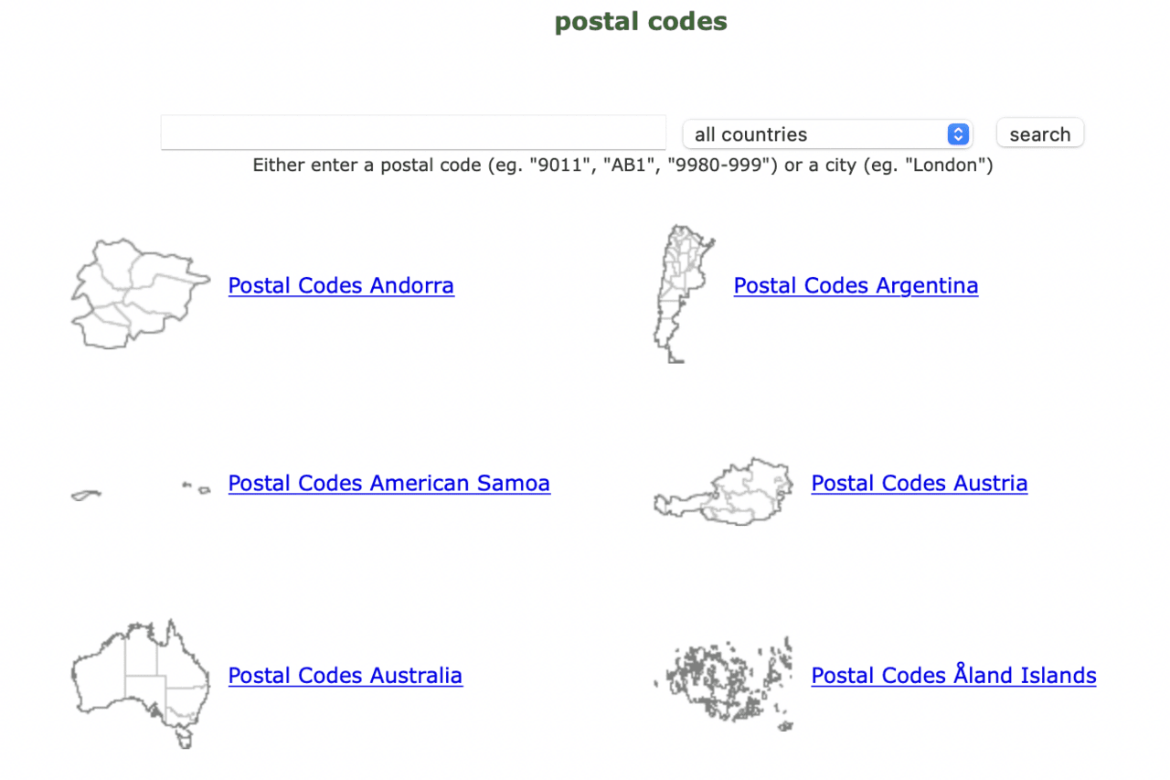
The GeoNames geographic database contains information on all countries and has about 11 million location names.
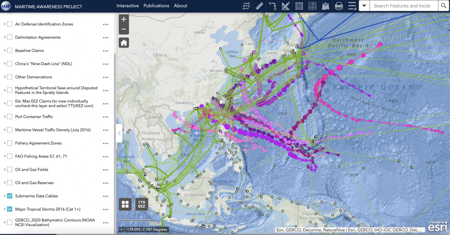
Interactive maps of the South China Sea with oil and gas fields, fishing areas, air defense zones and administrative, declared, disputed zones, submarine cables.
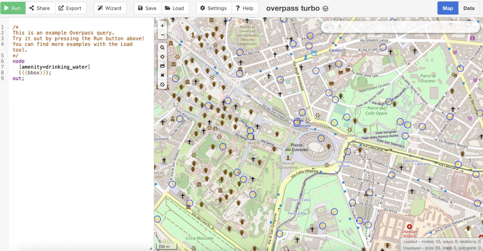
A web mining tool for OpenStreetMap.
Allows you to query the Google Maps API for two specific locations that are the exact distance apart from each other within a given radius. Useful for geolocating photos and videos. It’s a script, no user interface. A simple Python script has been written that allows you to query the Google Maps API for two specific locations at the exact distance from each other in a given area.
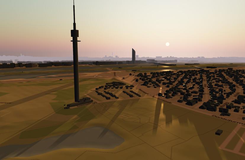
An interactive 3D map that allows you to view the location of the shadows of buildings around the world at any time of day and any day of the year. If you want to know which shadow you will have at a certain time and place, you can simply view its location on the shadow map. Enter the date and time of day and the shadow map will show you the shadows cast by nearby buildings at that exact moment.
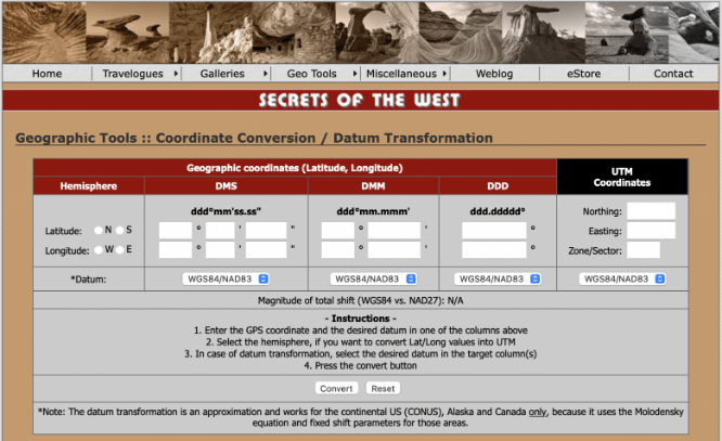
Convert geographic coordinates between different recording styles.
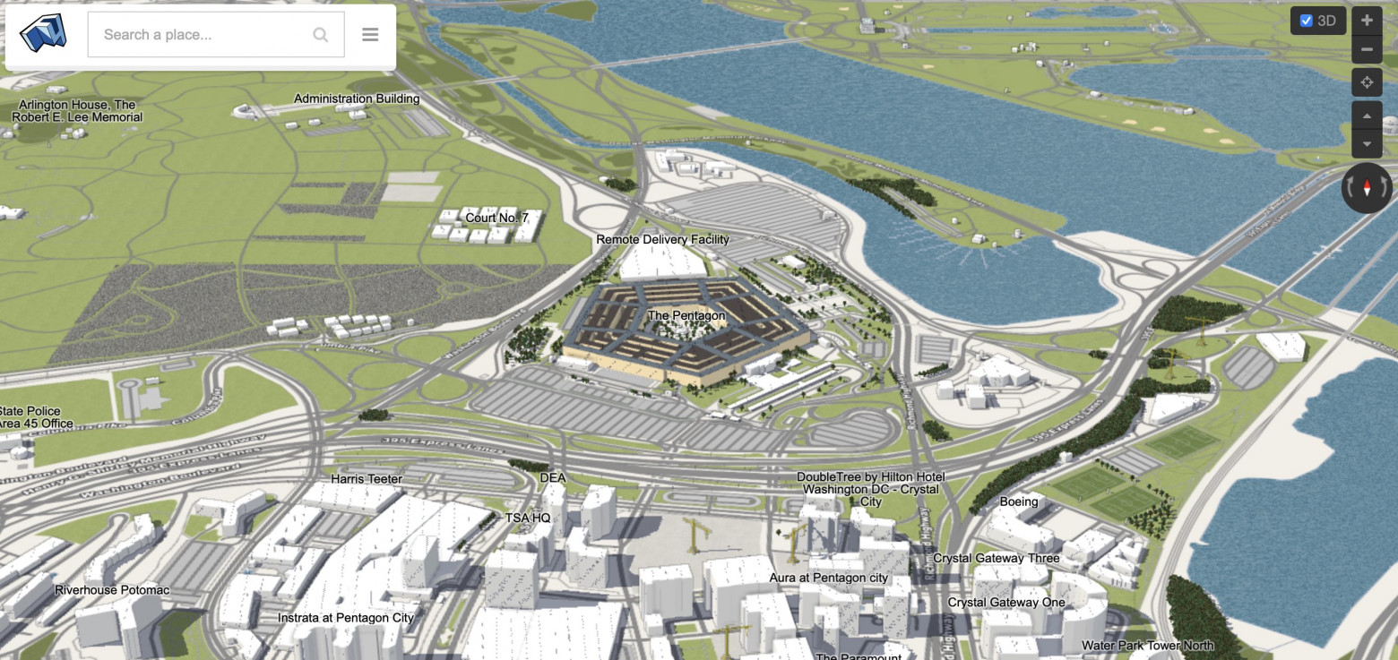
World map with 3D houses and their shadows at different times of the day.