27.02.2024
7 min
1278

How to find the exact location of a photo? The article uses the example of the Ostankino TV Tower to examine a step-by-step process: analyzing photo details, creating a building plan, and searching using maps.

The task is to determine the coordinates where the photo was taken.
Of course, we are not talking about a photo with a laptop, but about a picture of a poster. Are the objects poorly visible? Will it be difficult to find a place?
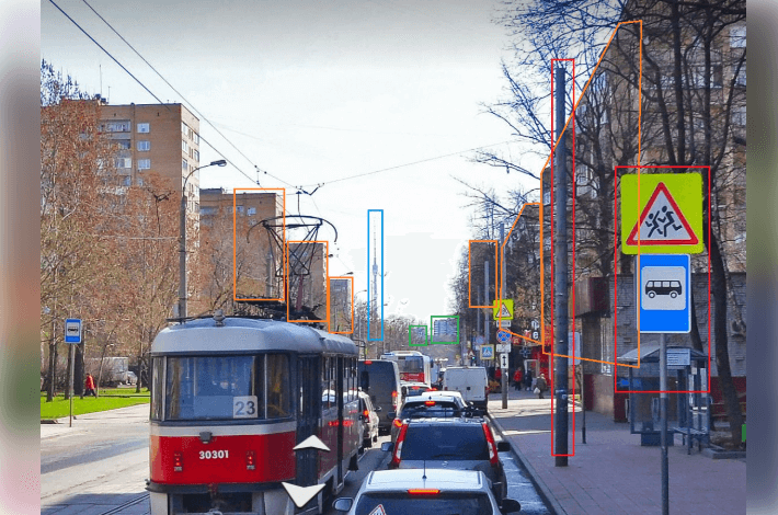
Actually, no. Let’s look more closely. There is a unique object in the photo – the Ostankino TV Tower. So, this is Moscow. But how to determine the exact location? Let’s try to figure it out.
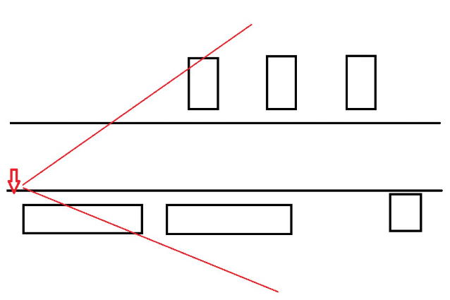
Although the TV tower is visible from almost any point in Moscow, this requires a fairly large open space, which we see in the photo – a long straight street leading towards the TV tower. Moreover, it is quite wide, with several lanes of traffic in each direction. What else could be useful?
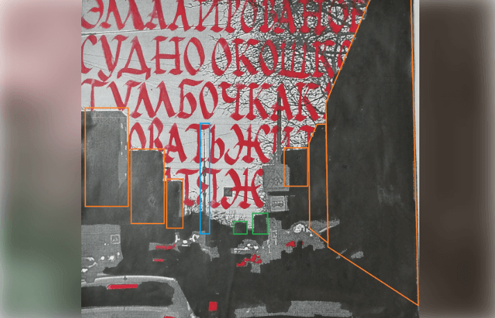
Three buildings are clearly visible on the left, which could be either “candle houses” or houses facing the road. Three buildings are also visible on the right, two of which are along the road. In addition, two more objects can be seen in the distance.
Let’s define a radius of 10 km. We will leave aside the options of shooting with a 600 mm telephoto lens for now, since they are unlikely. Theoretically, one could try to calculate the focal length from the angle of view of the lens in the photo, but this makes no sense, because the image could be a cut fragment from a frame taken with a regular lens.
Now let’s open a map of Moscow and see how many long straight streets with residential buildings leading towards the TV tower are in this radius.
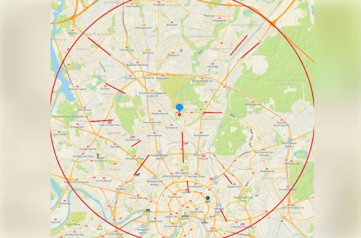
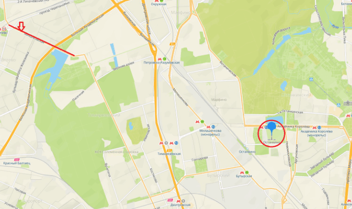
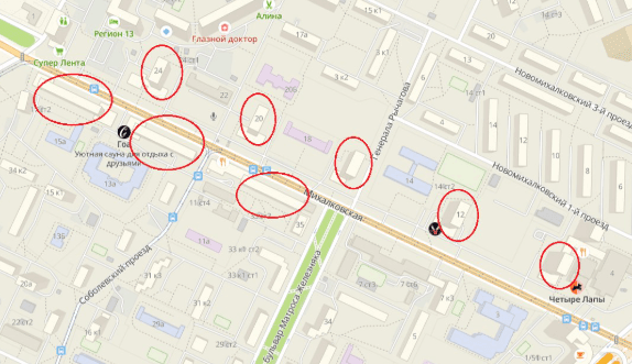
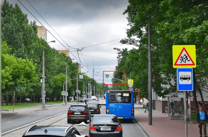
Let’s go to view panoramas and look for the desired angle.
The desired location is located at the coordinates: 55.839797, 37.526054.