Geolocation by photo is an interesting and useful skill that helps determine the location of an object from photos or panoramas. In this article, we will look at how to find the exact coordinates of a point using images from Google Street View.
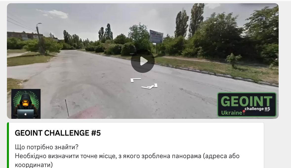
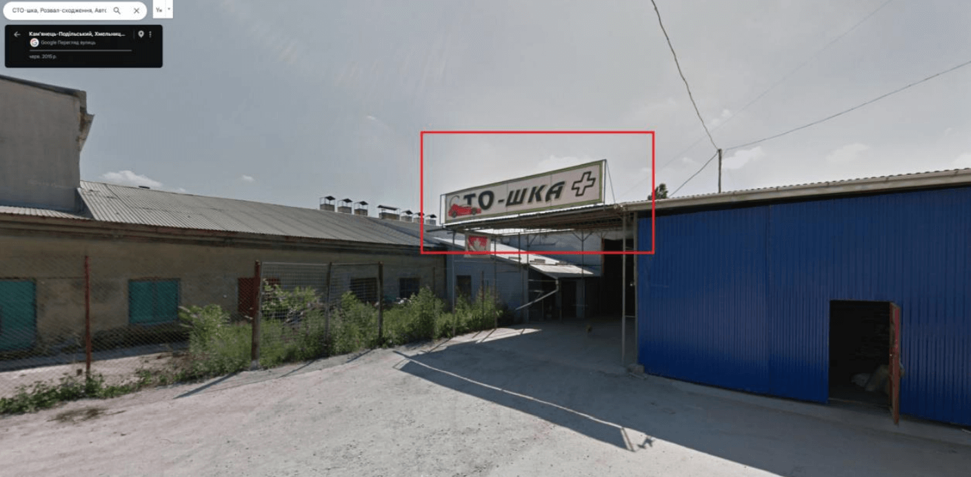
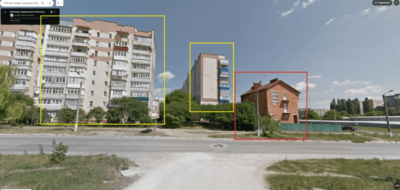
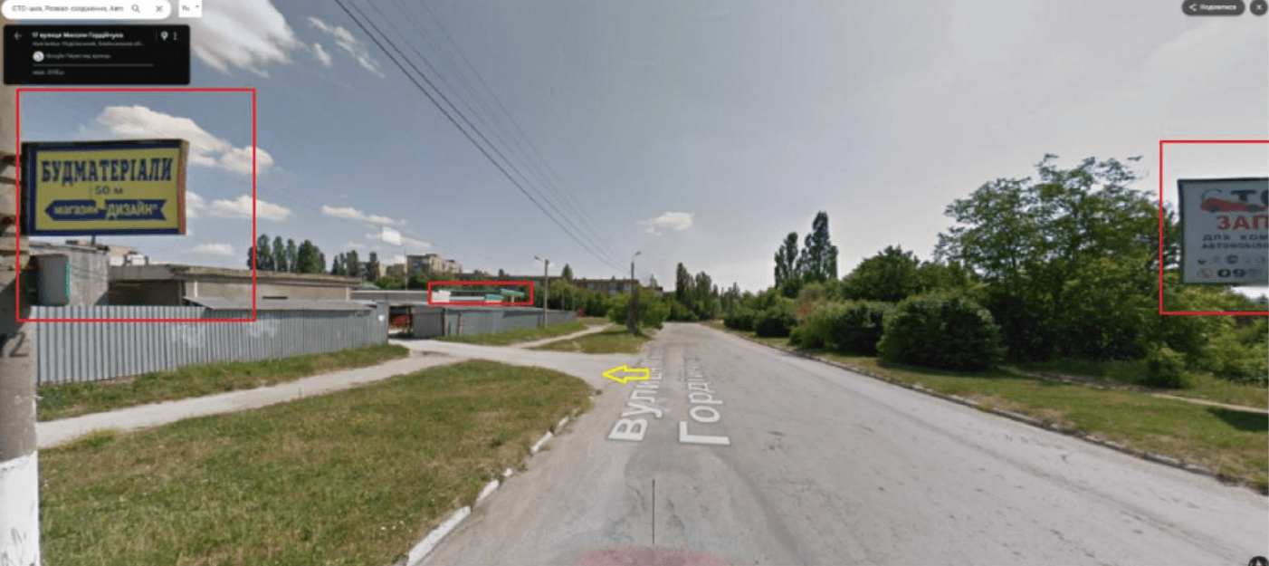
1. Consideration of input data. In Fig. 5.1 you can see a street with a T-shaped intersection. In the background are two high-rise buildings, as well as a red brick house surrounded by a green fence. Important landmarks are a billboard advertising the “STO-shka” service station, which is located near the green gas station. These elements serve as key clues for further location determination.

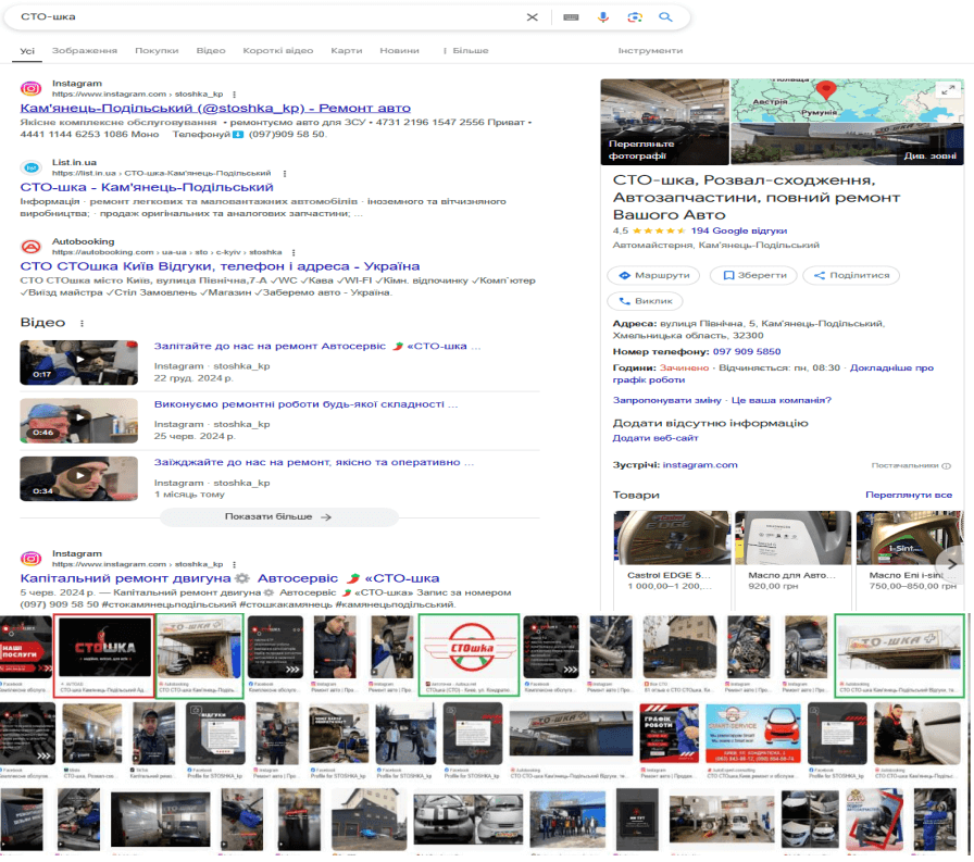
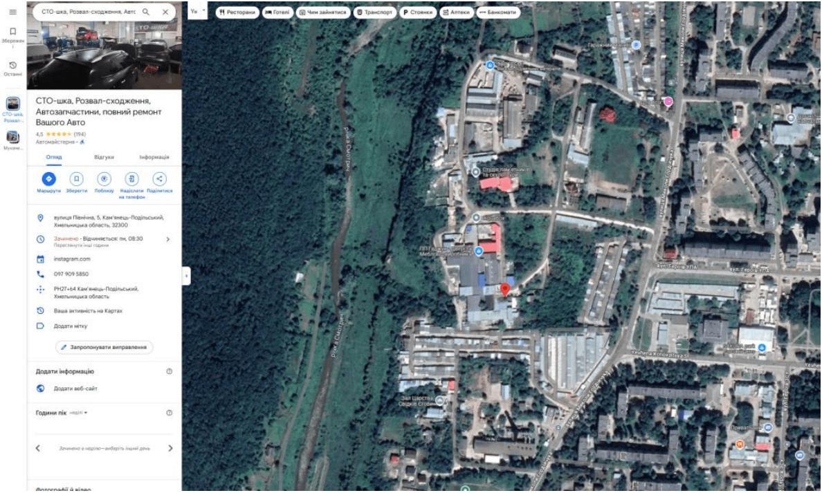
2. Search for a location via Google. We enter “STO-shka” into the search and analyze the results. We find several car services with a similar name. Looking at the photos and logos, we make sure that the option we need is in Kamianets-Podilskyi.
3. Open Google Maps to explore the location of this service station and switch to Google Street View mode.
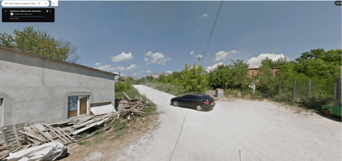
4. We turn around and start moving towards the main road. As we do this, we analyze the environment and look for familiar elements that were present in the first image.
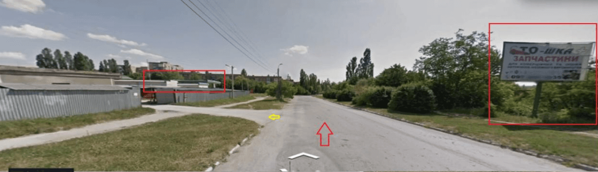
5. We get out onto the main road and immediately notice familiar sights: two high-rise buildings, a red brick house, and a green fence. This confirms that we are heading in the right direction.
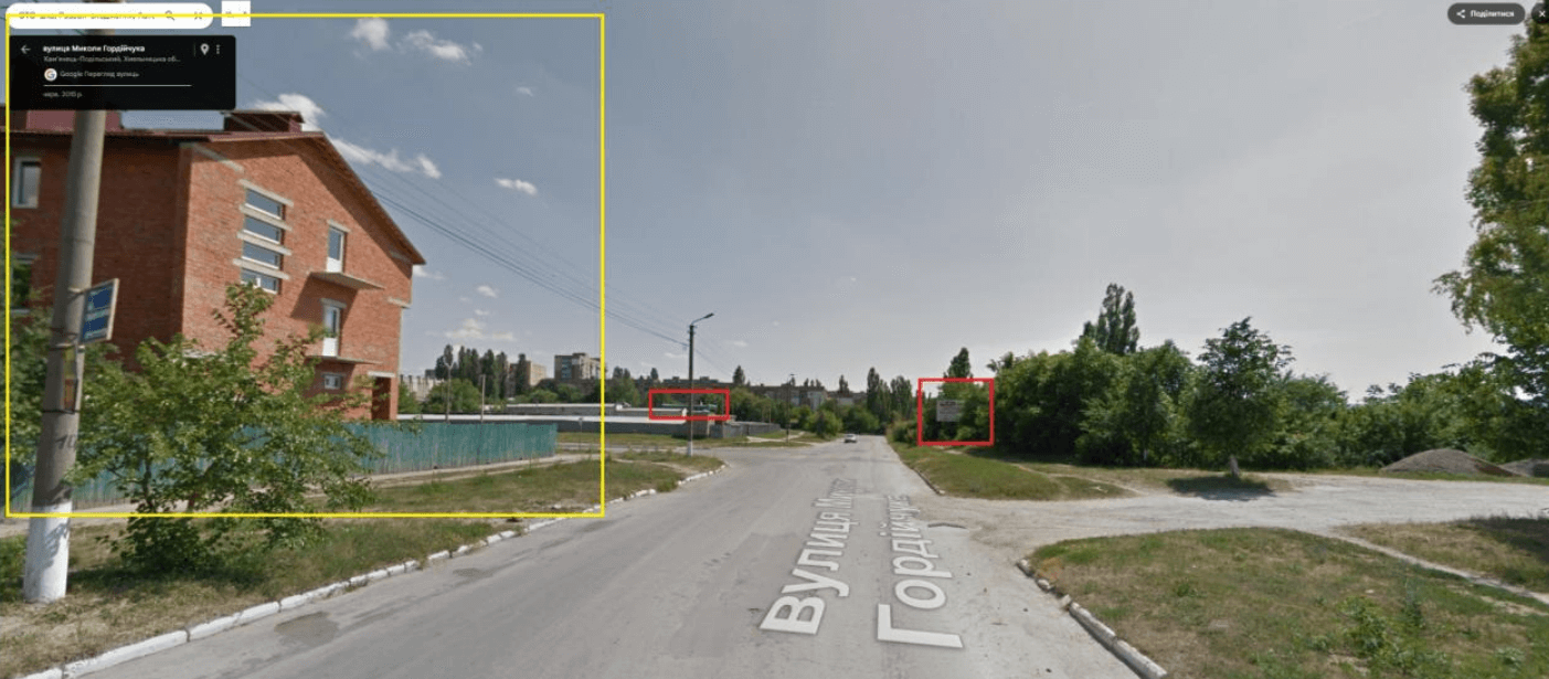
6. Next, we notice a billboard “STO-shka” near the green gas station, which once again confirms the correctness of the location we found. Thanks to this, we can accurately determine the coordinates of the location from which the panoramic photo was taken.
Coordinates: 48.70091270660604, 26.565578522302918
Location: Mykola Hordiychuk Street, Kamianets-Podilskyi
Link to map: Google Maps 🌍
Geolocation by photo is an effective way to determine the location of a photo, based on the analysis of details and the use of mapping services. In this case, we managed to establish the exact location of the intersection in Kamianets-Podilskyi, focusing on characteristic landmarks: a billboard of the “STO-shka” service station, a green gas station, multi-story buildings and a red-brick house.
Thanks to step-by-step analysis, searching for objects in Google Maps and comparing panoramic images with real streets, we were able to determine the exact coordinates of the place from which the photo was taken. This once again confirms that attention to detail and competent use of digital tools allow us to find any location with high accuracy.