Geolocation methods from photos allow you to determine the exact location of a photo using maps, satellite images, and analysis of details in the photo. In this article, we will consider a real-life case study of finding the location of a road in Poland using Google Maps, analyzing road signs, and satellite images.
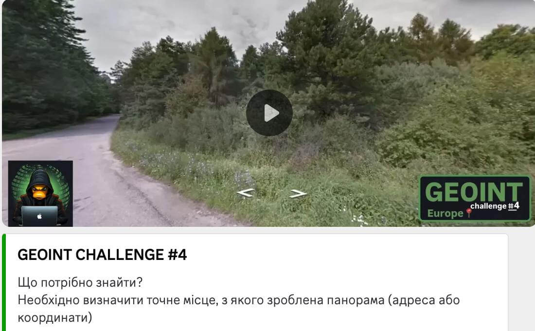
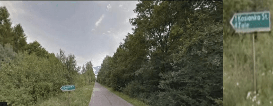
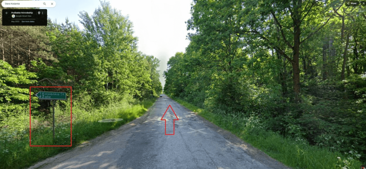
1. In Fig. 4.1, a road diverges in two opposite directions, forming a fork. On the side of the road there is a road sign that says “1 Kosianka St, 4 Zale”. This indicates that the settlements of Kosianka and Zale are located nearby, and the same road leads to them. We also draw attention to the natural surroundings – a forested area, which is typical for many regions of Eastern Europe.
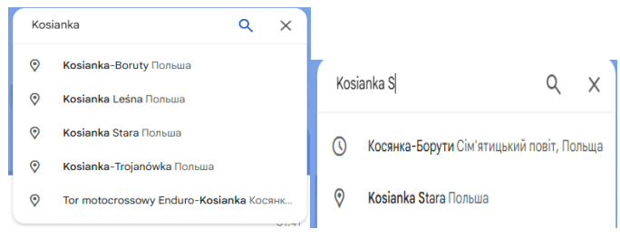
2. To check the name “Kosianka”, enter it in Google Maps. Several options appear in the search results, but only one of them has the corresponding location. We check its location. Next, we search for the settlement of Zale, which should be near Kosianka. In the Google Maps results, we find it within 3-5 km. This confirms that we are in the correct search area. (Fig. 4.2-4.3)
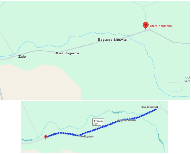
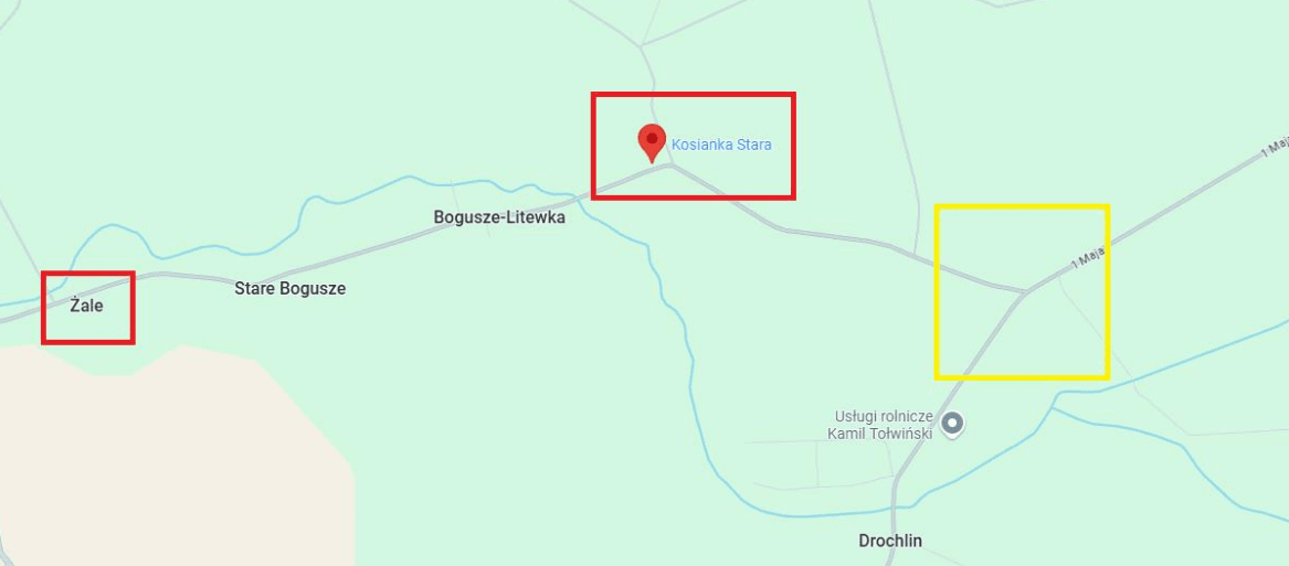
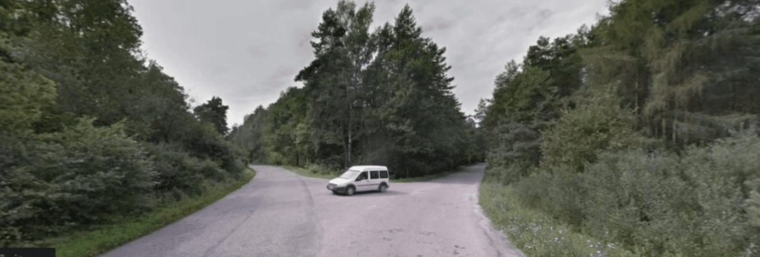
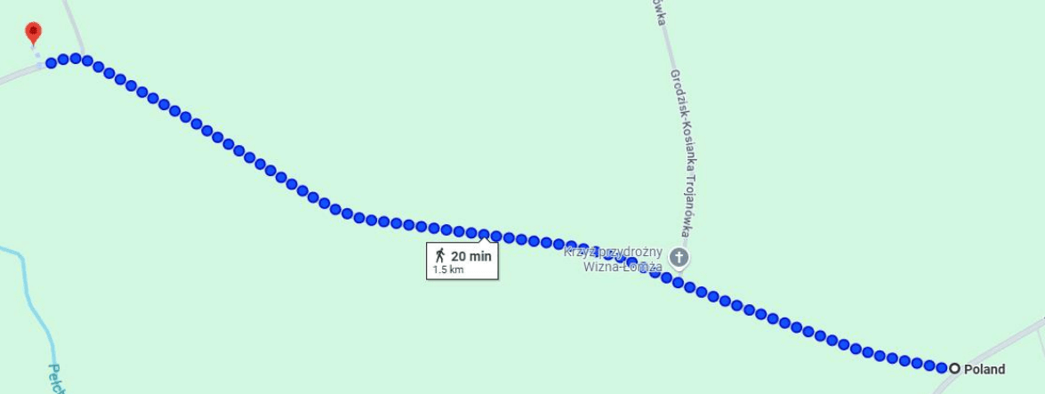
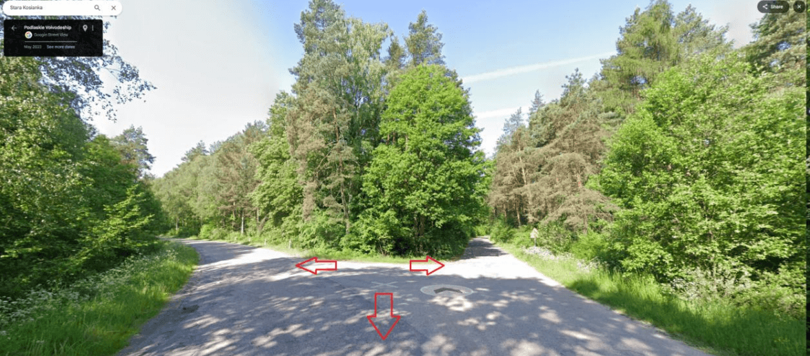
3. Given the panorama, we need to find a specific road that corresponds to the fork we saw. We use the satellite view of Google Maps and check the roads within a radius of 1 km from Kosianka Stara. At a distance of 1.5 km from Kosianka Stara, we find a similar fork pattern. Comparing the image with our initial panorama, we confirm the correspondence. The shape of the road, the location of the trees and the road sign completely coincide. We determine the exact coordinates of the place. (Fig. 4.4)
4. Answer: 52.57346823393176, 22.713643124379402 (Fig. 4.5-4.6)
Coordinates: 52.57346823393176, 22.713643124379402
Location: Grodzisk, Poland
Link to the map: Google Maps 🌍
Geolocation by photo is an effective method of determining the location of a photo using detail analysis and mapping services. In this case, we were able to identify the location of a road in Poland, based on road signs, natural surroundings and satellite images.
Thanks to a step-by-step analysis, searching for settlements in Google Maps and comparing panoramic images with real roads, we determined the exact coordinates of the location.